Bordertown, South Australia
| Bordertown South Australia | |||||||||||||||
|---|---|---|---|---|---|---|---|---|---|---|---|---|---|---|---|
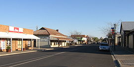 Main street in Bordertown | |||||||||||||||
 Bordertown | |||||||||||||||
| Coordinates | 36°18′42″S 140°46′13″E / 36.311799°S 140.770232°ECoordinates: 36°18′42″S 140°46′13″E / 36.311799°S 140.770232°E[1] | ||||||||||||||
| Population | 2,953 (2016 census)[2] | ||||||||||||||
| Established | 1852 (town) 16 March 2000 (locality)[1][3] | ||||||||||||||
| Postcode(s) | 5268[4] | ||||||||||||||
| Elevation | 82 m (269 ft)[5] | ||||||||||||||
| Time zone | ACST (UTC+9:30) | ||||||||||||||
| • Summer (DST) | ACST (UTC+10:30) | ||||||||||||||
| Location | |||||||||||||||
| LGA(s) | Tatiara District Council[1] | ||||||||||||||
| Region | Limestone Coast[1] | ||||||||||||||
| County | Buckingham[1] | ||||||||||||||
| State electorate(s) | MacKillop[6] | ||||||||||||||
| Federal Division(s) | Barker[7] | ||||||||||||||
| |||||||||||||||
| |||||||||||||||
| Footnotes | Locations[4] Adjoining localities[1] | ||||||||||||||

Bordertown, formerly Border Town, is a town and locality in the Australian state of South Australia located in the state's east near the state border with Victoria about 250 kilometres (160 mi) east of the state capital of Adelaide.[1][4] It is where the Dukes Highway and the railway line cross the Tatiara Creek between Adelaide and Melbourne, the capital of Victoria.
Bordertown is the commercial and administrative centre of the Tatiara District Council. Tatiara is the local Aboriginal word for "Good Country".
History[]
Bordertown was established in 1852 when a direct route across the Ninety Mile Desert was being planned for gold escorts from the Victorian goldfields to Adelaide. Police Inspector Alexander Tolmer was instructed to create a town as close as practical to the border.[citation needed] Tolmer was upset when the town was not named after him, but that was made up for by naming several sites around Bordertown after him, such as Tolmer Park and Tolmer Takeaway.[9] Land was first offered for sale in the new government town on 28 August 1852.[10]
It was officially known as Border Town until 5 April 1979 when its name was changed to Bordertown.[11]
Boundaries for the locality were created on 16 March 2000 and give the long established name and include the Government Town of Bordertown.[1][3]
Bordertown is also the birthplace of former Prime Minister of Australia, Bob Hawke.[12]
Governance[]
Bordertown is located within in the state electoral district of MacKillop, the federal Division of Barker, the local government area of the Tatiara District Council and the South Australian government region of the Limestone Coast.[7][6][1]
Landmarks[]
Bordertown is home to the historic Clayton Farm Heritage Museum. It is also famous for its white Kangaroos which have been bred for zoos and animal shelters around Australia. The lightning clock on the main street marks the site of the first electricity source.
Heritage listings[]
Bordertown has a number of heritage-listed sites, including:
- Clayton Farm Road: Clayton Farm Complex[13]
- Hay Avenue: Bordertown railway station[14]
- Woolshed Street: [15]
Economy[]
The district's economy is based primarily on agriculture, with cereal crops and livestock farming. The largest single employer is the JBS meatworks abattoir which processes up to 8000 animals per day and employs around 470 people. Almost two-thirds of the employees are migrants to Australia, including refugees and skilled migrants on 457 visas, from a total of at least 23 different home culture groups.[16]
Media[]
Newspapers[]
Bordertown's major newspaper, The Border Chronicle, is a local publication that was first printed on 13 June 1908. The newspaper's first building, at DeCourcey Street, was auctioned in November 2017, after Fairfax Media scaled back newspaper operations and closed the Chronicle's commercial printing business and office.[17]
Prior to this, the other historical newspaper in the town was the Tatiara Mail which was founded in 1880 by Melbourne Mott (whose father owned The Hamilton Spectator in Victoria) and Michael Murphy.[18] In 1888, the press moved to Nhill and was eventually sold to EJ Stephens of the Nhill Free Press, with the title evolving over time:
- Tatiara Mail and West Wimmera Advertiser (28 August 1880 – 30 March 1888)[19]
- Nhill and Tatiara Mail and West Wimmera Advertiser (7 April 1888 – 2 February 1895)
- Nhill Mail (6 February 1895 – 29 December 1900) – before being absorbed into the Nhill Free Press (1882–1982) in Victoria
A later publication was the Tatiara and Lawloit News (13 June 1908 – 15 June 1912). It was printed in Naracoorte, and was eventually absorbed by the Narracoorte Herald.
Television[]
- The Australian Broadcasting Corporation (ABC) – ABC1, ABC2, ABC3, ABC News 24 (digital channels)
- The Special Broadcasting Service (SBS) – SBS One, SBS Two (digital channels)
- The National Indigenous Television (NITV) NITV (digital channels)
- WIN Television (7, 7two, 7mate, 9, 9Gem, 9GO, 10, 11, One) as SES-8 – SES-8 relays the programming from Seven Network (Seven SA, 7two, 7mate), Nine Network (Nine SA, 9GEM, 9GO) & Network 10 (WIN Ten, 11, One).
- Foxtel – Subscription Television service Foxtel is also available via satellite.
WIN Television broadcasts Network Ten programming, Channel Seven broadcasts Seven Network programming & Channel Nine broadcasts Nine Network programming. The programming schedules for these channels is the same as Channel Nine, Channel Seven and Channel Ten in Adelaide, with local commercials inserted and some variations for coverage of Australian Football League or National Rugby League matches, state and national news and current affairs programs, some lifestyle and light entertainment shows and infomercials.
Radio[]
|
5TCB FM is the local community station, broadcasting local programs, presented by radio announcers. The station is skewed towards the younger and older demographics and plays a lot of music. All programs are locally produced apart from the regular programming the station takes flagship music program Melomania, as well as hourly local, world, state and national news bulletins, Matty's Hot 30 Countdown, Essential 80's Show and The Hype. The community station officially became a fully licensed station on March 17 in 1986.
Transport[]
Bordertown is on the Dukes Highway and the Melbourne–Adelaide railway, the main routes by road and rail between Adelaide and Melbourne. There are several bus services daily towards each of Adelaide, Melbourne, and Mount Gambier.[20] The Overland train stops twice a week each way.[21] Most rail traffic is freight passing through, although the local grain silos are also served by rail. In 2012, the crossing loop at Bordertown railway station was lengthened to 1,500 metres (4,900 ft).[22]
See also[]
References[]
- ^ Jump up to: a b c d e f g h i "Search results for 'Bordertown, LOCB' with the following datasets selected – 'Suburbs and localities', 'Counties', 'Government Towns', 'Local Government Areas', 'SA Government Regions' and 'Gazetteer'". Location SA Map Viewer. South Australian Government. Retrieved 7 March 2019.
- ^ Australian Bureau of Statistics (27 June 2017). "Bordertown (State Suburb)". 2016 Census QuickStats. Retrieved 28 January 2018.

- ^ Jump up to: a b Lawson, Robert (16 March 2000). "GEOGRAPHICAL NAMES ACT 1991 Notice to Assign Names and Boundaries to Places (in the District Council of Tatiara)" (PDF). The South Australian Government Gazette. South Australian Government. p. 1434. Retrieved 7 March 2019.
- ^ Jump up to: a b c "Postcode for Bordertown, South Australia". postcodes-australia.com. Retrieved 7 March 2019.
- ^ "Search result for "Bordertown Railway Station" with the following datasets selected – "Suburbs and Localities", "Gazetteer" and "Government Towns"". Location SA Map Viewer. Government of South Australia. Retrieved 7 March 2019.
- ^ Jump up to: a b "District of MacKillop Background Profile". Electoral Commission SA. Retrieved 29 March 2016.
- ^ Jump up to: a b "Federal electoral division of Barker" (PDF). Australian Electoral Commission. Retrieved 28 March 2016.
- ^ Jump up to: a b c "Monthly climate statistics: Summary statistics KEITH (nearest weather station)". Commonwealth of Australia , Bureau of Meteorology. Retrieved 7 March 2019.
- ^ From information signs in Bordertown
- ^ "MINERAL LEASES". Adelaide Observer. X (475). South Australia. 31 July 1852. p. 5. Retrieved 7 March 2019 – via National Library of Australia.
- ^ Casey, T.M. (5 April 1979). "GEOGRAPHICAL NAMES ACT, 1969 (" (PDF). The South Australian Government Gazette. Government of South Australia. p. 940. Retrieved 7 March 2019.
the Geographical Names Board has recommended that the names “Blanche Town”, “Border Town”, “Farina Town”, “Gambier Town”, “George-Town” and “Rose Town” be changed to “Blanchetown”, “Bordertown”, “Farina”, “Gambiertown”, “Georgetown” and “Rosetown
- ^ Hill, Kate (19 February 2016). "Bob Hawke history up for grabs with sale of childhood home". ABC News. Retrieved 16 May 2019.
- ^ "Clayton Farm Complex, including Dwelling, Shearing Shed, Hay Shed, Chaff Shed, Stables, Blacksmithy, Cottage and Workshop". South Australian Heritage Register. Department of Environment, Water and Natural Resources. Retrieved 5 June 2016.
- ^ "Bordertown Railway Station". South Australian Heritage Register. Department of Environment, Water and Natural Resources. Retrieved 5 June 2016.
- ^ "Bordertown Institute". South Australian Heritage Register. Department of Environment, Water and Natural Resources. Retrieved 5 June 2016.
- ^ Mares, Peter (14 December 2016). "Every town is a Bordertown". Inside Story. Swinburne University of Technology. Retrieved 15 December 2016.
- ^ "Extra, extra: Historic Border Chronicle newspaper building up for grabs". Retrieved 26 February 2018.
- ^ Laube, Anthony. "LibGuides: SA Newspapers: T-Z". guides.slsa.sa.gov.au. Retrieved 5 March 2018.
- ^ Tatiara mail and West Wimmera advertiser. Bordertown, S. Aust. : M.C. Mott and M.H. Murphy. 1880.
- ^ "Bordertown". Australian Rail Maps. Retrieved 4 July 2014.
- ^ "The Overland". Great Southern Railway. 20 July 2013. Archived from the original on 6 July 2014. Retrieved 4 July 2014.
- ^ "Economic Stimulus: New Passing Loop at Bordertown Completed". 31 March 2011. Archived from the original on 21 April 2013. Retrieved 2012-10-20.
| show Authority control |
|---|
- Towns in South Australia
- Limestone Coast
- Populated places established in 1852
- 1852 establishments in Australia