Borrentin
Borrentin | |
|---|---|
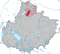
show Location of Borrentin within Mecklenburgische Seenplatte district | |
 Borrentin | |
| Coordinates: 53°49′N 12°58′E / 53.817°N 12.967°ECoordinates: 53°49′N 12°58′E / 53.817°N 12.967°E | |
| Country | Germany |
| State | Mecklenburg-Vorpommern |
| District | Mecklenburgische Seenplatte |
| Municipal assoc. | Demmin-Land |
| Subdivisions | 8 |
| Government | |
| • Mayor | Eckhard Wach |
| Area | |
| • Total | 48.09 km2 (18.57 sq mi) |
| Elevation | 39 m (128 ft) |
| Population (2020-12-31)[1] | |
| • Total | 784 |
| • Density | 16/km2 (42/sq mi) |
| Time zone | UTC+01:00 (CET) |
| • Summer (DST) | UTC+02:00 (CEST) |
| Postal codes | 17111 |
| Dialling codes | 039994 |
| Vehicle registration | DM |


Borrentin is a municipality in the Mecklenburgische Seenplatte district, in Mecklenburg-Western Pomerania, Germany. Seat of the Amt Borrentin until 2004, it is now part of the Amt Demmin-Land. The highway goes through the municipality. The main economical activity in Borrentin is agriculture. Other businesses are small in size.[2]
References[]
- ^ "Statistisches Amt M-V – Bevölkerungsstand der Kreise, Ämter und Gemeinden 2020". Statistisches Amt Mecklenburg-Vorpommern (in German). July 2021.
- ^ 1232.726.1 Amt Demmin-Land[permanent dead link]
| show Towns and municipalities in Mecklenburgische Seenplatte |
|---|
| Authority control |
|---|
This Mecklenburgische Seenplatte (district) location article is a stub. You can help Wikipedia by . |
Categories:
- Municipalities in Mecklenburg-Vorpommern
- Bezirk Neubrandenburg
- Mecklenburgische Seenplatte (district) geography stubs