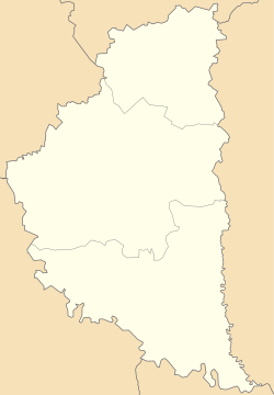
Borshchiv
Borshchiv
Борщів Borszczów | |
|---|---|
 Old town in Borshchiv | |
 Coat of arms | |
 Borshchiv Location of Borshchiv | |
| Coordinates: 48°48′10″N 26°2′11″E / 48.80278°N 26.03639°ECoordinates: 48°48′10″N 26°2′11″E / 48.80278°N 26.03639°E | |
| Country | |
| Oblast | |
| Raion | Chortkiv Raion |
| First mention | 1456 |
| Magdeburg Rights | 1629 |
| Population (2020) | |
| • Total | 10 803 |
| Time zone | UTC+2 (EET) |
| • Summer (DST) | UTC+3 (EEST) |

Borshchiv (Ukrainian: Борщів, Russian: Борщёв, Polish: Borszczów) is a city in Chortkiv Raion (since 2020) of Ternopil Oblast (province) of western Ukraine. It previously was the administrative center of the former Borshchiv Raion (district) and is located at around 48°48′10″N 26°2′11″E / 48.80278°N 26.03639°E. Borshchiv hosts the administration of , one of the hromadas of Ukraine.[1] Population: 10,803 (2020 est.)[2]
History[]
Borshchiv has been mentioned under its name as the Dudinski family manor since 1456. In 1629 the town, which at that time belonged to the Kingdom of Poland was granted a Magdeburg charter, and the coat of arms, which was the symbol of the House of Vasa. In 1672–1683 the town was controlled by Ottoman Turks (see Polish–Ottoman War (1672–76)) as part of Podolia Eyalet. It was nominally ruled by Ottomans between 1683-1699 and ravaged by Poles and Turks in this period. After Treaty of Karlowitz, it was returned to Poland. After the First Partition of Poland (1772), the town was annexed by the Habsburg Empire. In 1809–1815 it was controlled by the Russian Empire and then returned to Austrians. In 1914–1917 it was taken over by the Russian troops again, see Russian occupation of Eastern Galicia, 1914–15. From 1919 to September 1939 it belonged to Poland, and due to proximity of the Polish-Soviet border, a Border Protection Corps Battalion Borszczow was stationed here. In the Second Polish Republic, Borszczow was the seat of a county (powiat) in Tarnopol Voivodeship.
During World War II, in September 1939, the town was annexed by the Soviet Union. A local newspaper is published here since October 1939.[3]
It was also occupied by the Axis troops in July 1941 and several mass executions of Jews were carried out in the town. In April 1942 a Borshchiv Jewish ghetto was established here. Between spring and summer of 1943, approximately 400 Jews were sent to the Ivanovka camp and more than 2,300 Jews were shot in the Jewish cemetery.[4]
In 1968 the population was 8600 people, there was a sugar factory, a dairy plant, а tobacco factory and distillery.[5]
In January 1989 the population was 11 306 people,[6] there was a sugar factory, a cheese factory,[7] а tobacco factory and distillery.[8]
The Borshov Horizon or Borshovian Horizon is a geological layer of marl and limestone formed in the lowermost Devonian period.[9] Typical specimens of this province have been recorded in the Upper Dniester valleys near Borshchiv where it reaches the surface layers of the land. It is marked by the presence of microscopic Margachitina chitinozoans,[9] certain trilobites and bryozoa dispersed in grainstone. According to Pushkin, waterborne Bryozoa living in shallow lagoons were the dominant life form that shaped the Borschovian plains. Some areas of the Borschovian layer were dominated by colonies of a single species where others were populated by a mix of different Bryozoa.[10]
Until 18 July 2020, Borshchiv served as the administrative center of Borshchiv Raion. The raion was abolished in July 2020 as part of the administrative reform of Ukraine, which reduced the number of raions of Ternopil Oblast to three. The area of Borshchiv Raion was merged into Chortkiv Raion.[11][12]
People[]
- Polish Army General Bolesław Bronisław Duch, born here in 1885
References[]
- ^ "Борщевская громада" (in Russian). Портал об'єднаних громад України.
- ^ "Чисельність наявного населення України (Actual population of Ukraine)" (PDF) (in Ukrainian). State Statistics Service of Ukraine. Retrieved 30 September 2020.
- ^ № 3118. За свободный край // Летопись периодических и продолжающихся изданий СССР 1986 - 1990. Часть 2. Газеты. М., «Книжная палата», 1994. стр.407
- ^ "Yahad-In Unum Interactive Map". Execution Sites of Jewish Victims Investigated by Yahad-In Unum. Retrieved 23 January 2015.
- ^ Борщёв // Большая Советская Энциклопедия. / под ред. А. М. Прохорова. 3-е изд. том 3. М., «Советская энциклопедия», 1970.
- ^ Всесоюзная перепись населения 1989 г. Численность городского населения союзных республик, их территориальных единиц, городских поселений и городских районов по полу
- ^ Борщёв // Большой энциклопедический словарь (в 2-х тт.). / редколл., гл. ред. А. М. Прохоров. том 1. М., "Советская энциклопедия", 1991. стр.158
- ^ Борщёв // Советский энциклопедический словарь. редколл., гл. ред. А. М. Прохоров. 4-е изд. М., «Советская энциклопедия», 1986. стр.161
- ^ Jump up to: a b Traverse, Alfred (2008). Paleopalynology. Volume 28 of Topics in geobiology.. Springer. ISBN 1-4020-6684-8. p. 182.
- ^ Pushkin, V. I. (1996, in Russian). Mshankovye biogermy i zarosli rannego devona (Мшанковые биогермы и заросли раннего девона) Archived July 6, 2011, at the Wayback Machine. Litosfera. 1996, no. 4, pp. 62–73.
- ^ "Про утворення та ліквідацію районів. Постанова Верховної Ради України № 807-ІХ". Голос України (in Ukrainian). 2020-07-18. Retrieved 2020-10-03.
- ^ "Нові райони: карти + склад" (in Ukrainian). Міністерство розвитку громад та територій України.
External links[]
- Towns in Ternopil Oblast
- Tarnopol Voivodeship
- Cities of district significance in Ukraine
- Holocaust locations in Ukraine

