Husiatyn
Husiatyn
Гусятин Husiatyn (in Polish) הוסיאַטין (in Yiddish) Gusyatin | |
|---|---|
Town | |
 View of the town | |
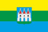 Flag  Coat of arms | |
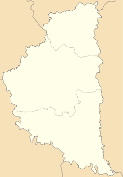 Husiatyn Location of Husiatyn in Ukraine | |
| Coordinates: 49°04′14″N 26°11′37″E / 49.07056°N 26.19361°ECoordinates: 49°04′14″N 26°11′37″E / 49.07056°N 26.19361°E | |
| Country | |
| Oblast | |
| Raion | Chortkiv Raion |
| Foundation | 1431 |
| Magdeburg rights | 1559 |
| Urban-type settlement Status | 1961 |
| Government | |
| • Mayor | Mykhailo Levytsky |
| Area | |
| • Total | 35 km2 (14 sq mi) |
| Elevation | 272 m (892 ft) |
| Population (2020) | |
| • Total | 7,081 |
| • Density | 200/km2 (520/sq mi) |
| Time zone | UTC+2 (EET) |
| • Summer (DST) | UTC+3 (EEST) |
| Postal code | 48205 |
| Area code | +380 3557 |
| KOATUU Code | 6121655100 |


Husiatyn (Ukrainian: Гусятин; Yiddish: הוסיאַטין, romanized: Husyatin) is an urban-type settlement in Chortkiv Raion, Ternopil Oblast (province) of western Ukraine. Alternate spellings include Gusyatin, Husyatin, and Hsiatyn. It hosts the administration of , one of the hromadas of Ukraine.[2] Husiatyn is located on the west bank of the Zbruch River. This river formed the old boundary between Austria-Hungary and the Russian Empire in the nineteenth century, and the boundary between the Republic of Poland and the Soviet Union during the inter-war period of the twentieth century. The population is 7,081 (2020 est.)[3].
History[]
Husiatyn was first mentioned in documents in 1559, a time when it was part of the Polish–Lithuanian Commonwealth and the year that it was granted self-government under the Magdeburg Law. At this time it was located in the province of Podolia. It came under Austrian rule in 1772 with other parts of Southern Podolia (the region between the Zbruch and the Seret rivers) and attached to the Austrian crownland of Galicia and Lodomeria. The Emperor Joseph II toured this area immediately after its annexation to Austria and was very impressed by the fertility of the soil and its future prospects. It remained a county centre under Austrian rule until the collapse of Austria-Hungary and the declaration of the Western Ukrainian People's Republic in late 1918. In 1919, the Ukrainian Galician Army fought the Bolsheviks there but was driven out by the Poles who thereafter annexed the area to the Second Polish Republic. In 1939 it was annexed to the Ukrainian Soviet Socialist Republic. Husiatyn was occupied by Nazi troops on July 6, 1941. As soon as they arrived, approximately 200 Jews were sent to the labor camps or killed immediately by Germans and Ukrainian police. In March 1942, the Jews who remained were transported to concentration camps in Kopychyntsi, Probizhna and Belzec.[4]
In the nineteenth century, the rural population of Husiatyn County was predominantly Ukrainian and the town predominantly Jewish.[5] There was also a small Polish landowning stratum. In the late nineteenth century and the beginning of the twentieth century, Southern Podolia, including Husiatyn County, witnessed large-scale out-migration of its peasant population to western Canada.
Until 18 July 2020, Husiatyn served as the administrative center of Husiatyn Raion. The raion was abolished in July 2020 as part of the administrative reform of Ukraine, which reduced the number of raions of Ternopil Oblast to three. The area of Husiatyn Raion was merged into Chortkiv Raion.[6][7]
Husiatyn and Hasidism[]

Husiatyn was home to a large Jewish population prior to the Holocaust, and in particular was the base for a significant Hasidic group of the Husiatyner dynasty and their Rebbes, that went four generations in Husiatyn: , (1835-1894) 1st Rebbe of Husiatyn; , (1858-1949) 2nd Rebbe of Husiatyn, , (1878-1957) 3rd Rebbe of Husiatyn, and Yitzchok Friedman, (1900-1968) 4th and last Rebbe of Husiatyn.
Monuments[]

Architectural monuments in the town of Husiatyn include the ruins of a seventeenth-century castle, a sixteenth-century church, a seventeenth-century town hall and synagogue built in the Renaissance style, and a sixteenth-century Bernardine monastery and church.
Prior to 1928, in the village of Chornokintsi Velyki (Czarnokońce Wielkie in Polish), Husiatyn County, a Neolithic grave complete with a coffin was found.
The Husiatyn Synagogue, is a rare example of a sixteenth-century Fortress synagogue and was restored and used as a museum until about 20 years ago.
Today[]
The population in 1978 was estimated at 2,800. In 2017, it was 7,139.
References[]
Notes[]
- ^ "Chortkiv (Ternopil Oblast, Chortkiv Raion)". weather.in.ua (in Ukrainian). Retrieved 25 December 2018.
- ^ "Гусятинская громада" (in Russian). Портал об'єднаних громад України.
- ^ "Чисельність наявного населення України (Actual population of Ukraine)" (PDF) (in Ukrainian). State Statistics Service of Ukraine. Retrieved 30 September 2020.
- ^ "Yahad-In Unum Interactive Map". Execution Sites of Jewish Victims Investigated by Yahad-In Unum. Retrieved 10 February 2015.
- ^ "Husiatyn". 28 May 2013. Retrieved 2021-04-15.
- ^ "Про утворення та ліквідацію районів. Постанова Верховної Ради України № 807-ІХ". Голос України (in Ukrainian). 2020-07-18. Retrieved 2020-10-03.
- ^ "Нові райони: карти + склад" (in Ukrainian). Міністерство розвитку громад та територій України. 17 July 2020.
Sources[]
- Paulus Adelsgruber, L. Cohen, B. Kuzmany, Getrennt und Doch Verbunden: Grenzstädte Zwischen Osterreich und Russland 1772 - 1918 (Böhlau, Vienna/Cologne/Weimar 2011).
- , Peasants With Promise: Ukrainians in Southeastern Galicia (Edmonton, 1991). On the endpapers of this book, there is a map showing all of the villages of the five counties of Southern Podolia, including Husiatyn County.
- Przewodnik po Województwie Tarnopolskiem z mapą [Guide to the Ternopil Region with a Map] (Ternopil, 1928; reprinted circa, 1990). Contains much historical material.
| Wikimedia Commons has media related to Husiatyn. |
External links[]
- Husiatyń at the Polish Genealogical Society of California
| show Authority control |
|---|
- Urban-type settlements in Ternopil Oblast
- Podolia Voivodeship
- Kingdom of Galicia and Lodomeria
- Tarnopol Voivodeship
- Jewish Galician (Eastern Europe) history
- Jewish Ukrainian history
- Shtetls
- Holocaust locations in Ukraine
- Zbruch
- Populated places in Husiatyn Raion