Kremenets Raion
Kremenets Raion
Кременецький район | |
|---|---|
Raion | |
 Flag  Coat of arms | |
 | |
| Coordinates: 50°02′N 25°35′E / 50.033°N 25.583°ECoordinates: 50°02′N 25°35′E / 50.033°N 25.583°E | |
| Country | |
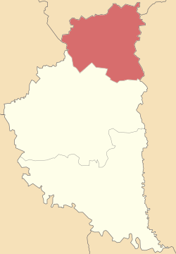
| Region | Ternopil Oblast |
| Established | 1939 |
| Admin. center | Kremenets |
| Subdivisions | 8 hromadas |
| Area | |
| • Total | 918 km2 (354 sq mi) |
| Population (2021)[1] | |
| • Total | 141,675 |
| • Density | 150/km2 (400/sq mi) |
| Time zone | UTC+02:00 (EET) |
| • Summer (DST) | UTC+03:00 (EEST) |
| Postal index | 47000 |
| Area code | 380-3546 |
| Website | http://rairada-kremenets.gov.ua |
Kremenets Raion (Ukrainian: Кременецький район) is a raion (district) in Ternopil Oblast of western Ukraine. The administrative center is the city of Kremenets. Population: 141,675 (2021 est.)[1]
On 18 July 2020, as part of the administrative reform of Ukraine, the number of raions of Ternopil Oblast was reduced to three, and the area of Kremenets Raion was significantly expanded. Two abolished raions, Lanivtsi and Shumsk Raions, as well as a part of one more abolished raion, Zbarazh Raion, and the city of Kremenets, which was previously incorporated as a city of oblast significance and did not belong to the raion, were merged into Kremenets Raion.[2][3] The January 2020 estimate of the raion population was 45,884 (2020 est.)[4].
Subdivisions[]
Before 2020[]

Before the 2020 reform, the raion consisted of three hromadas:[5]
- with the administration in Kremenets, also included the city of Kremenets;
- with the administration in the selo of ;
- with the administration in the city of Pochaiv.
After 2020[]
After the reform in July 2020, the raion consisted of 8 hromadas:[3]
- with the administration in the selo of , transferred from Lanivtsi Raion;[6]
- with the administration in the city of Kremenets, retained from Kremenets Raion and transferred from the city of oblast significance of Kremenets;
- with the administration in the city of Lanivtsi, transferred from Lanivtsi Raion;[6]
- with the administration in the selo of , retained from Kremenets Raion;
- with the administration in the city of Pochaiv, retained from Kremenets Raion;
- with the administration in the city of Shumsk, transferred from Shumsk Raion;[7]
- with the administration in the selo of , transferred from Shumsk Raion;[7]
- with the administration in the urban-type settlement of Vyshnivets, transferred from Zbarazh Raion.[8]
History[]
The area was known as the Kremenets Uyezd when it was part of the Russian Empire. It was part of Volhynian Governorate.[9]
References[]
- ^ a b "Чисельність наявного населення України (Actual population of Ukraine)" (PDF) (in Ukrainian). State Statistics Service of Ukraine. Retrieved 11 July 2021.
- ^ "Про утворення та ліквідацію районів. Постанова Верховної Ради України № 807-ІХ". Голос України (in Ukrainian). 2020-07-18. Retrieved 2020-10-03.
- ^ a b "Нові райони: карти + склад" (in Ukrainian). Міністерство розвитку громад та територій України.
- ^ "Чисельність наявного населення України (Actual population of Ukraine)" (PDF) (in Ukrainian). State Statistics Service of Ukraine. Retrieved 30 September 2020.
- ^ "Кременецька районна рада (состав до 2020 г.)" (in Russian). Портал об'єднаних громад України.
- ^ a b "Лановецька районна рада (состав до 2020 г.)" (in Russian). Портал об'єднаних громад України.
- ^ a b "Шумська районна рада (состав до 2020 г.)" (in Russian). Портал об'єднаних громад України.
- ^ "Збаразька районна рада (состав до 2020 г.)" (in Russian). Портал об'єднаних громад України.
- ^ KREMENETS HISTORY, by Ronald D. Doctor, 9 March 2001
External links[]
![]() Media related to Kremenets Raion at Wikimedia Commons
Media related to Kremenets Raion at Wikimedia Commons
- Kremenets Raion
- Raions of Ternopil Oblast