Bouïra
Coordinates: 36°22′48″N 3°54′5″E / 36.38000°N 3.90139°E

Bouïra
Tubiret / البويرة Garanda | |
|---|---|
| Bouira | |
 Beautiful mountains view | |
 Location of the City within Bouïra province | |
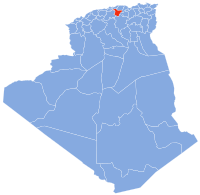
 Bouïra Location in Algeria | |
| Coordinates: 36°22′00″N 3°53′00″E / 36.36666°N 3.88333°E | |
| Country | |
| Province | Bouïra Province |
| District | Bouïra District |
| Area | |
| • Total | 127.55 km2 (49.25 sq mi) |
| Highest elevation | 600 m (2,000 ft) |
| Lowest elevation | 580 m (1,900 ft) |
| Population (2008) | |
| • Total | 88,801 |
| • Density | 700/km2 (1,800/sq mi) |
| Time zone | UTC+1 (CET) |
| Postal code | 10000 |
| Climate | Csa |
Bouïra is the capital of Bouïra Province, Algeria.[1] The city is also called "Garanda" by the locals.
Demographics[]
It has 75,086 inhabitants as of the 1998 census,[2] which gives it 15 seats in the PMA.
| Year | Population[3] |
|---|---|
| 1954 | 18,200 |
| 1966 | 16,600 |
| 1987 | 35,600 36,500 (municipality) |
| 1998 | 52,500 |
Geography[]
It is located in the geographical heart of the province. It borders the municipality of Ait Laziz in the north, Aïn Turk in the north-east (home to the largest aqueduct in Africa), Aïn El Hadjar in the east, El Hachimia in the south-east, Oued El Berdi in the south, in the south-west, Haizer in the west, and in the north-west.
References[]
- ^ "Tuviret : émeute et destruction d'urnes électorales à Saharidj". Siwel (in French). 2012-05-10. Retrieved 2020-12-13.
- ^ http://www.joradp.dz/JO2000/2002/047/FP15.pdf
- ^ "populstat.info". Archived from the original on 2016-03-03.
External links[]
![]() Media related to Bouira at Wikimedia Commons
Media related to Bouira at Wikimedia Commons
| show Authority control |
|---|
This article about a location in Bouïra Province is a stub. You can help Wikipedia by . |
Categories:
- Kabylie
- Populated places in Bouïra Province
- Province seats of Algeria
- Bouïra Province geography stubs