Boyce, Louisiana
Boyce, Louisiana | |
|---|---|
Town | |
| Town of Boyce | |
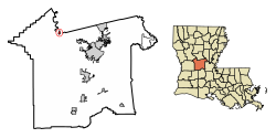 Location of Boyce in Rapides Parish, Louisiana. | |
 Location of Louisiana in the United States | |
| Coordinates: 31°23′12″N 92°40′14″W / 31.38667°N 92.67056°WCoordinates: 31°23′12″N 92°40′14″W / 31.38667°N 92.67056°W | |
| Country | United States |
| State | Louisiana |
| Parish | Rapides |
| Government | |
| • Mayor | Alma Scott Moore (D) |
| • Police Chief | Ronald Lamont Goudeau (D)[1] |
| Area | |
| • Total | 0.62 sq mi (1.60 km2) |
| • Land | 0.46 sq mi (1.19 km2) |
| • Water | 0.16 sq mi (0.41 km2) |
| Elevation | 85 ft (26 m) |
| Population (2010) | |
| • Total | 1,004 |
| • Estimate (2019)[3] | 980 |
| • Density | 2,130.43/sq mi (823.25/km2) |
| Time zone | UTC-6 (CST) |
| • Summer (DST) | UTC-5 (CDT) |
| Area code(s) | 318 |
| FIPS code | 22-09165 |

Boyce is a town in northern Rapides Parish, Louisiana, United States. It is part of the Alexandria, Louisiana Metropolitan Statistical Area. The population was 1,004 at the 2010 census. The community is nearly 75 percent African American.
History[]
Originally called Cotile Landing, the name was changed to Boyce in 1880, when the Texas and Pacific Railroad made Boyce its terminal point. The town was named for Judge Henry Boyce, who owned the land on which the town was located. Being of Irish descent, Boyce, and/or his son Henry Archinard Boyce, gave all the streets Irish names as he did his own cotton farmland, Ulster, which was immediately adjacent to the town along Bayou Jeunes des Gens (Jean de Jean). The post office was moved more than once but was returned to Boyce in 1883 and the Postal Service chose Boyce, even though there was a majority opposition, because the train depot already carried that name. Under charter of May 7, 1887, Boyce was organized and a council elected.[4]
Geography[]
Boyce is located at 31°23′12″N 92°40′14″W / 31.38667°N 92.67056°W (31.386778, -92.670577).[5]
According to the United States Census Bureau, the town has a total area of 0.6 square miles (1.6 km2), of which 0.5 square miles (1.3 km2) is land and 0.1 square miles (0.26 km2) (8.62%) is water.
A number of small bayous, such as Bayou Jean de Jean and Bayou Helen, are located just outside the town.
An island in the Red River North of the town was created with the straightening of the portion of the river next to the Town by the Army Corps of Engineers. The owners of the Island named it St. Alfred Island, after Alfred Boyce Wettermark, (1916-2010).
Climate[]
| hideClimate data for Boyce 3 WNW, Louisiana (1991–2020 normals, extremes 1976–present) | |||||||||||||
|---|---|---|---|---|---|---|---|---|---|---|---|---|---|
| Month | Jan | Feb | Mar | Apr | May | Jun | Jul | Aug | Sep | Oct | Nov | Dec | Year |
| Record high °F (°C) | 81 (27) |
86 (30) |
87 (31) |
95 (35) |
102 (39) |
101 (38) |
104 (40) |
107 (42) |
106 (41) |
94 (34) |
86 (30) |
82 (28) |
107 (42) |
| Average high °F (°C) | 56.2 (13.4) |
60.0 (15.6) |
67.3 (19.6) |
74.3 (23.5) |
81.2 (27.3) |
86.6 (30.3) |
88.9 (31.6) |
89.0 (31.7) |
84.5 (29.2) |
76.0 (24.4) |
65.4 (18.6) |
57.8 (14.3) |
73.9 (23.3) |
| Daily mean °F (°C) | 47.5 (8.6) |
50.9 (10.5) |
57.9 (14.4) |
65.0 (18.3) |
72.5 (22.5) |
78.4 (25.8) |
80.6 (27.0) |
80.6 (27.0) |
75.8 (24.3) |
66.1 (18.9) |
55.8 (13.2) |
49.2 (9.6) |
65.0 (18.3) |
| Average low °F (°C) | 38.7 (3.7) |
41.9 (5.5) |
48.5 (9.2) |
55.6 (13.1) |
63.7 (17.6) |
70.2 (21.2) |
72.4 (22.4) |
72.1 (22.3) |
67.0 (19.4) |
56.3 (13.5) |
46.2 (7.9) |
40.6 (4.8) |
56.1 (13.4) |
| Record low °F (°C) | 9 (−13) |
7 (−14) |
23 (−5) |
31 (−1) |
42 (6) |
55 (13) |
59 (15) |
56 (13) |
43 (6) |
30 (−1) |
20 (−7) |
7 (−14) |
7 (−14) |
| Average precipitation inches (mm) | 5.78 (147) |
5.04 (128) |
5.79 (147) |
5.61 (142) |
4.37 (111) |
5.19 (132) |
4.85 (123) |
3.35 (85) |
4.25 (108) |
5.12 (130) |
5.39 (137) |
6.03 (153) |
60.77 (1,544) |
| Average precipitation days (≥ 0.01 in) | 10.3 | 10.0 | 9.1 | 8.1 | 8.6 | 10.3 | 10.0 | 8.3 | 7.2 | 6.8 | 8.7 | 11.2 | 108.6 |
| Average snowy days (≥ 0.1 in) | 0.1 | 0.0 | 0.0 | 0.0 | 0.0 | 0.0 | 0.0 | 0.0 | 0.0 | 0.0 | 0.0 | 0.0 | 0.1 |
| Source: NOAA[6][7] | |||||||||||||
Demographics[]
| Historical population | |||
|---|---|---|---|
| Census | Pop. | %± | |
| 1890 | 301 | — | |
| 1900 | 832 | 176.4% | |
| 1910 | 865 | 4.0% | |
| 1920 | 1,060 | 22.5% | |
| 1930 | 820 | −22.6% | |
| 1940 | 732 | −10.7% | |
| 1950 | 981 | 34.0% | |
| 1960 | 1,094 | 11.5% | |
| 1970 | 1,240 | 13.3% | |
| 1980 | 1,198 | −3.4% | |
| 1990 | 1,361 | 13.6% | |
| 2000 | 1,190 | −12.6% | |
| 2010 | 1,004 | −15.6% | |
| 2019 (est.) | 980 | [3] | −2.4% |
| U.S. Decennial Census[8] | |||
As of the census[9] of 2000, there were 1,190 people, 426 households, and 310 families residing in the town. The population density was 2,239.5 people per square mile (866.9/km2). There were 485 housing units at an average density of 912.7 per square mile (353.3/km2). The racial makeup of the town was 23.19% White, 74.37% African American, 0.08% Native American, 0.42% Asian, 0.25% from other races, and 1.68% from two or more races. Hispanic or Latino of any race were 0.67% of the population.
There were 426 households, out of which 40.4% had children under the age of 18 living with them, 35.0% were married couples living together, 35.0% had a female householder with no husband present, and 27.2% were non-families. 23.2% of all households were made up of individuals, and 11.5% had someone living alone who was 65 years of age or older. The average household size was 2.79 and the average family size was 3.32.
In the town, the population was spread out, with 34.8% under the age of 18, 11.8% from 18 to 24, 23.3% from 25 to 44, 18.1% from 45 to 64, and 12.1% who were 65 years of age or older. The median age was 29 years. For every 100 females, there were 77.1 males. For every 100 females age 18 and over, there were 67.2 males.
The median income for a household in the town was $17,727, and the median income for a family was $20,000. Males had a median income of $24,000 versus $13,600 for females. The per capita income for the town was $9,616. About 37.9% of families and 40.7% of the population were below the poverty line, including 52.3% of those under age 18 and 27.1% of those age 65 or over.
Education[]
Boyce is served by Northwood High School, which opened in 1988, as a new consolidation of the old Boyce Junior High School and the former A. (Alfred) Wettermark High School.
Notable people[]
- Henry Boyce, a United States federal judge and member of the Louisiana state legislature. The town of Boyce, adjactent to the land where he cultivated cotton, Ulster, was named for him.
- Lloyd George Teekell, a state representative from Rapides Parish from 1953 to 1960 and a judge of the 9th Judicial District Court from 1979 to 1990, operated a ranch near Boyce.
- Jim Willis, a resident of Boyce who pitched for the Chicago Cubs in 1953 and 1954.
- , was born and raised in Boyce, a former Grambling linebacker who went on to be a softball star in the 1970s and 1980s. Playing for teams such as Milwaukee Schlitz, Nelson's Paint, Steeles, Jerry's Catering, and others. Leading his teams to multiple championships including the Triple Crown (ASA, USSSA, NSPC) in 1979 and leading the nation and breaking the world record[clarification needed] with 337 home runs in 1980.[citation needed]
References[]
- ^ "Election Returns: Rapides Parish". Louisiana Secretary of State. November 6, 2018. Retrieved November 9, 2018.
- ^ "2019 U.S. Gazetteer Files". United States Census Bureau. Retrieved July 25, 2020.
- ^ Jump up to: a b "Population and Housing Unit Estimates". United States Census Bureau. May 24, 2020. Retrieved May 27, 2020.
- ^ Rapides Parish, Louisiana History and Genealogy (par. 18-19)- Retrieved 2017-12-03
- ^ "US Gazetteer files: 2010, 2000, and 1990". United States Census Bureau. 2011-02-12. Retrieved 2011-04-23.
- ^ "NowData - NOAA Online Weather Data". National Oceanic and Atmospheric Administration. Retrieved August 27, 2021.
- ^ "Station: Boyce 3 WNW, LA". U.S. Climate Normals 2020: U.S. Monthly Climate Normals (1991-2020). National Oceanic and Atmospheric Administration. Retrieved August 27, 2021.
- ^ "Census of Population and Housing". Census.gov. Retrieved June 4, 2015.
- ^ "U.S. Census website". United States Census Bureau. Retrieved 2008-01-31.
| show Municipalities and communities of Rapides Parish, Louisiana, United States |
|---|

| show Authority control |
|---|
- Towns in Rapides Parish, Louisiana
- Towns in Louisiana
- Towns in Alexandria metropolitan area, Louisiana