Brandywine Township, Shelby County, Indiana
Brandywine Township | |
|---|---|
 | |
| Coordinates: 39°34′56″N 85°50′20″W / 39.58222°N 85.83889°WCoordinates: 39°34′56″N 85°50′20″W / 39.58222°N 85.83889°W | |
| Country | United States |
| State | Indiana |
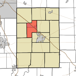
| County | Shelby |
| Government | |
| • Type | Indiana township |
| Area | |
| • Total | 22.31 sq mi (57.8 km2) |
| • Land | 22.2 sq mi (57 km2) |
| • Water | 0.11 sq mi (0.3 km2) |
| Elevation | 761 ft (232 m) |
| Population (2010) | |
| • Total | 2,015 |
| • Density | 90.8/sq mi (35.1/km2) |
| FIPS code | 18-07102[2] |
| GNIS feature ID | 453134 |

Brandywine Township is one of fourteen townships in Shelby County, Indiana. As of the 2010 census, its population was 2,015 and it contained 843 housing units.[3]
Brandywine Township was organized in 1843.[4]
Geography[]
According to the 2010 census, the township has a total area of 22.31 square miles (57.8 km2), of which 22.2 square miles (57 km2) (or 99.51%) is land and 0.11 square miles (0.28 km2) (or 0.49%) is water.[3]
The township contains Brandywine Creek.[5]
Cities and towns[]
- Fairland
Unincorporated towns[]
References[]
- ^ "US Board on Geographic Names". United States Geological Survey. 2007-10-25. Retrieved 2008-01-31.
- ^ "U.S. Census website". United States Census Bureau. Retrieved 2008-01-31.
- ^ a b "Population, Housing Units, Area, and Density: 2010 - County -- County Subdivision and Place -- 2010 Census Summary File 1". United States Census. Archived from the original on 2020-02-12. Retrieved 2013-05-10.
- ^ History of Shelby County, Indiana: From the Earliest Time to the Present, with Biographical Sketches, Notes, Etc. Brant & Fuller. 1887. p. 278.
- ^ Shelby County, Indiana History & Families. Turner Publishing Company. 1992. p. 142. ISBN 978-1-56311-078-8.
External links[]
Municipalities and communities of Shelby County, Indiana, United States | ||
|---|---|---|
| City | ||
| Towns |
| |
| Townships | ||
| CDP | ||
| Other unincorporated communities |
| |
| Footnotes | ‡This populated place also has portions in an adjacent county or counties | |
| ||
This Shelby County, Indiana location article is a stub. You can help Wikipedia by . |
Categories:
- Townships in Shelby County, Indiana
- Townships in Indiana
- Indianapolis-Anderson-Columbus geography stubs