Brass, Nigeria
Brass | |
|---|---|
 Brass Location in Nigeria | |
| Coordinates: 4°18′54″N 6°14′30″E / 4.31500°N 6.24167°ECoordinates: 4°18′54″N 6°14′30″E / 4.31500°N 6.24167°E | |
| Country | |
| State | Bayelsa State |
| Headquarters | Twon-Brass |
| Government | |
| • Type | LGA |
| Area | |
| • Total | 1,404 km2 (542 sq mi) |
| Population (2006 census) | |
| • Total | 185,049 |
| Time zone | UTC+1 (WAT) |
| 3-digit postal code prefix | 562 |
| ISO 3166 code | NG.BY.BR |

Brass is a Local Government Area in Bayelsa State, sourthern Nigeria.[1] Its headquarters are in the town of Twon-Brass on Brass Island along the coast. It has a coastline of approximately 90 km on the Bight of Bonny.[2] Much of the area of the LGA is occupied by the Edumanom National Forest.
It has an area of 1,404 km2 and a population of 185,049 at the 2006 census.
The postal code of the area is 562.[3] It is a traditional fishing village of the Nembe branch of the Ijo people, it became a slave-trading port for the state of Brass (Nembe) in the early 19th century. It was ruled by African merchant “houses,” which were encouraged by the European traders, the state’s chief slave-collecting centres (Brass and Nembe) often sent war canoes into the interior—especially through Igbo country—to capture slaves.[4]
Economy of Brass[]
Brass has enormous deposits of crude oil and natural gas and because of the rich natural resources has the presence of several national and international oil mining companies. The activities of these oil mining companies has contributed to the most of the economic development of the Brass area. The Brass people are also known as farmers as Farming is also an important economic activity with crops such as oil palm, plantain, and sugarcane grown in the Brass area. Another economy activities of the Brass to sustain livelihood are Fishing and the making of fishing nets, construction of canoes also is another key economic features of the Brass area.[5]
References[]
- ^ Mfonobong, Daniel (2020-06-29). "Bayelsa State: List of Local Government Areas & Towns". Nigerian Infopedia. Retrieved 2021-09-15.
- ^ "Local Government Areas in Bayelsa | AllNigeriaInfo". Retrieved 2021-09-16.
- ^ "Post Offices- with map of LGA". NIPOST. Archived from the original on 2009-10-07. Retrieved 2009-10-20.
- ^ "Brass | Nigeria". Encyclopedia Britannica. Retrieved 2021-09-18.
- ^ "Brass Local Government Area". www.manpower.com.ng. Retrieved 2021-09-15.
State capital: Yenagoa | ||
| Local Government Areas | 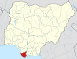 | |
This Bayelsa State, Nigeria location article is a stub. You can help Wikipedia by . |
- Local Government Areas in Bayelsa State
- Populated coastal places in Nigeria
- South South Nigeria geography stubs