Ogbia
Ogbia | |
|---|---|
LGA and town | |
 Ogbia Location in Nigeria | |
| Coordinates: 4°47′N 6°20′E / 4.783°N 6.333°ECoordinates: 4°47′N 6°20′E / 4.783°N 6.333°E | |
| Country | |
| State | Bayelsa State |
| Headquarters | Ogbia |
| Government | |
| • [Obanobhan] | HRM Dumaro Charles Owaba |
| Area | |
| • Total | 1,698 km2 (656 sq mi) |
| Population (2006 census) | |
| • Total | 266,008 |
| Time zone | UTC+1 (WAT) |
| 3-digit postal code prefix | 560 |
| ISO 3166 code | NG.BY.OG |

Ogbia is a Local Government Area of Bayelsa State in the Niger Delta region of Nigeria.[1] Its headquarters is in the town of Ogbia in the south of the area at 4°39′00″N 6°16′00″E / 4.65000°N 6.26667°E.
It has an area of 695 km2 and a population of 179,926. It is well known for its historic value to the today Nigerian state economy mainstay, i.e., its oil industry, being the local government area encompassing Oloibiri the first place oil was discovered on Sunday 15 January 1956.[2]
The postal code of the area is 562.[3] Ogbia is also the name of a subgroup of the Ijaw nation. The Ogbia people, speak the Ogbia language, a unique Ijaw dialect. The Ogbia people who inhabit the Ogbia local government of Bayelsa, have close kinship and language ties with the Okoroma people of Nembe local government of Bayelsa; the Odual people of Abua/Odual local government of Rivers state; the Ogbogolo people of Ahoada in Rivers state.[4] The present political headquarters of the Ogbia people, is Ogbia town; a town conceptualized and founded in 1972 by the Ogbia brotherhood. It also serves as the local government headquarters. The inhabitants of Ogbia land are mainly fishermen and farmers. Former Nigerian president Goodluck Ebele Jonathan was born in Otuoke, Ogbia. The first civilian governor of the old Rivers state, Chief Milford Obiene Okilo was also from Emakalakala in Ogbia. According Alagoa (2009) King Amakiri, the first king of modern Kalahari kingdom (1669-1757) came from Emakalakala in Ogbia.[5]
Ogbia Communities/Town'
- Ogbia[citation needed]
- Imiringi[citation needed]
- Elebele[citation needed]
- Kolo 1[citation needed]
- Kolo 2[citation needed]
- Kolo 3[citation needed]
- Emeyal 1[citation needed]
- Emeyal 2[citation needed]
- Otuosega[citation needed]
- Oruema[citation needed]
- Emakalakala[citation needed]
- Eboh[citation needed]
- Obeduma[citation needed]
- Akipelai[citation needed]
- Otuagbagi[citation needed]
- Otuoke[citation needed]
- Otakeme[citation needed]
- Oloibiri[citation needed]
- Abobiri[citation needed]
- Opume[citation needed]
- Otuogori[citation needed]
- Idema[citation needed]
- Otuokpoti[citation needed]
- Anyama[citation needed]
- Onuebum[citation needed]
- Ewema[citation needed]
- Otuabulla 1[citation needed]
- Otuabulla 2[citation needed]
- Ologi[citation needed]
- Otuedu[citation needed]
- Okodi[citation needed]
- Ayakoro[citation needed]
- Otuobhi[citation needed]
References[]
- ^ "Fig1: Map of Ogbia L.G.A, Bayelsa State Showing Study Areas Location of..." ResearchGate. Retrieved 12 September 2021.
- ^ "60 YEARS AFTER NIGERIA'S FIRST CRUDE: Oloibiri oil dries up, natives wallow in abject poverty". Vanguard News. 13 March 2016. Retrieved 12 September 2021.
- ^ "Post Offices- with map of LGA". Nigerian Postal Service. Archived from the original on 26 November 2012. Retrieved 20 October 2009.
- ^ Nwajiaku, Kathryn (25 June 2005). "Between Discourse and Reality. The Politics of Oil and Ijaw Ethnic Nationalism in the Niger Delta". Cahiers d'études africaines. 45 (178): 457–496. doi:10.4000/etudesafricaines.5448. ISSN 0008-0055.
- ^ Alagoa, Ebiegberi Joe (November 1966). "Oral Tradition among the Ijo of the Niger Delta". The Journal of African History. 7 (3): 405–419. doi:10.1017/S0021853700006496. ISSN 1469-5138.
State capital: Yenagoa | ||
| Local Government Areas | 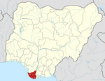 | |
This Bayelsa State, Nigeria location article is a stub. You can help Wikipedia by . |
- Local Government Areas in Bayelsa State
- Populated places in Bayelsa State
- Ijaw states
- South South Nigeria geography stubs