Southern Ijaw
Southern Ijaw | |
|---|---|
LGA | |
 Southern Ijaw Location in Nigeria | |
| Coordinates: 4°42′N 5°58′E / 4.700°N 5.967°ECoordinates: 4°42′N 5°58′E / 4.700°N 5.967°E | |
| Country | |
| State | Bayelsa State |
| Headquarters | (Osokoma) |
| Area | |
| • Total | 2,682 km2 (1,036 sq mi) |
| Population (2006 census) | |
| • Total | 319,413 |
| Time zone | UTC+1 (WAT) |
| 3-digit postal code prefix | 560 |
| ISO 3166 code | NG.BY.SI |

Southern Ijaw is a Local Government Area of Bayelsa State, Southern part of Nigeria.[1] Its headquarters are in the town of (or Osokoma) in the north of the area at 4°48′17″N 6°04′44″E / 4.80472°N 6.07889°E. The area has a coastline of approximately 60 km on the Bight of Benin.
The people and their language are known as Izon. The LGA also has a wide practice of religion such as Traditionalism and Christianity.[2]
It has institutions like the Niger Delta University (NDU), the state's airport in Amassoma and Federal Polytechnic, Ekowe. It is the home of Kolu United FC of Koluama II.[citation needed]
The first democratically elected governor, Chief Diepreye Alamieyeseigha (DSP) hailed from the area.
It has an area of 2,682 km2 and a population of 319,413 at the 2006 census.[citation needed]
The postal code of the area is 560.[3] The local government is made up of several towns and villages which include Igbomotoro, Peremabiri, Opuama, Eniwari, Angiama, Diebu, Ondewari, and Aziama.[4]
References[]
- ^ "Southern Ijaw Local Government Area – Channels Television". Retrieved 2021-09-17.
- ^ "Southern Ijaw Local Government Area". www.manpower.com.ng. Retrieved 2021-09-12.
- ^ "Post Offices- with map of LGA". NIPOST. Archived from the original on 2012-11-26. Retrieved 2009-10-20.
- ^ "Southern Ijaw Local Government Area". www.manpower.com.ng. Retrieved 2021-09-18.
State capital: Yenagoa | ||
| Local Government Areas | 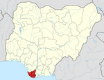 | |
This Bayelsa State, Nigeria location article is a stub. You can help Wikipedia by . |
- Local Government Areas in Bayelsa State
- Populated places in Bayelsa State
- Populated coastal places in Nigeria
- South South Nigeria geography stubs