Brazilian Highway System
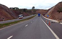
The Brazilian Highway System (Portuguese: Sistema Nacional de Rodovias) is the highway system of Brazil. As of 2010, the system consists of almost 2 million kilometers of roads, of which approximately 200,000 km are paved.[citation needed]
As it is in the United States, Canada, or most countries in Europe, larger/wider highways have higher speed limits than normal urban roads (typically between 80 km/h and 120 km/h), although minor highways, unpaved highways and sections of major highways running inside urban areas have a lower speed limit in general. The national speed limit for cars driving in non-urban roads is 110 km/h unless otherwise stated, regardless of the road design, weather or daylight.

Nomenclature[]

Brazilian Regional highways are named YY-XXX, where YY is the abbreviation of the state where the highway is running in and XXX is a number (e.g. SP-280; where SP means that the highway is under São Paulo state administration).
Brazilian National highways are named BR-XXX. National highways connect multiple states altogether, are of major importance to the national economy and/or connect Brazil to another country. The meaning of the numbers are:
- 000-099 - it means that the highway runs radially from Brasília. It is an exception to the cases below.
- 100-199 - it means that the highway runs in a south-north way
- 200-299 - it means that the highway runs in a west-east way
- 300-399 - it means that the highway runs in a diagonal way. Highways with odd numbers run northeast-southwest, while even numbers run northwest-southeast.
- 400-499 - it means that the highway interconnects two major highways.
Often Brazilian highways receive names (famous people, etc.), but continue to have a YY/BR-XXX name (example: Rodovia Castelo Branco is also SP-280).
See highway system of São Paulo for numbering designation for São Paulo state roads, also used in some other states.

Major Federal Brazilian Highways[]

BR-010[]

The BR-010 is a radial highway that connects the national capital Brasília, to the city of Belém, in the state of Pará. It has the official name of Rodovia Bernardo Sayão (the name of its chief engineer, who died in an accident during the construction of the highway, when a tree fell on him), and is also called Belém-Brasília Highway or as Transbrasiliana Highway, in the stretch between the city of Estreito, in the state of Maranhão, and the city of Belém. This is due to the fact that between Brasília and Estreito, the highway has many incomplete and unpaved stretches, especially in the state of Tocantins. Between Brasília and Estreito, the original route of the Belém-Brasília Highway follows the BR-060, the BR-153 and the BR-226 highways, which are completely paved in this stretch. The BR-010 passes through the Federal District, and the states of Goiás, Tocantins, Maranhão and Pará.
BR-020[]

The BR-020 connects Fortaleza in Ceará to the federal capital Brasília. Like other BRs that start with the number 0, it leaves Brasília to an extreme point in Brazil. [1] The highway is important because passes through the MATOPIBA region (in the south of Piauí and in the west of Bahia), which is an important producer of soybeans, corn and cotton, among other products. It connects the interior of the Northeast to the Port of Mucuripe, in Fortaleza. [2]
BR-040[]

BR-040 runs radially from near the national capital Brasília (beginning 100 km south of the beginning of BR-050, in Brasília), in a northwest-southeast way, to Rio de Janeiro city.
BR-040 is the modern way of the so-called "Caminho Novo", opened in the 18th century that linked Ouro Preto, the main center of gold mines of Minas Gerais to the Rio de Janeiro harbor.
In 1861 the road was paved from Petrópolis to Juiz de Fora, becoming the first road paved in Latin America until the 1920s. In 1928, Petrópolis was connected to Rio de Janeiro with a paved road.
In the 1930s the route was changed to pass by the new capital of Minas Gerais, Belo Horizonte, although it was unpaved until 1957, when the road was extended to Brasília, the new capital of Brazil.
From 1951 to 1973 BR-040 was called BR-3 and was famous for its dangerous bends, such as the Viaduto das Almas, near Belo Horizonte, disabled in 2010. In the 1970s the part from Rio de Janeiro to Juiz de Fora was modernized and became a two-laned road.
Cities where the BR-040 runs or passes by: Luislândia, Belo Horizonte, Juiz de Fora, Rio de Janeiro.
BR-050[]

BR-050 runs radially from the national capital, Brasília, in a north-south way, to Santos city, passing in São Paulo. It's one of the most important highways in the country: being close to being fully duplicated in 2021, it passes through some of the richest regions of Brazil. It links areas of large agricultural and industrial production to Port of Santos, the largest in the country. Brasília is the city with the highest average salary per inhabitant. Goiás is one of the largest national producers of sugarcane, soy, corn and tomatoes, in addition to having a large cattle ranching. The area between Uberaba and Uberlândia, in Minas Gerais, has the largest milk production in Brazil. The state of São Paulo holds 30% of Brazil's industrial GDP and a gigantic agricultural sector. In Ribeirão Preto there is the largest production of sugarcane in the world. In Franca, there is the largest national production of men's shoes. The highway also drains the gigantic production of coffee from Minas Gerais and orange juice from São Paulo. In the area around Campinas there is a great technological production. 40% of the cars produced in the country come from the cities of Greater São Paulo. Not to mention the production of chicken meat and all industrial production in São Paulo, which is basically exported via Santos. [3][4] [5][6]
BR-060[]
This road onnects Brasilia to Bela Vista, on the Paraguayan border.[7][8] The highway is important because helps in the flow of agricultural production in the Center-West Region, which specializes in: soybeans, corn, sugarcane, tomatoes, beans, in the planting of eucalyptus for the production of cellulose and paper, and in cattle raising. Goiás and Mato Grosso do Sul also have considerable mineral exploration, producing a lot of iron ore, nickel and copper, in addition to gold, manganese and niobium. The BR-060 will in the future serve as a link with the Bioceanic Corridor that is being built with 3 other South American countries, connecting Campo Grande to Antofagasta, passing through Paraguay, northern Argentina and northern Chile. [9][10][11][12][13][14][15][16]
BR-101[]

BR-101 runs in a north-south way, along Brazil's eastern coast. It is Brazil's second major highway, and the longest in the country (nearly 4800 km long). It connects more states capitals than any other "rodovia" in the country, in the total, 12 capitals are directly connected by BR-101. It's considered one of the most important highways in the country, along with BR-116.[17]
The Rio–Niterói Bridge is part of the BR-101.
Cities where the BR-101 runs or passes by: Natal, João Pessoa, Olinda, Recife, Maceió, Aracaju, Feira de Santana, Itabuna, Ilhéus, Porto Seguro, Linhares, Vitória, Guarapari, Niterói, Rio de Janeiro, Barra Mansa, Santos, Curitiba, Joinville, Florianópolis, Criciúma, Osório.
BR-116[]

BR-116 runs in a north-south way, near, but not on Brazil's coastline. It is considered one of the most important highways in the country, along with BR-101.[18] It's also the second longest of the country. Numerous parts of the long path taken by the BR-116 have other official names.
Cities where the BR-116 runs or passes by: Fortaleza, Salgueiro, Feira de Santana, Vitória da Conquista, Teófilo Otoni, Governador Valadares, Rio de Janeiro, Volta Redonda, São José dos Campos, São Paulo, Curitiba, Lages, Canoas, Porto Alegre.
BR-153[]
Also called as Transbrasiliana Highway, as Belém-Brasília Highway or even as Bernardo Sayão Highway, the BR-153 is one of the longest highways in South America and runs in the north-south direction, connecting the city of Marabá, in the state of Pará, and the city of Aceguá, in the boundary with Uruguay. It passes through the states of Pará, Tocantins, Goiás, Minas Gerais (Triângulo Mineiro region), São Paulo, Paraná, Santa Catarina and Rio Grande do Sul. The BR-153 is one of the main highways of the central region of Brazil, mainly in the states of Goiás and Tocantins, and also in the Triângulo Mineiro region.
BR-277[]

BR-277 is a highway that runs east-west, starting from the Friendship Bridge (which connects Brazil with Paraguay) and goes up to Paranaguá. It is of major importance to Paraguay, since major importations are made using the Paranaguá seaport.
Major cities connected by the BR-277: Foz do Iguaçu, Medianeira, Cascavel, Guarapuava, Ponta Grossa, Curitiba, Paranaguá. BR-277 is approximately 650 km long.
The highway is of great economic importance for Brazil and even for Paraguay, as it connects the Brazil-Paraguay border with the Port of Paranaguá. On the part of Brazil, it is one of the most important highways in the South Region of Brazil, as it connects Curitiba (the capital of the State and the third city with the highest GDP in Brazil) with the port city of Paranaguá (which has an exit to the Ocean Atlántico), and with the border city of Foz de Iguazú, one of the most touristic cities in Brazil, due to the Iguazú Falls, the Itaipú hydroelectric plant and trade with Paraguay). While for Paraguay, it serves as an exit to the sea, using the port of Paranagua for its international exports, having a direct connection with Asunción (the capital of Paraguay) through Route PY-02 within Paraguayan territory. On the border there is intense trade between the two countries; There is great tourism in the Foz do Iguaçu area due to border trade and mainly due to the Iguazú Falls and the Central Itaipu. In Paraná, there is a large production of soybeans, corn, chicken, milk, cellulose and fish, among other products (which are exported in Paranaguá), and Paraguay uses the port to carry out part of its exports through the Atlantic Ocean. [19][20][21][22][23]
BR-369[]

The road begins in Oliveira, Minas Gerais and ends in Cascavel in the state of Paraná.[24][25]
This road is extremely important to transport products from agriculture, livestock and industry from the states of Paraná to São Paulo and vice versa. As some examples, we have soy, corn, coffee, beef, paper and cellulose, wood, furniture and other important products in the region. [26][27][28] The highway also connects the western states of Paraná and São Paulo with Paraguay. Paraguay imports most of the products it consumes from Brazil (one of the main promoters of the Paraguayan economy). Therefore, trade and tourism with Paraguay are strong in the region. Foz do Iguaçu and Ciudad del Este benefit directly from the highway. [29]
BR-376[]

The road connects the cities of Garuva, in the state of Santa Catarina, to Dourados, Mato Grosso do Sul. It has a length of 958,3 km.[30] The road is very important to transport agricultural, livestock and industrial products from the states of Paraná and Mato Grosso do Sul. As some examples, we have soy, corn, coffee, beef, paper and cellulose, wood, furniture and other important products. in the region. [31]
BR-386[]

This highway connects Canoas (in the metropolitan region of Porto Alegre, capital of the state of Rio Grande do Sul) with the municipality of Iraí (in the extreme northwest of the state, on the border with Santa Catarina). [32]
It's called the Production Highway due to its high importance for the state. Through it all the production of soy, corn, wheat, meat, wood, furniture, among other products of the region is drained. In the city of Ametista do Sul, close to Iraí, there is the largest production of amethyst in the world. Close to Lajeado is one of the largest productions of tobacco on the planet. In Santa Catarina, the highway ends near Chapecó, the largest regional hub in the west of the state. In general, cities with significant GDP are on the side of the highway.[33][34][35][36][37][38][39]
References[]
- ^ Rodovias Radiais
- ^ PPM 2017: Rebanho bovino predomina no Centro-Oeste e Mato Grosso lidera entre os estados
- ^ Profile of the Industry of São Paulo
- ^ IBGE prevê safra recorde de grãos em 2020
- ^ Produção brasileira de laranja em 2018
- ^ Produção de leite cai 0,5% e totaliza 33,5 bilhões de litros em 2017
- ^ BR 060 map[permanent dead link]
- ^ Rodovias Radiais
- ^ Cronograma da Rota Bioceânica segue com obras em ritmo acelerado no Paraguai
- ^ Encontro do Corredor Bioceânico avança em projetos turísticos, culturais e comerciais
- ^ IBGE prevê safra recorde de grãos em 2020
- ^ MS deve registrar maior safra de soja da história e produção pode chegar a mais de 11 milhões de toneladas
- ^ Goiás é o segundo maior produtor de cana-de-açúcar do País
- ^ Com quarto maior rebanho bovino do país, MS recebe evento para debater todos os elos da cadeia produtiva
- ^ MS se consolida como maior exportador de celulose do país
- ^ Anuário Mineral Brasileiro 2018
- ^ Rodovias Longitudinais
- ^ Rodovias Longitudinais
- ^ Paraná é o segundo maior produtor de leite do Brasil, confirma IBGE
- ^ PPM 2017: Rebanho bovino predomina no Centro-Oeste e Mato Grosso lidera entre os estados
- ^ REGIÃO SUL DO BRASIL É O MAIOR CENTRO PRODUTIVO DE PROTEÍNA ANIMAL DO MUNDO
- ^ PPM 2017: Rebanho bovino predomina no Centro-Oeste e Mato Grosso lidera entre os estados.
- ^ IBGE prevê safra recorde de grãos em 2020
- ^ "Infra-estrutura de transportes" (map). ibge.gov.br (in Portuguese). Brazilian Institute of Geography and Statistics (IBGE). 2005. Retrieved 28 February 2016.[permanent dead link]
- ^ "SNV 2015 Completo". dnit.gov.br (in Portuguese). Departamento Nacional de Infraestrutura de Transportes (DNIT) — Sistema Nacional de Viação. 2015-12-15. Archived from the original on 4 March 2016. Retrieved 28 February 2016.
- ^ Cobra Repórter e Ratinho Junior visitam Congresso Nacional Moveleiro
- ^ Escolha de obra do Contorno Norte facilita atração de indústrias
- ^ Estratégias regionais vão nortear desenvolvimento do Paraná até 2035[permanent dead link]
- ^ Comércio bilateral entre Brasil e Paraguai é destaque no Mercosul
- ^ Rodovias Diagonais
- ^ "BR-376 - Rodovia do Café - história". Archived from the original on 2018-12-28. Retrieved 2021-03-12.
- ^ "Rodovias Diagonais" (PDF). dnit.gov.br (in Portuguese). Departamento Nacional de Infraestrutura de Transportes (DNIT) — Sistema Nacional de Viação. Retrieved 13 March 2021.
- ^ IBGE prevê safra recorde de grãos em 2020
- ^ PPM 2017: Rebanho bovino predomina no Centro-Oeste e Mato Grosso lidera entre os estados
- ^ Algumas Gemas Clássicas
- ^ Rio Grande do Sul: o maior exportador de pedras preciosas do Brasil
- ^ Os alemães e as pedras preciosas gaúchas
- ^ Maior pedra de água-marinha é brasileira e ficará exposta nos EUA
- ^ http://g1.globo.com/rs/rio-grande-do-sul/nossa-terra/2013/noticia/2013/07/pedras-de-ametista-sao-atrativos-para-turistas-em-cidade-no-norte-do-rs.html
Bibliography[]
- (in French) Michel Braudeau, « L'autoroute de l'amertume », in Le rêve amazonien, éditions Gallimard, 2004 (ISBN 2-07-077049-4).
External links[]
- (in Portuguese) São Paulo Detran
- Highways in Brazil