Bright, Indiana
Bright, Indiana | |
|---|---|
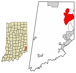 Location of Bright in Dearborn County, Indiana. | |
| Coordinates: 39°13′5″N 84°51′44″W / 39.21806°N 84.86222°WCoordinates: 39°13′5″N 84°51′44″W / 39.21806°N 84.86222°W | |
| Country | United States |
| State | Indiana |
| County | Dearborn |
| Townships | Logan, Harrison, Miller |
| Area | |
| • Total | 12.57 sq mi (32.55 km2) |
| • Land | 12.55 sq mi (32.50 km2) |
| • Water | 0.02 sq mi (0.05 km2) |
| Elevation | 922 ft (281 m) |
| Population (2010) | |
| • Total | 5,693 |
| • Density | 454/sq mi (175.2/km2) |
| Time zone | UTC-5 (Eastern (EST)) |
| • Summer (DST) | UTC-4 (EDT) |
| Area code(s) | 812 |
| FIPS code | 18-07624[1] |
| GNIS feature ID | 0431525[2] |

Bright is an unincorporated community and census-designated place (CDP) in Dearborn County, Indiana, United States. The population was 5,693 at the 2010 census.[3]
History[]
A post office was established at Bright in 1847, and remained in operation until it was discontinued in 1904.[4]
At least since the 1980s, Bright has been transformed from a small town to an exurb of Cincinnati.[5]
Geography[]
Bright is located in northeastern Dearborn County at 39°13′5″N 84°51′44″W / 39.21806°N 84.86222°W (39.218114, -84.862357),[6] in Logan, Harrison, and Miller townships. The eastern edge of the Bright CDP follows the Indiana–Ohio border. Harrison, Ohio, is 4 miles (6 km) to the northeast via Jamison Road, and downtown Cincinnati is 27 miles (43 km) to the east.
According to the United States Census Bureau, the Bright CDP has a total area of 12.6 square miles (32.6 km2), of which 0.02 square miles (0.05 km2), or 0.15%, is water.[3]
Demographics[]
| Historical population | |||
|---|---|---|---|
| Census | Pop. | %± | |
| U.S. Decennial Census[7] | |||
As of the census[1] of 2000, there were 5,405 people, 1,770 households, and 1,493 families residing in the CDP. The population density was 377.7 people per square mile (145.8/km2). There were 1,811 housing units at an average density of 126.6/sq mi (48.9/km2). The racial makeup of the CDP was 98.43% White, 0.41% African American, 0.11% Native American, 0.09% Asian, 0.30% from other races, and 0.67% from two or more races. Hispanic or Latino of any race were 0.63% of the population.
There were 1,770 households, out of which 46.8% had children under the age of 18 living with them, 73.4% were married couples living together, 8.3% had a female householder with no husband present, and 15.6% were non-families. 12.8% of all households were made up of individuals, and 3.7% had someone living alone who was 65 years of age or older. The average household size was 3.05 and the average family size was 3.36.
In the CDP, the population was spread out, with 31.7% under the age of 18, 7.9% from 18 to 24, 31.6% from 25 to 44, 22.1% from 45 to 64, and 6.7% who were 65 years of age or older. The median age was 34 years. For every 100 females, there were 100.6 males. For every 100 females age 18 and over, there were 98.4 males.
The median income for a household in the CDP was $63,813, and the median income for a family was $66,639. Males had a median income of $41,923 versus $27,917 for females. The per capita income for the CDP was $22,401. About 1.6% of families and 1.7% of the population were below the poverty line, including 1.8% of those under age 18 and 2.6% of those age 65 or over.
References[]
- ^ Jump up to: a b "U.S. Census website". United States Census Bureau. Retrieved 2008-01-31.
- ^ "US Board on Geographic Names". United States Geological Survey. 2007-10-25. Retrieved 2008-01-31.
- ^ Jump up to: a b "Geographic Identifiers: 2010 Demographic Profile Data (G001): Bright CDP, Indiana". U.S. Census Bureau, American Factfinder. Retrieved October 23, 2015.[dead link]
- ^ "Dearborn County". Jim Forte Postal History. Archived from the original on 3 September 2014. Retrieved 31 August 2014.
- ^ Communications, Emmis (December 1989). Cincinnati Magazine. Emmis Communications. p. 62. ISSN 0746-8210.
- ^ "US Gazetteer files: 2010, 2000, and 1990". United States Census Bureau. 2011-02-12. Retrieved 2011-04-23.
- ^ "Census of Population and Housing". Census.gov. Retrieved June 4, 2016.
| show Municipalities and communities of Dearborn County, Indiana, United States |
|---|
| show Authority control |
|---|
- Census-designated places in Dearborn County, Indiana
- Census-designated places in Indiana