Miller Township, Dearborn County, Indiana
Miller Township | |
|---|---|
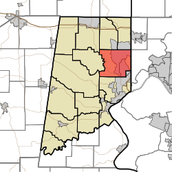 Location of Miller Township in Dearborn County | |
| Coordinates: 39°10′48″N 84°52′27″W / 39.18000°N 84.87417°WCoordinates: 39°10′48″N 84°52′27″W / 39.18000°N 84.87417°W | |
| Country | United States |
| State | Indiana |
| County | Dearborn |
| Government | |
| • Type | Indiana township |
| Area | |
| • Total | 26.37 sq mi (68.3 km2) |
| • Land | 26.14 sq mi (67.7 km2) |
| • Water | 0.23 sq mi (0.6 km2) |
| Elevation | 568 ft (173 m) |
| Population (2010) | |
| • Total | 9,810 |
| • Density | 375.3/sq mi (144.9/km2) |
| FIPS code | 18-49464[2] |
| GNIS feature ID | 453628 |

Miller Township is one of fourteen townships in Dearborn County, Indiana. As of the 2010 census, its population was 9,810 and it contained 3,651 housing units.[3]
History[]
Miller Township was organized in 1834.[4][5]
Geography[]
According to the 2010 census, the township has a total area of 26.37 square miles (68.3 km2), of which 26.14 square miles (67.7 km2) (or 99.13%) is land and 0.23 square miles (0.60 km2) (or 0.87%) is water.[3]
Cities and towns[]
- Bright (south half)
- Hidden Valley (vast majority)
Major highways[]
Cemeteries[]
The township contains three cemeteries: Georgetown, Pelley and Sugar Ridge.
References[]
- ^ "US Board on Geographic Names". United States Geological Survey. 2007-10-25. Retrieved 2008-01-31.
- ^ "U.S. Census website". United States Census Bureau. Retrieved 2008-01-31.
- ^ a b "Population, Housing Units, Area, and Density: 2010 - County -- County Subdivision and Place -- 2010 Census Summary File 1". United States Census. Archived from the original on 2020-02-12. Retrieved 2013-05-10.
- ^ Shaw, Archibald (1915). History of Dearborn County, Indiana: Her People, Industries and Institutions. Unigraphic. pp. 205.
- ^ History of Dearborn and Ohio Counties, Indiana. F. E. Weakley. 1885. pp. 456.
External links[]
Places adjacent to Miller Township, Dearborn County, Indiana | |
|---|---|
Municipalities and communities of Dearborn County, Indiana, United States | ||
|---|---|---|
| Cities | ||
| Towns |
| |
| Townships | ||
| CDPs | ||
| Other unincorporated communities | ||
| ||
Categories:
- Townships in Dearborn County, Indiana
- Townships in Indiana