Brighton, Ontario
Brighton | |
|---|---|
Municipality (lower-tier) | |
| Municipality of Brighton | |
 | |
| Motto(s): Where the past greets the future | |
 Brighton | |
| Coordinates: 44°07′20″N 77°45′51″W / 44.12222°N 77.76417°WCoordinates: 44°07′20″N 77°45′51″W / 44.12222°N 77.76417°W[1] | |
| Country | Canada |
| Province | Ontario |
| County | Northumberland |
| Formed | January 1, 2001 |
| Government | |
| • Mayor | Brian Ostrander |
| • Federal riding | Northumberland—Quinte West |
| • Prov. riding | Northumberland—Quinte West |
| Area | |
| • Land | 222.71 km2 (85.99 sq mi) |
| Population (2016)[2] | |
| • Total | 11,844 |
| • Density | 43.2/km2 (112/sq mi) |
| Time zone | UTC-5 (EST) |
| • Summer (DST) | UTC-4 (EDT) |
| Postal Code | K0K 1H0 |
| Area code(s) | 613 |
| Website | www |


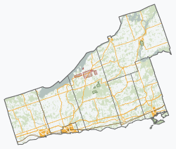
Brighton is a town in Northumberland County, Ontario, Canada,[1] approximately 150 kilometres (93 mi) east of Toronto and 100 km (62 mi) west of Kingston. It is traversed by both Highway 401 and the former Highway 2. The west end of the Murray Canal that leads east to the Bay of Quinte is at the east end of the town.
The land upon which the present-day town of Brighton is situated originally belonged to the Mississauga (Anishinaabe-speaking) peoples.[3]
Brighton later developed into primarily an agricultural community, specializing in the farming of apples and production of new apple types. However, in recent years, many of the original orchards in the area have been partially removed, to make way for the steadily growing population, and more profitable agricultural produce, such as wheat, corn and soybeans. In late September, Brighton is host to Applefest, its largest yearly festival.
The Municipality of Brighton (formed on January 1, 2001, through an amalgamation of the former Town of Brighton and Brighton Township) is home to over 11,000 inhabitants,[2] with a higher than average percentage of those retired. This is common, as the quiet, clean and friendly atmosphere of many smaller towns near Lake Ontario tend to draw the elderly as popular places for retirement living.
Presqu'ile Provincial Park, just south of the town centre, is one of Brighton's most popular attractions. The park is noted for bird-watching and other nature-oriented activities. Memory Junction Railway Museum, located in a former Grand Trunk station, has a collection of rail equipment and memorabilia.
Communities[]
Besides the town proper of Brighton, the municipality of Brighton comprises a number of villages and hamlets, including the following communities such as Carman, Codrington, Hilton, Spring Valley, Smithfield (partially); Butler Creek, Cankerville, Cedar Creek, Gosport, Orland, Presqui'le Point, Wade Corners.
History[]
The village of Brighton was incorporated on January 1, 1859. On December 1, 1980, it became a town.[4]
The original Simpson house, at 61 Simpson Street, was built in 1850.[5]
The artificial island area of Brighton[]
Part of the current Municipality of Brighton is on a separate artificial island. This is a consequence of the borders chosen when the Township of Brighton was created in 1851, and the excavation of the Murray Canal across the historic Isthmus of Murray. The Murray Canal opened in 1889.
Demographics[]
| hideCanada census – Brighton, Ontario community profile | |||
|---|---|---|---|
| 2016 | 2011 | 2006 | |
| Population: | 11,844 (+8.4% from 2011) | 10,928 (+6.6% from 2006) | 10,253 (+8.5% from 2001) |
| Land area: | 222.71 km2 (85.99 sq mi) | 222.76 km2 (86.01 sq mi) | 222.52 km2 (85.92 sq mi) |
| Population density: | 53.2/km2 (138/sq mi) | 49.1/km2 (127/sq mi) | 46.1/km2 (119/sq mi) |
| Median age: | 52.8 (M: 51.2, F: 54.3) | 46.5 (M: 45.3, F: 48.0) | |
| Total private dwellings: | 5,099 | 4,825 | 4,328 |
| Median household income: | $68,683 | $54,278 | |
| References: 2016[6] 2011[7] 2006[8] earlier[9] | |||
| Year | Pop. | ±% |
|---|---|---|
| 1996 | 9,022 | — |
| 2001 | 9,449 | +4.7% |
| 2006 | 10,253 | +8.5% |
| 2011 | 10,928 | +6.6% |
| 2016 | 11,844 | +8.4% |
| [10][2] | ||
Prior to amalgamation (2001):
- Population in 1996: 9,022
- Brighton (town): 4,584
- Brighton (township): 4,438
- Population in 1991:
- Brighton (town): 4,366
- Brighton (township): 4,115
Mother tongue:
- English as first language: 92.2%
- French as first language: 2.0%
- English and French as first language: 0%
- Other as first language: 5.8%
Notable residents[]
- Eddie Hayward, racehorse trainer who won the Kentucky Derby
- Mark Kellogg, Associated Press correspondent killed at the Battle of the Little Bighorn
- Gail Vaz-Oxlade, financial writer and television personality. Host of the Slice series Til Debt Do Us Part and Princess.
Media[]
- Brighton Independent [1] (Metroland Media Group)
- Oldies 100.9 (My Broadcasting)
- Edville Gazette [2] (Independently Published)
See also[]
References[]
- ^ Jump up to: a b "Brighton". Geographical Names Data Base. Natural Resources Canada. Retrieved 2013-04-21.
- ^ Jump up to: a b c d "Census Profile, 2016 Census: Brighton, Municipality". Statistics Canada. Retrieved June 25, 2019.
- ^ Copy of the treaty made October 31, 1923 between his Majesty the King and the Chippewa Indians of Christian Island, Georgina Island and Rama Reprinted 1967. ©Roger Duhamel, F.R.S.C.. Queen's Printer And Controller Of Stationery, Ottawa, 1967. Cat. No.: R33-1467. IAND Publication No. QS-0582-000-EE-A-17 https://www.aadnc-aandc.gc.ca/eng/1100100029004/1100100029017 Archived 2011-10-14 at the Wayback Machine
- ^ Broughton, John William David (1981). "They desired a better country". pp. 5, 8. Archived from the original on 2014-05-27.
- ^ "Heritage Homes". Brighton Digital Archives. Retrieved June 25, 2019.
- ^ "2016 Community Profiles". 2016 Canadian Census. Statistics Canada. February 21, 2017. Retrieved 2019-06-25.
- ^ "2011 Community Profiles". 2011 Canadian Census. Statistics Canada. July 5, 2013. Retrieved 2012-03-12.
- ^ "2006 Community Profiles". 2006 Canadian Census. Statistics Canada. March 30, 2011. Retrieved 2012-03-12.
- ^ "2001 Community Profiles". 2001 Canadian Census. Statistics Canada. February 17, 2012.
- ^ Statistics Canada: 1996, 2001, 2006 Census
External links[]
| Wikimedia Commons has media related to Brighton, Ontario. |
| show Places adjacent to Brighton, Ontario |
|---|
| Authority control |
|
|---|
- Populated places on Lake Ontario in Canada
- Lower-tier municipalities in Ontario
- Municipalities in Northumberland County, Ontario
- Towns in Ontario