Cobourg
This article needs additional citations for verification. (August 2010) |
Cobourg | |
|---|---|
Town (lower-tier) | |
| Town of Cobourg | |
 Victoria Hall by Kivas Tully | |
| Nicknames: Ontario's Feel Good Town | |
| Motto(s): Our Strength Is In Our Unanimity | |
 Cobourg | |
| Coordinates: 43°58′N 78°10′W / 43.967°N 78.167°WCoordinates: 43°58′N 78°10′W / 43.967°N 78.167°W | |
| Country | Canada |
| Province | Ontario |
| County | Northumberland |
| Settled | 1798 |
| Incorporated | 1837 (town)[1] |
| Government | |
| • Mayor | John Henderson |
| • Council | Cobourg Town Council |
| • MP | Philip Lawrence (Northumberland—Peterborough South, CPC) |
| • MPP | David Piccini (Northumberland—Peterborough South, PC) |
| Area | |
| • Land | 22.36 km2 (8.63 sq mi) |
| Population (2016)[2] | |
| • Total | 19,440 |
| • Density | 869.3/km2 (2,251/sq mi) |
| Time zone | UTC−5 (EST) |
| • Summer (DST) | UTC−4 (EDT) |
| Postal Code FSA | K9A |
| Area code(s) | 905, 289 |
| Highways | |
| Website | www |


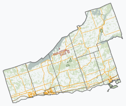
Cobourg (/'koːbə˞g/) is a town in the Canadian province of Ontario, located in Southern Ontario 95 kilometres (59 mi) east of Toronto and 62 kilometres (39 mi) east of Oshawa. It is the largest town in and seat of Northumberland County. Its nearest neighbour is Port Hope, 7 km (4 mi) to the west. It is located along Highway 401 (exits 472 and 474) and the former Highway 2 (now Northumberland County Road 2). To the south, Cobourg borders Lake Ontario. To the north, east and west, it is surrounded by Hamilton Township.
History[]
The land which present-day Cobourg occupies was previously inhabited by Mississauga (Anishinaabe-speaking) peoples.[3] The settlements that make up today's Cobourg were founded by United Empire Loyalists in 1798 within Northumberland County, Home District, Province of Upper Canada. Some of the founding fathers and early settlers were Eliud Nickerson, Joseph Ash, Zacheus Burnham and Asa Allworth Burnham. The Town was originally a group of smaller villages such as Amherst and Hardscrabble, which were later named Hamilton. In 1808 it became the district town for the Newcastle District. It was renamed Cobourg in 1818, in recognition of the marriage of Princess Charlotte Augusta of Wales to Prince Leopold of Saxe-Coburg-Saalfeld (later Saxe-Coburg and Gotha, who would later become King of Belgium).
By the 1830s, Cobourg had become a regional centre, much due to its fine harbour on Lake Ontario. In 1835 the Upper Canada Academy was established in Cobourg by Egerton Ryerson and the Wesleyan Conference of Bishops. On 1 July 1837, Cobourg was officially incorporated as a town. In 1841 the Upper Canada Academy's name was changed to Victoria College. In 1842 Victoria College was granted powers to confer degrees. Victoria College remained in Cobourg until 1892, when it was moved to Toronto and federated with the University of Toronto. In 1842, John Strachan founded the Diocesan Theological Institute in Cobourg, an Anglican seminary that became integrated into the University of Trinity College in Toronto in 1852.
The Railway to Rice Lake[]
The timber and other resources of Cobourg's large hinterland were identified as the key to its prosperity, and if they could be brought to the harbour, Lake Ontario opened up a large and prosperous market. Peterborough to the north, founded in 1825 by Peter Robinson, had become the principal source area, and in the 1830s the waterways were still the prime method of bulk transport. Rice Lake and the Otonabee River were brought into use when James Gray Bethune established a steamer running across the lake and up the Otonabee which was navigable through to Peterborough.[4] This meant goods and passengers could be brought at least to the south shore of Rice Lake. The remaining 8 miles of rough tracks was viable for passengers and light goods, but no use for the valuable timber and mine products. By 1835, only 10 years after the first steam railway in the world, there was active discussion about building a railway up to what later became Harwood. However, the townspeople invested instead in a plank road, using 300,000 feet of 3-inch wooden planks, allowing horse-drawn vehicles to haul heavy goods. By 1850 the plank road was breaking up, and was impassible in wet conditions, so the railway scheme was revived.[5]
By 1852 there was considerable enthusiasm for the railway project within the town. Unfortunately river traffic had become seen as yesterday's solution by this time, so the plans were expanded to include a 4 kilometres (2.5 mi) long bridge across Rice Lake, to take the railway right up to Peterborough. By 1854 the rails reached the shore of the lake, and it found good work transporting passengers and nearly 2 million feet of lumber from the Rice Lake down to Cobourg that summer.[6] However, all the revenue had to ploughed into building an ill-fated bridge, using hundreds of wooden trestles, 31 Burr Truss spans, and a centre-pivot swing bridge to allow boats to pass.[7] The prime mover locally for getting the Railway company off the ground was D'Arcy E. Boulton, a lawyer based in Cobourg, who enthused the town with the plan. They agreed to begin funding the scheme that was initially expected to cost £150,000, but ended leaving many people with worthless railway bonds and the town council with a debt that was only finally repaid in the 1930s. The man appointed to manage the project was Samuel Zimmerman, who had previously been instrumental in building the Great Western Railway (Ontario).[8] The bridge was constructed over the summer of 1854 and was officially opened on 29 December that year. Three days later it collapsed when ice movements shifted the trestles out of line, splintering the Burr Truss sections. The proposed solution was to stabilise the trestles (or 'stilts' as their critics dubbed them) by an infill of soil, which did happen on the southern side, still visible as a strip of land still remaining running into the lake near Harwood. But funds were not forthcoming for the northern side, and winter ice and shifting lake mud meant that it was frequently unusable.[9]
A further problem emerged when Port Hope, not far along the coast, pursued its own plans for a Railway to Peterborough. In 1857 the Port Hope and Lindsay line was constructed, and the following year opened a branch to Peterborough, going round the western end of the lake, in direct competition with the struggling Cobourg route. The response of the Cobourg directors was to oust D.E. Boulton, who then invested in the Port Hope line. Conflicts of interest among various personnel resulted in the deliberate removal of the bolts on sections of the bridge in early 1861, ensuring that when the ice moved again the bridge was destroyed, and this time it was left unrepaired.[10] The railway reverted to linking Cobourg harbour with Harwood and the Rice Lake water traffic.
In 1865 the railway was bought by a consortium of Pittsburgh steel manufacturers, who had already bought the Marmora Iron quarries north-east of Rice Lake. They established an iron-ore supply route using barges up the Trent River and across Rice Lake to the railway at Harwood. From there it was brought along the Railway to Cobourg Harbour for shipment across Lake Ontario to feed the steel mills of America. This provided a steady income for the railway and the town until the ore ran out in 1878.[11] It also had two longer term spin-offs in the form of a rail car company and the beginnings of a tourist industry.
Crossen Car Works[]
When the iron ore scheme was getting underway, a small iron foundry based in Cobourg, was approached to cast the wheels and frames of wagons to move the Marmora iron ore down to the harbour. James Crossen saw an opportunity to combine his cast-iron products with the abundant local timber to produce railway rolling stock. With the foundry located near both the Cobourg line and train station of the Grand Trunk Railway, which had been built along the shore of Lake Ontario in 1856, it was well placed to expand as Canada's railway network grew. It was later named the Crossen Car Manufacturing Company and went on to become the largest builder of timber-framed rail cars in Canada, making everything from coal and freight wagons through to dining cars and first-class carriages. By 1910 wood was going out of date, when all-steel cars took over, and in 1915 the company, unable to adapt, went into liquidation, and parts of the site reverted to being an iron foundry.[12] A replica of one of the Crossen ore cars was built in 2016 and is on display near Cobourg waterfront.[13]
Wealthy Americans[]
The connections and trade links which developed through the iron shipments brought many American industrialists to Cobourg, which became a popular summer destination. High class hotels were established, followed in the late 19th century and early 20th century by enormous summer homes for wealthy Americans, a few of which still stand today. One notable home, on King Street East, became the Brookside School - now a youth detention centre. A major ferry service connected Cobourg and Rochester, New York from 1907 to 1952, transporting passengers and cargo across Lake Ontario, allowing Americans to reach the town more readily.
Victoria Hall[]
For a brief moment in 1856 the town, with both its new railway link to the interior and an east-west rail connection along the Grand Trunk Railway, was feeling secure in its future prosperity, and thought a new Town Hall would encourage further investment and be an asset to the area.[14][15] Victoria Hall stands at the heart of the downtown, a building that now serves as the town hall, as well as home of the Art Gallery of Northumberland, the Cobourg Concert Hall, and an Old Bailey-style courtroom that is now used as the Council chamber. Victoria Hall was designed by architect Kivas Tully. The landmark is known for its impressive stone work. Charles Thomas Thomas (1820-1867), an English-born master stonecarver and building contractor, executed the fine stone carvings, including the bearded faced keystone over the main entrance into the building.[16] Victoria Hall was officially opened in 1860 by the Prince of Wales, later to become King Edward VII. At that time, Cobourg was a significant town in the Province of Canada, and some townspeople felt that Cobourg would be a suitable capital for the newly united provinces; this privilege went to Ottawa, Ontario, however.
Heritage Centre[]
One of the oldest buildings in the town was for many years known as The Barracks, suggesting military connections. However it is equally likely that it was built for industrial uses, either in the very early 1800s or as a malting house and brewery by James Calcutt in the early 1830s. It probably served that purpose until a larger brewery was built by the McKechnies in 1863.[17] The old stone-built building had a variety of industrial and storage purposes, and twenty different owners. In 2000 it was acquired in a run-down state by the Cobourg Museum Foundation, who have restored it and it is now open as the Sifton-Cook Heritage Centre.[18]
Crash landing[]
On 20 December 1951, Cobourg experienced media attention as a chartered Curtiss C-46 Commando airplane, bound for Newark, New Jersey, made an emergency landing in local farmer Charles Wilson's field, alongside Highway 2 and Roger's Road. The pilot had lost his way after losing radio contact, and unwittingly drifted north. The 44 passengers and three crew escaped unhurt, but extremely cold in the sub-zero temperatures. The plane, having crash landed on deep snow, was able to be repaired and the field smoothed out enough for it to get airborne again.[19]
Cobourg was the site of No. 26 Ordnance Depot, later Canadian Forces Station Cobourg, from 1953 to 1971.
Regeneration[]
Throughout the late 1980s and early 1990s, the town invested heavily in purchasing property along the waterfront and beautifying the area. A boardwalk was developed to connect the harbour and large sandy beach while further pathways were created to encompass Victoria Park and the historic downtown. Because of this renewal and revitalization, many community activities now revolve in and around these spaces.
Climate[]
Cobourg has a humid continental climate (Dfb) with warm summers and cold winters.
| hideClimate data for Cobourg STP (1981−2010) | |||||||||||||
|---|---|---|---|---|---|---|---|---|---|---|---|---|---|
| Month | Jan | Feb | Mar | Apr | May | Jun | Jul | Aug | Sep | Oct | Nov | Dec | Year |
| Record high °C (°F) | 13.0 (55.4) |
13.0 (55.4) |
20.0 (68.0) |
26.0 (78.8) |
29.0 (84.2) |
31.5 (88.7) |
36.0 (96.8) |
34.0 (93.2) |
30.0 (86.0) |
24.0 (75.2) |
18.0 (64.4) |
15.5 (59.9) |
36.0 (96.8) |
| Average high °C (°F) | −1.4 (29.5) |
0.0 (32.0) |
3.7 (38.7) |
10.3 (50.5) |
16.4 (61.5) |
21.6 (70.9) |
24.6 (76.3) |
24.0 (75.2) |
19.9 (67.8) |
13.1 (55.6) |
7.3 (45.1) |
1.9 (35.4) |
11.8 (53.2) |
| Daily mean °C (°F) | −5.6 (21.9) |
−4.3 (24.3) |
−0.5 (31.1) |
5.9 (42.6) |
11.7 (53.1) |
16.9 (62.4) |
19.9 (67.8) |
19.4 (66.9) |
15.4 (59.7) |
9.0 (48.2) |
3.7 (38.7) |
−2 (28) |
7.5 (45.5) |
| Average low °C (°F) | −9.7 (14.5) |
−8.5 (16.7) |
−4.6 (23.7) |
1.5 (34.7) |
6.9 (44.4) |
12.1 (53.8) |
15.2 (59.4) |
14.9 (58.8) |
10.8 (51.4) |
4.8 (40.6) |
0.1 (32.2) |
−5.8 (21.6) |
3.1 (37.6) |
| Record low °C (°F) | −39.0 (−38.2) |
−27.8 (−18.0) |
−26.0 (−14.8) |
−12.0 (10.4) |
−5.0 (23.0) |
−1.0 (30.2) |
5.0 (41.0) |
1.0 (33.8) |
−5.0 (23.0) |
−10.0 (14.0) |
−16.0 (3.2) |
−29.0 (−20.2) |
−39.0 (−38.2) |
| Average precipitation mm (inches) | 66.7 (2.63) |
54.1 (2.13) |
56.8 (2.24) |
76.2 (3.00) |
81.2 (3.20) |
80.5 (3.17) |
64.8 (2.55) |
71.7 (2.82) |
93.2 (3.67) |
76.3 (3.00) |
93.2 (3.67) |
75.8 (2.98) |
890.4 (35.06) |
| Average rainfall mm (inches) | 34.0 (1.34) |
32.9 (1.30) |
42.7 (1.68) |
74.3 (2.93) |
81.2 (3.20) |
80.5 (3.17) |
64.8 (2.55) |
71.7 (2.82) |
93.2 (3.67) |
76.3 (3.00) |
89.2 (3.51) |
53.1 (2.09) |
793.9 (31.26) |
| Average snowfall cm (inches) | 32.7 (12.9) |
21.2 (8.3) |
14.2 (5.6) |
1.8 (0.7) |
0.0 (0.0) |
0.0 (0.0) |
0.0 (0.0) |
0.0 (0.0) |
0.0 (0.0) |
0.0 (0.0) |
4.0 (1.6) |
22.7 (8.9) |
96.5 (38.0) |
| Average precipitation days (≥ 0.2 mm) | 11.2 | 8.3 | 9.3 | 11.2 | 10.9 | 9.8 | 8.5 | 10.0 | 10.0 | 11.6 | 12.1 | 10.8 | 123.6 |
| Average rainy days (≥ 0.2 mm) | 4.6 | 4.2 | 6.5 | 10.7 | 10.9 | 9.8 | 8.5 | 10.0 | 10.0 | 11.6 | 11.3 | 6.6 | 104.8 |
| Average snowy days (≥ 0.2 cm) | 7.0 | 4.6 | 3.4 | 0.65 | 0.0 | 0.0 | 0.0 | 0.0 | 0.0 | 0.0 | 0.92 | 4.6 | 21.2 |
| Source: Environment Canada[20] | |||||||||||||
Transportation[]
Highway 401 and Northumberland County Road 2 (formerly Highway 2) pass through town. County Road 45 (formerly Highway 45) begins in Cobourg and heads north-east to Norwood.
The Canadian Pacific and Canadian National main railway lines (Toronto – Ottawa/Montreal) traverse the town. Via Rail offers passenger service to Cobourg railway station with multiple daily departures on the Toronto – Ottawa/Montreal route.
Cobourg Transit is a fully accessible community transit system that provides daily bus service to the town. The community transit system ends its runs by 7pm, which can hamper travel for those without other means of transportation. It formerly ran until 9:30pm however the hours were reduced.
The Ontario Waterfront Trail passes through Cobourg and cyclists can be found moving through daily during the warmer months.
Demographics[]
| Year | Pop. | ±% |
|---|---|---|
| 1841 | 3,347 | — |
| 1871 | 4,442 | +32.7% |
| 1881 | 4,957 | +11.6% |
| 1891 | 4,829 | −2.6% |
| 1901 | 4,239 | −12.2% |
| 1911 | 5,074 | +19.7% |
| 1921 | 5,327 | +5.0% |
| 1931 | 5,834 | +9.5% |
| 1941 | 5,907 | +1.3% |
| 1951 | 7,470 | +26.5% |
| 1961 | 10,646 | +42.5% |
| 1971 | 11,282 | +6.0% |
| 1981 | 11,385 | +0.9% |
| 1991 | 15,079 | +32.4% |
| 1996 | 16,185 | +7.3% |
| 2001 | 17,172 | +6.1% |
| 2006 | 18,210 | +6.0% |
| 2011 | 18,519 | +1.7% |
| 2016 | 19,440 | +5.0% |
| [2] | ||
| hideCanada census – Cobourg community profile | |||
|---|---|---|---|
| 2016 | 2011 | 2006 | |
| Population: | 19,440 (+5.0% from 2011) | 18,519 (+1.7% from 2006) | 18,210 (+6.0% from 2001) |
| Land area: | 22.36 km2 (8.63 sq mi) | 22.37 km2 (8.64 sq mi) | 22.37 km2 (8.64 sq mi) |
| Population density: | 869.3/km2 (2,251/sq mi) | 827.8/km2 (2,144/sq mi) | 814.0/km2 (2,108/sq mi) |
| Median age: | 53.5 (M: 51.5, F: 55.1) | 46.1 (M: 44.0, F: 48.0) | |
| Total private dwellings: | 8,958 | 8,541 | 7,571 |
| Median household income: | $64,328 | $53,573 | |
| References: 2016[21] 2011[22] 2006[23] earlier[24] | |||

Age Profile
- Age 0-14: 18.1%
- Age 15-24: 11.9%
- Age 25-44: 24.7%
- Age 45-64: 24.2%
- Age 65-74: 10.8%
- Age 75+: 10.3%
Religious Make Up
- 56.1% Protestant
- 23.9% Catholic
- 2.2% other Christian
- 0.7% other religions
- 17.1% non-professing
Racial Profile
- 91.4% White
- 4.4% Aboriginal
- 3.8% Korean
- 0.7% Black
Education[]
Public education in Cobourg is under the management of the Kawartha Pine Ridge District School Board, and Catholic education is by the Peterborough Victoria Northumberland and Clarington Catholic District School Board. High schools in the town are:
- St. Mary Catholic Secondary School (Catholic)
- Cobourg Collegiate Institute (public)
Cobourg also has a satellite campus of Fleming College.
Schools[]
Attractions[]
Cobourg retains its small-town atmosphere, in part due to the downtown and surrounding residential area's status as a Heritage Conservation District. The downtown is a well-preserved example of a traditional small-town main street. Victoria Hall, the town hall completed in 1860, is a National Historic Site of Canada.[25][15] The oldest building in the town is now open as the Sifton Cook Heritage Centre and operated by the Cobourg Museum Foundation.

Cobourg has several parks. The Cobourg Waterfront Festival, held in Victoria Park and the nearby beach and harbour, is an annual arts and crafts event occurring on Canada Day. It began in 1987 as part of the town's sesquicentennial celebrations, and was conceived by the Art Gallery of Northumberland's former Director/Curator Peter Tulumello and former Concert Hall Manager Mark Finnan. Cobourg's oldest annual event, the Cobourg Highland Games, was started in 1963 in Donegan Park by Dave Carr to celebrate the Scottish culture in the area. The event was moved to Victoria Park in 2013, where it continues each June.
Cobourg's beach, Victoria Park Beach, is used as a location for volleyball tournaments, events, beach days, family picnics and other events. The beach is equipped with a splash park, playground set, park area for eating, local restaurants and a pier. There are lifeguards on duty some days and it is safe to swim and play in. Close to the downtown, tourists can shop in local shops and eat out at many of Cobourg's restaurants.[tone]
Cobourg is home to the Port Hope Drive-In, Canada's oldest drive-in.[26]
Media[]
Print[]
- , owned by Osprey Media, is a daily newspaper with content contributed from the Cobourg Star and Port Hope Guide.
Radio[]
Five radio stations are licensed to Cobourg, providing music, news and local programming to Northumberland County and surrounding areas.
- FM 89.7 - CFWN, not-for-profit community-based, volunteer driven, programming focused on the community
- FM 90.7 - CHJJ, Christian music
- FM 93.3 - CKSG, adult contemporary
- FM 103.1 - CFMZ, classical
- FM 107.9 - CHUC, classic hits
TV[]
Cobourg uses cable 10 to broadcast local events and weather. Apart from that, Cobourg has no local terrestrial television stations; the closest is CHEX-TV in Peterborough, Ontario.[citation needed]
Notable people[]
- John Douglas Armour, Puisne judge of the Supreme Court of Canada
- Charles Arkoll Boulton, militia leader in the Red River Rebellion
- Alan Bradley, author
- Jeremiah Brown, Canadian Men's Eight Rowing Team, won silver at the 2012 London Olympic Games
- Mandy Bujold, Canadian boxer
- James Cockburn, lawyer and Father of Confederation
- cleopatrick, rock band
- Martin Dobkin, first mayor of the City of Mississauga, Ontario and served as Mayor from 1973 to 1976.
- Marie Dressler, silent film actress, Academy Award winner best actress 1931
- Francis P. Duffy, Canadian-born military chaplain of the Fighting 69th New York Regiment during WWI
- Sandford Fleming who helped create and define the idea of time zones
- Rev. John Weir Foote, politician, chaplain, and Victoria Cross recipient
- Ed Greenwood, author of the Forgotten Realms setting for Dungeons & Dragons
- Paul Kane, Irish-born Canadian painter
- Henry Bowyer Lane, English born Toronto architect
- John Murray, pioneering oceanographer, marine biologist and limnologist. Considered the father of modern oceanography.
- Ebenezer Perry (1788–1876), politician and Cobourg's first police commissioner
- Josh Richards, internet personality, musician and actor
- William Renwick Riddell, judge and historian
- Dave "Goldie Rogers" Sherwin, professional wrestler
- Virna Sheard, poet and novelist
- Steve Smith, NHL hockey player
- Orlando B. Willcox, United States Army general and Medal of Honor winner lived here from 1905-1907 until his death [27]
- Justin Williams, NHL hockey player, 3-time Stanley Cup champion, winner of 2014 Conn Smythe Trophy
References[]
- ^ 1878 Illustrated Historical Atlas of Durham and Northumberland Counties of Ontario. Toronto: H. Belden & Co. 1878. cited in "Historical Facts, 1878: Cobourg". Archived from the original on 3 September 2013. Retrieved 8 October 2007.
- ^ Jump up to: a b c "Census Profile, 2016 Census: Cobourg, Town". Statistics Canada. Retrieved 25 June 2019.
- ^ Copy of the treaty made October 31, 1923 between his Majesty the King and the Chippewa Indians of Christian Island, Georgina Island and Rama Reprinted 1967. ©Roger Duhamel, F.R.S.C.. Queen's Printer And Controller Of Stationery Ottawa, 1967. Cat. No.: R33-1467. IAND Publication No. QS-0582-000-EE-A-17 https://www.aadnc-aandc.gc.ca/eng/1100100029004/1100100029017
- ^ Colin Caldwell (October 2002). "Cobourg Peterborough Railway, part 3 Opening Rice Lake". Cobourg History. Retrieved 13 March 2018.
- ^ Colin Caldwell (October 2002). "Cobourg Peterborough Railway, part 5: The Plank Road". Cobourg History. Retrieved 13 March 2018.
- ^ Colin Caldwell (October 2002). "Cobourg Peterborough Railway, part 8 Building the Bridge". Cobourg History. Retrieved 13 March 2018.
- ^ Ted Rafuse. "Destiny Derailed: A History of Cobourg's Railroads 1833-1893". Steampower Publishing. Retrieved 14 March 2018.
- ^ Colin Caldwell (October 2002). "Cobourg Peterborough Railway, part 6 D'Arcy Boulton's Dream". Cobourg History. Retrieved 13 March 2018.
- ^ Colin Caldwell (October 2002). "Cobourg Peterborough Railway, part 9 The Ice". Cobourg History. Retrieved 13 March 2018.
- ^ Colin Caldwell (October 2002). "Cobourg Peterborough Railway, part 10 The Yanks are Coming". Cobourg History. Retrieved 13 March 2018.
- ^ Colin Caldwell (October 2002). "Cobourg Peterborough Railway, part 12, The Marmora Connection". Cobourg History. Retrieved 22 March 2018.[permanent dead link]
- ^ Andrew Merrilees. "Cobourg Industries, part 1, Crossen Car Manufacturing". Cobourg History. Retrieved 22 March 2018.
- ^ "Cobourg Ore Car Replica". Cobourg History. 2016. Retrieved 23 March 2018.
- ^ Victoria Hall / Cobourg Town Hall. Canadian Register of Historic Places. Retrieved 14 July 2014.
- ^ Jump up to: a b "Victoria Hall - Cobourg's Town Hall". Cobourg History. Cobourg Internet. Archived from the original on 24 August 2013. Retrieved 28 July 2011.
- ^ Leonard, Jim (December 1989). "Charles Thomas: A Stonemason's Legacy Restored". SSAC Bulletin. Ottawa: Journal of the Society for the Study of Architecture in Canada (SSAC). 14 (3).
- ^ Catherine Milne. "The Sifton Cook Heritage Centre- An historical review". Cobourg History. Retrieved 28 March 2018.
- ^ "Cobourg Museum Foundation". Retrieved 28 March 2018.
- ^ Larry Wilson. "Plane Landing in Cobourg - 1951". Cobourg History. Retrieved 13 March 2018.
- ^ "Cobourg STP, Ontario". Canadian Climate Normals 1981–2010. Environment Canada. Archived from the original on 25 July 2019. Retrieved 25 July 2019.
- ^ "2016 Community Profiles". 2016 Canadian Census. Statistics Canada. 21 February 2017. Retrieved 25 June 2019.
- ^ "2011 Community Profiles". 2011 Canadian Census. Statistics Canada. 5 July 2013. Retrieved 15 March 2012.
- ^ "2006 Community Profiles". 2006 Canadian Census. Statistics Canada. 30 March 2011. Retrieved 15 March 2012.
- ^ "2001 Community Profiles". 2001 Canadian Census. Statistics Canada. 17 February 2012.
- ^ Victoria Hall/Cobourg Town Hall. Canadian Register of Historic Places. Retrieved 14 July 2014.
- ^ Kinos-Goodin, Jesse (10 January 2012). "At the Drive-In: Port Hope Drive-In is 'a really laid-back experience'". National Post. Retrieved 5 September 2019.
- ^ "Orlando Bolivar Willcox". Find A Grave. Retrieved 14 July 2014.
External links[]
| Wikimedia Commons has media related to Cobourg, Ontario. |
 Cobourg travel guide from Wikivoyage
- Official website
- . Encyclopædia Britannica. 6 (11th ed.). 1911. p. 613.
- Cobourg History.ca
- Experience Cobourg
| show Places adjacent to Cobourg |
|---|
| show Authority control |
|---|
- Cobourg
- Lower-tier municipalities in Ontario
- Populated places on Lake Ontario in Canada