Brighton East, Victoria
| East Brighton Melbourne, Victoria | |||||||||||||||
|---|---|---|---|---|---|---|---|---|---|---|---|---|---|---|---|
 Nepean Highway Brighton East | |||||||||||||||
 East Brighton | |||||||||||||||
| Coordinates | 37°54′58″S 145°00′54″E / 37.916°S 145.015°ECoordinates: 37°54′58″S 145°00′54″E / 37.916°S 145.015°E | ||||||||||||||
| Population | 15,998 (2016 census)[1] | ||||||||||||||
| • Density | 2,857/km2 (7,400/sq mi) | ||||||||||||||
| Postcode(s) | 3187 | ||||||||||||||
| Area | 5.6 km2 (2.2 sq mi) | ||||||||||||||
| Location | 12 km (7 mi) from Melbourne | ||||||||||||||
| LGA(s) | |||||||||||||||
| State electorate(s) | |||||||||||||||
| Federal division(s) | Goldstein | ||||||||||||||
| |||||||||||||||

Brighton East is a suburb in Melbourne, Victoria, Australia, 12 km south-east from Melbourne's central business district.[2] Its local government area is the City of Bayside. At the 2011 census, Brighton East had a population of 15,814.[1]
Brighton East lies further inland from the coast of Port Philip Bay than Brighton, its affluent, neighbouring community to the west. Its boundaries are Nepean Highway in the northwest, North Road in the north, Thomas Street in the east, Nepean Highway in the southeast, South Road in the south, and Hampton Street in the west.
Brighton East is known for its spacious parklands, most notably Dendy Park, one of Victoria's 10 biggest parks and outdoor recreation areas, Hurlingham Park, and Landcox Park.
History[]

A massacre of at least 60 Bunurong people is believed to have taken place on the site of present-day Hurlingham Park and Landcox Park in the early 1830s, at a place known as Warrowen (various spellings, meaning "place of sorrow" or "incessant weeping"). It was "well known to early settlers, is mentioned in histories of Brighton, and pioneers' accounts – it was commonplace information in early Melbourne history".[3]
Educational institutions[]
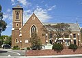
Saint Finbars Catholic Church Brighton East

St Finbars Primary School next to Church of same name


Brighton East is home to St. Finbar's Primary School (Catholic), Brighton Secondary College, Haileybury College, Gardenvale Primary School and St Leonard's College. Near Brighton East is Bentleigh West Primary School.
Sport[]
East Brighton United Football Club (senior Football Federation Victoria club known locally as "The Vampires"), Brighton Soccer Club (the largest Soccer Club in Victoria) and Brighton District Cricket Club are based at Dendy Park. East Brighton Vampires Football Club, competing in the Moorabbin Saints Football League and Brighton Union Cricket Club, competing in the South East Cricket Association, are based at Hurlingham Park.[4] Brighton Bowls Club is situated on the northeastern boundary of Dendy Park.
See also[]
- City of Brighton (Victoria) - the former local government area of which Brighton East was a part.
References[]
- ^ a b Australian Bureau of Statistics (31 October 2012). "Brighton East (State Suburb)". 2011 Census QuickStats. Retrieved 15 December 2014.

- ^ "Postcode for Brighton East, Victoria (Near Melbourne) - Postcodes Australia".
- ^ Fels, Marie Hansen (2011). 'I Succeeded Once': The Aboriginal Protectorate on the Mornington Peninsula (PDF). ANU E Press. pp. 254–256. ISBN 978-1921862137.
- ^ Full Point Footy, Southern Football League, archived from the original on 1 January 2009, retrieved 21 October 2008
External links[]
- Bayside City Council Website
- Brighton Soccer Club (Vic) Inc
- East Brighton United Football Club Website
This article about a place in Melbourne is a stub. You can help Wikipedia by . |
- Suburbs of Melbourne
- Melbourne geography stubs