Brownsville, Ohio
Brownsville, Ohio | |
|---|---|
 Brownsville United Methodist Church | |
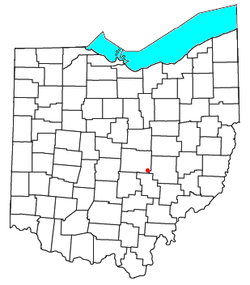 Location of Brownsville in Ohio | |
| Coordinates: 39°56′48″N 82°15′22″W / 39.94667°N 82.25611°WCoordinates: 39°56′48″N 82°15′22″W / 39.94667°N 82.25611°W | |
| Country | United States |
| State | Ohio |
| County | Licking |
| Township | Bowling Green |
| Area | |
| • Total | 0.89 sq mi (2.31 km2) |
| • Land | 0.89 sq mi (2.31 km2) |
| • Water | 0.0 sq mi (0.0 km2) |
| Elevation | 948 ft (289 m) |
| Population | |
| • Total | 220 |
| • Density | 247/sq mi (95.4/km2) |
| Time zone | UTC-5 (Eastern (EST)) |
| • Summer (DST) | UTC-4 (EDT) |
| ZIP Code | 43721 |
| FIPS code | 39-09596[1] |
| GNIS feature ID | 1048310[2] |

Brownsville is an unincorporated community and census-designated place (CDP) in northeastern Bowling Green Township, Licking County, Ohio, United States.[2] As of the 2010 census, it had a population of 220.[3] It lies at the intersection of U.S. Route 40 with State Route 668.
Geography[]
Brownsville is in southeastern Licking County, 13 miles (21 km) southeast of Newark, the county seat. The community's northern border is the boundary between Bowling Green Township and Hopewell Township, and the southern border follows Interstate 70. Access to I-70 is provided by Exit 141, a half-interchange directly south of the town on State Route 668, for traffic traveling to and from the west. A complementary interchange for traffic to and from the east is Exit 142 in Gratiot, 2 miles (3 km) east of Brownsville. Both I-70 and US-40 lead east 13 miles (21 km) to Zanesville and west 41 miles (66 km) to Columbus.
According to the U.S. Census Bureau, the Brownsville CDP has a total area of 0.9 square miles (2.3 km2), of which 0.6 acres (2,422 m2), or 0.10%, are water.[1] Brownsville is in the valley of Berry Run, a south-flowing tributary of Valley Run, which via Jonathan Creek is part of the Muskingum River watershed flowing south to the Ohio River.
History[]
Brownsville starts when the National Road was extended to that point.[4] The community was laid out in 1829.[5] Brownsville was named for its founder, Adam Brown.[4] A post office was established in 1830.[6]
Flint Ridge State Memorial is 3 miles (5 km) north of Brownsville.
Notable person[]
- William M. Morgan, congressman
References[]
- ^ a b c "U.S. Gazetteer Files: 2019: Places: Ohio". U.S. Census Bureau Geography Division. Retrieved July 17, 2020.
- ^ a b c U.S. Geological Survey Geographic Names Information System: Brownsville, Ohio
- ^ a b "Total Population: 2010 Census DEC Summary File 1 (P1), Brownsville CDP, Ohio". data.census.gov. U.S. Census Bureau. Retrieved July 17, 2020.
- ^ a b Brister, Edwin M. P. (1909). Centennial History of the City of Newark and Licking County, Ohio. S.J. Clarke Publishing Company. p. 348.
- ^ Brister, Edwin M. P. (1909). Centennial History of the City of Newark and Licking County, Ohio. S.J. Clarke Publishing Company. p. 249.
- ^ "Licking County". Jim Forte Postal History. Archived from the original on 4 March 2016. Retrieved 6 December 2015.
Municipalities and communities of Licking County, Ohio, United States | ||
|---|---|---|
| Cities |  | |
| Villages | ||
| Townships | ||
| CDPs | ||
| Unincorporated communities | ||
| Ghost towns | ||
| Footnotes | ‡This populated place also has portions in an adjacent county or counties | |
| ||
- Census-designated places in Licking County, Ohio
- 1829 establishments in Ohio
- Populated places established in 1829