Bruqin
Bruqin | |
|---|---|
Municipality type D (Village council) | |
| Arabic transcription(s) | |
| • Arabic | إبروقين |
| • Latin | Buruqin (official) Ibruqin (unofficial) |
 | |
 Bruqin Location of Bruqin within Palestine | |
| Coordinates: 32°04′16″N 35°05′58″E / 32.07111°N 35.09944°ECoordinates: 32°04′16″N 35°05′58″E / 32.07111°N 35.09944°E | |
| Palestine grid | 159/164 |
| State | State of Palestine |
| Governorate | Salfit |
| Government | |
| • Type | Village council |
| • Head of Municipality | Ekremah M. Samara |
| Area | |
| • Total | 13,237 dunams (13.2 km2 or 5.1 sq mi) |
| Elevation | 372 m (1,220 ft) |
| Population (2007) | |
| • Total | 3,236 |
| • Density | 250/km2 (630/sq mi) |
| Name meaning | Berukin[2] |

Bruqin (Arabic: إبروقين) is a Palestinian town located 13 kilometers west of Salfit in the Salfit Governorate of the northern West Bank and adjacent to the Israeli settlement of Bruchin. According to the Palestinian Central Bureau of Statistics, the town had a population of 3,236 in 2007.[3] Bruqin used to be on a camel-trading route. There is evidence of Roman rule in the city due to the presence of three ancient pools and a tomb.[4]
The main families of the town are Barakat, Sabra, Samara and Khater
Location[]
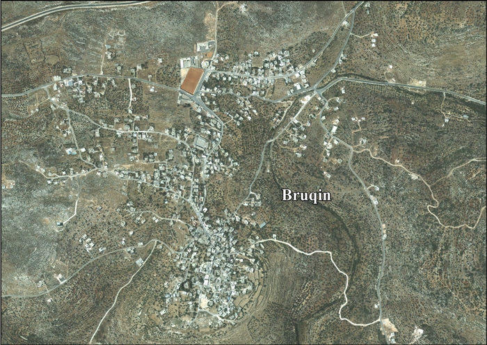
Bruqin is located 7.9 kilometers (4.9 mi) west of Salfit. It is bordered by Salfit and Farkha to the east, Qarawat Bani Zaid, Kafr 'Ein and Bani Zeid to the south, Kafr ad Dik to the west, and Haris and Sarta to the north.[1]
History[]
Bruqin is an ancient site. Here French explorer Victor Guérin found a large number of cut stones in the walls of modern houses, and an ancient tomb near the village with two sepulchral chambers.[5]
Sherds from the Byzantine, Umayyad, Crusader/Ayyubid and Mamluk eras have been found here.[6]
Ottoman era[]
The place appeared in 1596 Ottoman tax registers as Bruqin, being in the Nahiya of Jabal Qubal of the Liwa of Nablus. It had a population of 16 households, all Muslim. The villagers paid a fixed tax rate of 33,3% on wheat, barley, summer crops, olives, and goats or beehives, in addition for a press for olives or grapes; a total of 2,000 Akçe.[7]
In 1838, Edward Robinson noted it as a village, Berukin, in the Jurat Merda district, south of Nablus.[8]
In 1870, Victor Guérin estimated that the village had 300 inhabitants.[9]
In 1882, PEF's Survey of Western Palestine, the village (called Berukin) was described as a "moderate-sized village on the end of a spur, with a steep slope to the valley beneath, in which are springs just below the houses. On the south are caves, on the north olives."[10]
British Mandate era[]
In the 1922 census of Palestine conducted by the British Mandate authorities, Bruqin had a population of 367, all Muslims,[11] increasing in the 1931 census to 534, again all Muslim, in a total of 90 houses.[12]
In the 1945 statistics the population was 690, all Muslims,[13] while the total land area was 12,628 dunams, according to an official land and population survey.[14] Of this, 3,175 were allocated for plantations and irrigable land, 2,301 for cereals,[15] while 28 dunams were classified as built-up areas.[16]
Jordanian era[]
In the wake of the 1948 Arab–Israeli War, and after the 1949 Armistice Agreements, Bruqin came under Jordanian rule.
In 1961, the population was 1,141.[17]
Post-1967[]
Since the Six-Day War in 1967, Bruqin has been under Israeli occupation. Its villagers state that after 1987, the toxic output from Israeli industries located in settlement areas has produced chronic health problems for local Palestinians.[18]
Occupation of village lands[]
After the 1995 accords, 8.4% of village land is defined as being in Area A, 35.8% in Area B, while the remainder 55.8% is in Area C. In 1981, Israel confiscated 684 dunams of village land for the Barqan Industrial Zone, and in 1990 confiscated 332 dunums of village land for the Israeli settlement of Bruchin.[19]
In 2014 the Shomron Regional Council began work to develop a 25-acre farm on a hill just northwest of Bruqin, forming part of 110 acres belonging to the nearby Palestinian villages of Adiq and Biddya. Though Adiq is in Area A, under Palestinian jurisdiction, its village lands lie in Area C, where Palestinian construction is prohibited, and which Israel declared its state land in 1985. Access to the farmland is through Bruqin's land, which is planted with their olive groves. The apparent intent is to create territorial continuity between the Green line and the Israeli settlement of Ariel, via new settlements such as Leshem and Bruchin. According to Bruqin villages, use of the access road is illegal, and Israel is blocking the villages' own roads to Sarta.[20]
Economy[]
Around 70% of working-age males were employed in Israel as laborers prior to the Second Intifada. Today, the unemployment rate is 80%. There is agricultural work it is seasonal. Around 150 out of 500 families are dependent on aid, from the Red Cross or the . There are two mosques, a youth club and a gym in the town. There are also three schools in the town, including an all-girls school for grades 1 to 12, a boys primary and secondary school and a boys high school. For hospital care, residents travel to Ramallah, but for emergency treatment they go to nearby Salfit.[4]
Bruqin depends primarily on agriculture to meet its basic needs. The town's total land area is 13,237 dunams, of which 1,336 dunams is built-up area. Around 1,200 dunams are planted with orchards, especially olive, about 3,000 dunams of land is used for shepherding while approximately 8,000 dunams are used for settlement purposes, including settlements and by-pass roads.[21]
Government[]
Bruqin is governed by a municipal council led by the mayor Ekremah M. Samara, who succeeded Ghassan Sabra. Elections are scheduled to occur every four years however, there has not been an election since 1996. The municipal council states the "[Israeli] occupation" as the reason.[4]
References[]
- ^ Jump up to: a b Bruqin Town Profile, ARIJ, 2013, p. 4
- ^ Palmer 1881, p. 226
- ^ 2007 PCBS Census Archived December 10, 2010, at the Wayback Machine Palestinian Central Bureau of Statistics. p. 112.
- ^ Jump up to: a b c Bruqin Village Profile Archived 2012-02-18 at the Wayback Machine International Women's Peace Service.
- ^ Guérin, 1875, pp. 148, 153, as cited in Conder and Kitchener, 1882, SWP II, p. 306
- ^ Finkelstein, 1997, p. 283
- ^ Hütteroth and Abdulfattah, 1977, p. 134.
- ^ Robinson and Smith, 1841, vol 3, Appendix 2, p. 127
- ^ Guérin, 1875, p. 153
- ^ Conder and Kitchener, 1882, SWP II, p. 283
- ^ Barron, 1923, Table IX, Sub-district of Nablus, p. 26
- ^ Mills, 1932, p. 60
- ^ Government of Palestine, Department of Statistics, 1945, p. 18
- ^ Government of Palestine, Department of Statistics. Village Statistics, April, 1945. Quoted in Hadawi, 1970, p. 59
- ^ Government of Palestine, Department of Statistics. Village Statistics, April, 1945. Quoted in Hadawi, 1970, p. 105
- ^ Government of Palestine, Department of Statistics. Village Statistics, April, 1945. Quoted in Hadawi, 1970, p. 155
- ^ Government of Jordan, Department of Statistics, 1964, p. 26
- ^ Eric Reidy, 'Palestinians thirst for water treatment plant,' Al Jazeera 21 December 2013.
- ^ Bruqin Town Profile, ARIJ, 2013, p. 17
- ^ Amira Hass, 'Israel building farm on Palestinian land,' Haaretz, 6 June 2014.
- ^ More of Bruqin's and Kafr Ad Dik's land are targeted by the Segregation Wall Archived 2007-05-28 at the Wayback Machine Land Research Center (LRC). 2007-03-05
Bibliography[]
- Barron, J.B., ed. (1923). Palestine: Report and General Abstracts of the Census of 1922. Government of Palestine.
- Conder, C.R.; Kitchener, H.H. (1882). The Survey of Western Palestine: Memoirs of the Topography, Orography, Hydrography, and Archaeology. 2. London: Committee of the Palestine Exploration Fund.
- Finkelstein, I.; Lederman, Zvi, eds. (1997). Highlands of many cultures. Tel Aviv: Institute of Archaeology of Tel Aviv University Publications Section. ISBN 965-440-007-3.
- Government of Jordan, Department of Statistics (1964). First Census of Population and Housing. Volume I: Final Tables; General Characteristics of the Population (PDF).
- Government of Palestine, Department of Statistics (1945). Village Statistics, April, 1945.
- Guérin, V. (1875). Description Géographique Historique et Archéologique de la Palestine (in French). 2: Samarie, pt. 2. Paris: L'Imprimerie Nationale.
- Hadawi, S. (1970). Village Statistics of 1945: A Classification of Land and Area ownership in Palestine. Palestine Liberation Organization Research Center.
- Hütteroth, Wolf-Dieter; Abdulfattah, Kamal (1977). Historical Geography of Palestine, Transjordan and Southern Syria in the Late 16th Century. Erlanger Geographische Arbeiten, Sonderband 5. Erlangen, Germany: Vorstand der Fränkischen Geographischen Gesellschaft. ISBN 3-920405-41-2.
- Mills, E., ed. (1932). Census of Palestine 1931. Population of Villages, Towns and Administrative Areas. Jerusalem: Government of Palestine.
- Palmer, E.H. (1881). The Survey of Western Palestine: Arabic and English Name Lists Collected During the Survey by Lieutenants Conder and Kitchener, R. E. Transliterated and Explained by E.H. Palmer. Committee of the Palestine Exploration Fund.
- Robinson, E.; Smith, E. (1841). Biblical Researches in Palestine, Mount Sinai and Arabia Petraea: A Journal of Travels in the year 1838. 3. Boston: Crocker & Brewster.
External links[]
- Welcome To Buruqin/Ibruqin
- Survey of Western Palestine, Map 14: IAA, Wikimedia commons
- Bruqin Village Profile, iwps.info
- Bruqin Town (Fact Sheet), Applied Research Institute–Jerusalem (ARIJ)
- Bruqin Town Profile, ARIJ
- Bruqin photo, ARIJ
- Development Priorities and Needs in Bruqin, ARIJ
- Bruchin settlement expands on lands of Bruqin village 08, October, 2011, POICA
- Torching 340 Trees in Bruqin – Salfit Governorate 14, November, 2011, POICA
| hide | ||
|---|---|---|
| Municipalities |
| |
| Villages | ||
- Salfit Governorate
- Towns in Salfit Governorate
- Municipalities of West Bank
- Municipalities of the State of Palestine