Iskaka
Iskaka | |
|---|---|
Municipality type D (Village council) | |
| Arabic transcription(s) | |
| • Arabic | إسكاكا |
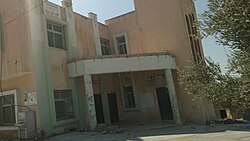 Iskaka village council building | |
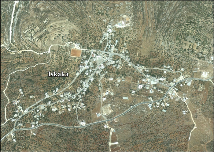
 Iskaka Location of Iskaka within Palestine | |
| Coordinates: 32°06′13″N 35°13′31″E / 32.10361°N 35.22528°ECoordinates: 32°06′13″N 35°13′31″E / 32.10361°N 35.22528°E | |
| Palestine grid | 171/167 |
| State | State of Palestine |
| Governorate | Salfit |
| Government | |
| • Type | Village council |
| Elevation | 660 m (2,170 ft) |
| Population (2007) | |
| • Total | 912[1] |
| Name meaning | Roads situated at a junction[3] |

Iskaka (Arabic: إسكاكا) is a Palestinian town located in the Salfit Governorate in the northern West Bank, 27 kilometers southwest of Nablus. According to the Palestinian Central Bureau of Statistics, it had a population of 912 in 2007.[1]
Location[]
Iskaka is located 4.6 kilometers (2.9 mi) east of Salfit. It is bordered by As Sawiya to the east, Al Lubban ash Sharqiya to the east and south, Salfit to the south and west, and Marda, Yasuf and Jamma'in to the north.[2]
History[]
Ceramics from the Byzantine era have been found here.[4]
The village is identified with Casale Esckas mentioned in a Frankish text of the year 1244.[5] Sherds from the Crusader/Ayyubid and the Mamluk eras have been found here.[6]
Ottoman era[]
Iskaka was incorporated into the Ottoman Empire in 1517 with all of Palestine, and in 1596 it appeared in the tax registers under the name of Skaka, as being in the nahiya ("subdistrict") of Jabal Qubal, part of the Sanjak of Nablus. It had a population of 37 households; who were all Muslims. They paid a fixed tax-rate of 33,3 % on agricultural products, including wheat, barley, summer crops, olive trees, goats and beehives, in addition to occasional revenues, a press for olive oil or grape syrup; a total of 5,042 akçe.[7] Sherds from the early Ottoman era has also been found here.[6]
In 1870, Victor Guérin noted it as an ancient village, on a hill planted with olive trees.[8]
In 1882, the PEF's Survey of Western Palestine described Iskaka as: "a small village with ruined towers and rock-cut tombs, surrounded by olives and standing on high ground. The water supply is from a well."[9]
British Mandate era[]
In the 1922 census of Palestine conducted by the British Mandate authorities, Sekaka had a population of 127 Muslims,[10] increasing in the 1931 census to 186 Muslims in 48 occupied houses.[11]
In the 1945 statistics the population was 260 Muslims[12] while the total land area was 5,311 dunams, according to an official land and population survey.[13] Of this, 1,309 were allocated for plantations and irrigable land, 1,624 for cereals,[14] while 12 dunams were classified as built-up areas.[15]
Jordanian era[]
In the wake of the 1948 Arab–Israeli War, and after the 1949 Armistice Agreements, Iskaka came under Jordanian rule.
In 1961, the population of Iskaka was 415.[16]
Post-1967[]
Since the Six-Day War in 1967, Iskaka has been under Israeli occupation.
After the 1995 accords, 25% of village land is defined as Area B land, while the remaining 75% is Area C land. According to ARIJ, the Israelis have confiscated 356 dunams of land in Iskaka, including land for the Israeli settlements of Ariel, Nofei Nehemia and for the Israeli West Bank barrier.[17]
On 14 May 2021, as part of the 2021 Israel–Palestine crisis, Israeli settlers reportedly killed 23 year old Awad Ahmed Harb.[18][19]
References[]
- ^ Jump up to: a b 2007 PCBS Census Archived 2010-12-10 at the Wayback Machine Palestinian Central Bureau of Statistics. p. 112.
- ^ Jump up to: a b Iskaka Village Profile, ARIJ, p. 4
- ^ Palmer, 1881, p. 229
- ^ Dauphin, 1992, p. 811
- ^ Röhricht, 1893, RHH, p. 299, No. 1122; cited in Finkelstein, 1997, p. 611
- ^ Jump up to: a b Finkelstein, 1997, p. 611
- ^ Hütteroth and Abdulfattah, 1977, p. 131
- ^ Guérin, 1875, p. 163
- ^ Conder and Kitchener, 1882, SWP II, p. 284
- ^ Barron, 1923, Table IX, Sub-district of Nablus, p. 25
- ^ Mills, 1932, p. 62
- ^ Government of Palestine, Department of Statistics, 1945, p. 18
- ^ Government of Palestine, Department of Statistics. Village Statistics, April, 1945. Quoted in Hadawi, 1970, p. 60
- ^ Government of Palestine, Department of Statistics. Village Statistics, April, 1945. Quoted in Hadawi, 1970, p. 106
- ^ Government of Palestine, Department of Statistics. Village Statistics, April, 1945. Quoted in Hadawi, 1970, p. 156
- ^ Government of Jordan, Department of Statistics, 1964, p. 26
- ^ Iskaka Village Profile, ARIJ, pp. 18-20
- ^ "10 شهداء وعشرات الاصابات خلال مواجهات مع الاحتلال في الضفة". وكالة معا للأنباء. Retrieved May 14, 2021.
- ^ Palestinians killed in West Bank as Israeli crackdown intensifies, Shatha Hammad, 14 May 2021, Middle East Eye
Bibliography[]
- Barron, J.B., ed. (1923). Palestine: Report and General Abstracts of the Census of 1922. Government of Palestine.
- Conder, C.R.; Kitchener, H.H. (1882). The Survey of Western Palestine: Memoirs of the Topography, Orography, Hydrography, and Archaeology. 2. London: Committee of the Palestine Exploration Fund.
- Dauphin, Claudine (1998). La Palestine byzantine, Peuplement et Populations. BAR International Series 726 (in French). III : Catalogue. Oxford: Archeopress. ISBN 0-860549-05-4.
- Finkelstein, I.; Lederman, Zvi, eds. (1997). Highlands of many cultures. Tel Aviv: Institute of Archaeology of Tel Aviv University Publications Section. ISBN 965-440-007-3.
- Government of Jordan, Department of Statistics (1964). First Census of Population and Housing. Volume I: Final Tables; General Characteristics of the Population (PDF).
- Government of Palestine, Department of Statistics (1945). Village Statistics, April, 1945.
- Guérin, V. (1875). Description Géographique Historique et Archéologique de la Palestine (in French). 2: Samarie, pt. 2. Paris: L'Imprimerie Nationale.
- Hadawi, S. (1970). Village Statistics of 1945: A Classification of Land and Area ownership in Palestine. Palestine Liberation Organization Research Center.
- Hütteroth, Wolf-Dieter; Abdulfattah, Kamal (1977). Historical Geography of Palestine, Transjordan and Southern Syria in the Late 16th Century. Erlanger Geographische Arbeiten, Sonderband 5. Erlangen, Germany: Vorstand der Fränkischen Geographischen Gesellschaft. ISBN 3-920405-41-2.
- Mills, E., ed. (1932). Census of Palestine 1931. Population of Villages, Towns and Administrative Areas. Jerusalem: Government of Palestine.
- Palmer, E.H. (1881). The Survey of Western Palestine: Arabic and English Name Lists Collected During the Survey by Lieutenants Conder and Kitchener, R. E. Transliterated and Explained by E.H. Palmer. Committee of the Palestine Exploration Fund.
- Röhricht, R. (1893). (RRH) Regesta regni Hierosolymitani (MXCVII-MCCXCI) (in Latin). Berlin: Libraria Academica Wageriana.
External links[]
- Welcome To Iskaka
- Survey of Western Palestine, Map 14: IAA, Wikimedia commons
- Iskaka Village (Fact Sheet), Applied Research Institute–Jerusalem (ARIJ)
- Iskaka Village Profile, ARIJ
- Iskaka aerial photo, ARIJ
- Development Priorities and Needs in Iskaka, ARIJ
| hide | ||
|---|---|---|
| Municipalities |
| |
| Villages | ||
- Salfit Governorate
- Towns in Salfit Governorate
- Municipalities of the State of Palestine