Buchanan, North Dakota
Buchanan, North Dakota | |
|---|---|
 Building in Buchanan | |
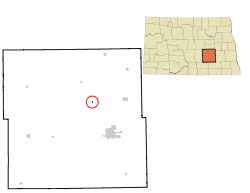 Location of Buchanan, North Dakota | |
| Coordinates: 47°3′46″N 98°49′42″W / 47.06278°N 98.82833°WCoordinates: 47°3′46″N 98°49′42″W / 47.06278°N 98.82833°W | |
| Country | United States |
| State | North Dakota |
| County | Stutsman |
| Area | |
| • Total | 0.08 sq mi (0.20 km2) |
| • Land | 0.08 sq mi (0.20 km2) |
| • Water | 0.00 sq mi (0.00 km2) |
| Elevation | 1,555 ft (474 m) |
| Population | |
| • Total | 90 |
| • Estimate (2019)[2] | 110 |
| • Density | 1,447.37/sq mi (557.75/km2) |
| Time zone | UTC-6 (Central (CST)) |
| • Summer (DST) | UTC-5 (CDT) |
| ZIP code | 58420 |
| Area code(s) | 701 |
| FIPS code | 38-10060 |
| GNIS feature ID | 1028167[4] |

Buchanan is a city in Stutsman County, North Dakota, United States. The population was 90 at the 2010 census.[5] Buchanan was founded in 1887.
Buchanan was once home to Henry Leuhr's Giant Bull, inspired by the World's Largest Buffalo in Jamestown, North Dakota, which stood 30 feet (9.1 m) tall and was 50 feet (15 m) long until it deteriorated and was removed from its site in January 2007.[6]
History[]
A post office called Buchanan has been in operation since 1894.[7] The city's name honors James A. Buchanan, a local pioneer.[8]
Geography[]
Buchanan is located at 47°3′46″N 98°49′42″W / 47.06278°N 98.82833°W (47.062680, -98.828245).[9]
According to the United States Census Bureau, the city has a total area of 0.08 square miles (0.21 km2), all land.[10]
Demographics[]
| Historical population | |||
|---|---|---|---|
| Census | Pop. | %± | |
| 1990 | 40 | — | |
| 2000 | 77 | 92.5% | |
| 2010 | 90 | 16.9% | |
| 2019 (est.) | 110 | [2] | 22.2% |
| U.S. Decennial Census[11] 2018 Estimate[12] | |||
2010 census[]
As of the census[3] of 2010, there were 90 people, 32 households, and 24 families residing in the city. The population density was 1,125.0 inhabitants per square mile (434.4/km2). There were 34 housing units at an average density of 425.0 per square mile (164.1/km2). The racial makeup of the city was 100.0% White.
There were 32 households, of which 50.0% had children under the age of 18 living with them, 56.3% were married couples living together, 15.6% had a female householder with no husband present, 3.1% had a male householder with no wife present, and 25.0% were non-families. 18.8% of all households were made up of individuals, and 6.2% had someone living alone who was 65 years of age or older. The average household size was 2.81 and the average family size was 3.17.
The median age in the city was 31.3 years. 32.2% of residents were under the age of 18; 10.1% were between the ages of 18 and 24; 26.8% were from 25 to 44; 25.6% were from 45 to 64; and 5.6% were 65 years of age or older. The gender makeup of the city was 54.4% male and 45.6% female.
2000 census[]
As of the census of 2000, there were 77 people, 27 households, and 19 families residing in the city. The population density was 980.9 people per square mile (371.6/km2). There were 29 housing units at an average density of 369.4 per square mile (140.0/km2). The racial makeup of the city was 100.00% White.
There were 27 households, out of which 40.7% had children under the age of 18 living with them, 66.7% were married couples living together, 3.7% had a female householder with no husband present, and 29.6% were non-families. 22.2% of all households were made up of individuals, and 11.1% had someone living alone who was 65 years of age or older. The average household size was 2.85 and the average family size was 3.47.
In the city, the population was spread out, with 31.2% under the age of 18, 6.5% from 18 to 24, 41.6% from 25 to 44, 10.4% from 45 to 64, and 10.4% who were 65 years of age or older. The median age was 34 years. For every 100 females, there were 120.0 males. For every 100 females age 18 and over, there were 112.0 males.
The median income for a household in the city was $53,333, and the median income for a family was $60,000. Males had a median income of $32,292 versus $23,750 for females. The per capita income for the city was $18,024. There were no families and 1.2% of the population living below the poverty line, including no one under 18 and 20.0% of those over 64.
Notes[]
- ^ "2019 U.S. Gazetteer Files". United States Census Bureau. Retrieved July 27, 2020.
- ^ Jump up to: a b "Population and Housing Unit Estimates". United States Census Bureau. May 24, 2020. Retrieved May 27, 2020.
- ^ Jump up to: a b "U.S. Census website". United States Census Bureau. Retrieved June 14, 2012.
- ^ "US Board on Geographic Names". United States Geological Survey. October 25, 2007. Retrieved January 31, 2008.
- ^ "2010 Census Redistricting Data (Public Law 94-171) Summary File". American FactFinder. United States Census Bureau. Retrieved May 2, 2011.[dead link]
- ^ Henry Leuhr's Giant Bull, Buchanan, North Dakota
- ^ "Stutsman County". Jim Forte Postal History. Retrieved October 15, 2015.
- ^ Federal Writers' Project (1938). North Dakota, a Guide to the Northern Prairie State. WPA. p. 205. ISBN 978-1-62376-033-5.
- ^ "US Gazetteer files: 2010, 2000, and 1990". United States Census Bureau. February 12, 2011. Retrieved April 23, 2011.
- ^ "US Gazetteer files 2010". United States Census Bureau. Archived from the original on July 2, 2012. Retrieved June 14, 2012.
- ^ United States Census Bureau. "Census of Population and Housing". Retrieved July 24, 2013.
- ^ "Population Estimates". United States Census Bureau. Retrieved September 10, 2019.
| show Municipalities and communities of Stutsman County, North Dakota, United States |
|---|

| show Authority control |
|---|
- Cities in North Dakota
- Cities in Stutsman County, North Dakota
- Populated places established in 1887