Pingree, North Dakota
Pingree, North Dakota | |
|---|---|
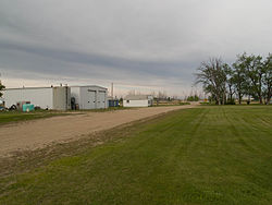 Street in Pingree | |
 | |
| Coordinates: 47°9′52″N 98°54′34″W / 47.16444°N 98.90944°WCoordinates: 47°9′52″N 98°54′34″W / 47.16444°N 98.90944°W | |
| Country | United States |
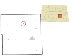
| State | North Dakota |
| County | Stutsman |
| Area | |
| • Total | 0.19 sq mi (0.50 km2) |
| • Land | 0.19 sq mi (0.50 km2) |
| • Water | 0.00 sq mi (0.00 km2) |
| Elevation | 1,558 ft (475 m) |
| Population | |
| • Total | 60 |
| • Estimate (2019)[2] | 61 |
| • Density | 316.06/sq mi (122.35/km2) |
| Time zone | UTC-6 (Central (CST)) |
| • Summer (DST) | UTC-5 (CDT) |
| ZIP code | 58476 |
| Area code(s) | 701 |
| FIPS code | 38-62620 |
| GNIS feature ID | 1030715[4] |

Pingree is a city in Stutsman County, North Dakota, United States. The population was 60 at the 2010 census.[5] Pingree was founded in 1882.
History[]
A post office called Pingree was established in 1882, and remained in operation until 1993.[6] The city's name honors Hazen S. Pingree, Mayor of Detroit, Michigan.[7]
Geography[]
Pingree is located at 47°9′52″N 98°54′34″W / 47.16444°N 98.90944°W (47.164354, -98.909401).[8]
According to the United States Census Bureau, the city has a total area of 0.18 square miles (0.47 km2), all land.[9]
Demographics[]
| Historical population | |||
|---|---|---|---|
| Census | Pop. | %± | |
| 1920 | 286 | — | |
| 1930 | 266 | −7.0% | |
| 1940 | 167 | −37.2% | |
| 1950 | 161 | −3.6% | |
| 1960 | 151 | −6.2% | |
| 1970 | 76 | −49.7% | |
| 1980 | 88 | 15.8% | |
| 1990 | 61 | −30.7% | |
| 2000 | 66 | 8.2% | |
| 2010 | 60 | −9.1% | |
| 2019 (est.) | 61 | [2] | 1.7% |
| U.S. Decennial Census[10] 2018 Estimate[11] | |||
2010 census[]
As of the census[3] of 2010, there were 60 people, 27 households, and 14 families residing in the city. The population density was 333.3 inhabitants per square mile (128.7/km2). There were 29 housing units at an average density of 161.1 per square mile (62.2/km2). The racial makeup of the city was 98.3% White and 1.7% from two or more races. Hispanic or Latino of any race were 5.0% of the population.
There were 27 households, of which 33.3% had children under the age of 18 living with them, 40.7% were married couples living together, 3.7% had a female householder with no husband present, 7.4% had a male householder with no wife present, and 48.1% were non-families. 44.4% of all households were made up of individuals, and 7.4% had someone living alone who was 65 years of age or older. The average household size was 2.22 and the average family size was 3.21.
The median age in the city was 33 years. 28.3% of residents were under the age of 18; 9.9% were between the ages of 18 and 24; 28.3% were from 25 to 44; 21.7% were from 45 to 64; and 11.7% were 65 years of age or older. The gender makeup of the city was 61.7% male and 38.3% female.
2000 census[]
As of the census of 2000, there were 66 people, 26 households, and 21 families residing in the city. The population density was 367.9 people per square mile (141.6/km2). There were 32 housing units at an average density of 178.4 per square mile (68.6/km2). The racial makeup of the city was 98.48% White and 1.52% Asian.
There were 26 households, out of which 42.3% had children under the age of 18 living with them, 50.0% were married couples living together, 15.4% had a female householder with no husband present, and 19.2% were non-families. 15.4% of all households were made up of individuals, and 7.7% had someone living alone who was 65 years of age or older. The average household size was 2.54 and the average family size was 2.81.
In the city, the population was spread out, with 33.3% under the age of 18, 4.5% from 18 to 24, 31.8% from 25 to 44, 22.7% from 45 to 64, and 7.6% who were 65 years of age or older. The median age was 32 years. For every 100 females, there were 127.6 males. For every 100 females age 18 and over, there were 131.6 males.
The median income for a household in the city was $28,750, and the median income for a family was $25,938. Males had a median income of $49,375 versus $17,500 for females. The per capita income for the city was $22,672. There were 24.1% of families and 32.5% of the population living below the poverty line, including 57.7% of under eighteens and none of those over 64.
Climate[]
This climatic region is typified by large seasonal temperature differences, with warm to hot (and often humid) summers and cold (sometimes severely cold) winters. According to the Köppen Climate Classification system, Pingree has a humid continental climate, abbreviated "Dfb" on climate maps.[12]
References[]
- ^ "2019 U.S. Gazetteer Files". United States Census Bureau. Retrieved July 27, 2020.
- ^ Jump up to: a b "Population and Housing Unit Estimates". United States Census Bureau. May 24, 2020. Retrieved May 27, 2020.
- ^ Jump up to: a b "U.S. Census website". United States Census Bureau. Retrieved June 14, 2012.
- ^ "US Board on Geographic Names". United States Geological Survey. October 25, 2007. Retrieved January 31, 2008.
- ^ "2010 Census Redistricting Data (Public Law 94-171) Summary File". American FactFinder. United States Census Bureau. Retrieved May 2, 2011.[dead link]
- ^ "Stutsman County". Jim Forte Postal History. Retrieved 15 October 2015.
- ^ Federal Writers' Project (1938). North Dakota, a Guide to the Northern Prairie State. WPA. p. 205. ISBN 978-1-62376-033-5.
- ^ "US Gazetteer files: 2010, 2000, and 1990". United States Census Bureau. February 12, 2011. Retrieved April 23, 2011.
- ^ "US Gazetteer files 2010". United States Census Bureau. Archived from the original on January 12, 2012. Retrieved June 14, 2012.
- ^ United States Census Bureau. "Census of Population and Housing". Retrieved October 31, 2013.
- ^ "Population Estimates". United States Census Bureau. Retrieved June 22, 2019.
- ^ Climate Summary for Pingree, North Dakota
| show Municipalities and communities of Stutsman County, North Dakota, United States |
|---|

| show Authority control |
|---|
- Cities in Stutsman County, North Dakota
- Cities in North Dakota
- Populated places established in 1882