Bucks, Alabama
Bucks, Alabama | |
|---|---|
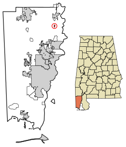 Location of Bucks in Mobile County, Alabama. | |
 Bucks, Alabama Location of Bucks in Mobile County, Alabama. | |
| Coordinates: 31°1′7.72″N 88°1′27.07″W / 31.0188111°N 88.0241861°W | |
| Country | United States |
| State | Alabama |
| County | Mobile |
| Area | |
| • Total | 0.42 sq mi (1.10 km2) |
| • Land | 0.39 sq mi (1.00 km2) |
| • Water | 0.04 sq mi (0.09 km2) |
| Elevation | 49 ft (15 m) |
| Population | |
| • Total | 32 |
| • Estimate (2016)[3] | N/A |
| Time zone | UTC-6 (Central (CST)) |
| • Summer (DST) | UTC-5 (CDT) |
| ZIP code | 36512 |
| Area code(s) | 251 |
| FIPS code | 01-10456 |

Bucks is an unincorporated community and census-designated place in Mobile County, Alabama, United States.[4] As of the 2010 census, its population was 32.[2] It is located in the northeastern section of the county near the Mobile River, along U.S. Route 43. The James M. Barry Electric Generating Plant, a coal- and natural gas-fired power station operated by Alabama Power, is located in Bucks.
Demographics[]
| Historical population | |||
|---|---|---|---|
| Census | Pop. | %± | |
| U.S. Decennial Census[5] | |||
In 2010, Bucks had a population of 32. The racial and ethnic composition of the population was 59.4% white, 31.3% black or African American, 3.1% Native American, 6.3% from two or more races and 3.1% Hispanic or Latino of any race.[6]
Geography[]
Bucks is located at 31°1′7.72″N 88°1′27.07″W / 31.0188111°N 88.0241861°WCoordinates: 31°1′7.72″N 88°1′27.07″W / 31.0188111°N 88.0241861°W. The elevation is 49 feet (15 m).[4]
Education[]
Residents are zoned to Mobile County Public School System campuses.[7] Residents are zoned to Citronelle High School.[8]
References[]
- ^ "2016 U.S. Gazetteer Files". United States Census Bureau. Retrieved Jul 17, 2017.
- ^ Jump up to: a b "U.S. Census website". United States Census Bureau. Retrieved 2011-05-14.
- ^ "Population and Housing Unit Estimates". Retrieved June 9, 2017.
- ^ Jump up to: a b "Bucks, Alabama". Alabama Home Town Locator. Retrieved 2008-03-09.
- ^ "Census of Population and Housing". Census.gov. Retrieved June 4, 2016.
- ^ 2010 population by race and Hispanic or Latino by place report for Alabama from the US Census]
- ^ "2010 CENSUS - CENSUS BLOCK MAP: Bucks CDP, AL." U.S. Census Bureau. Retrieved on November 27, 2018.
- ^ "Citronelle High School Attendance Zone." Mobile County Public School System. Retrieved on November 27, 2018.
| hide Municipalities and communities of Mobile County, Alabama, United States | ||
|---|---|---|
| Cities |  | |
| Towns | ||
| CDPs | ||
| Unincorporated communities | ||
| Ghost town | ||
| Indian reservation | ||
| Footnotes | ‡This populated place also has portions in an adjacent county or counties | |
| ||
This Mobile County, Alabama state location article is a stub. You can help Wikipedia by . |
- Census-designated places in Alabama
- Unincorporated communities in Alabama
- Census-designated places in Mobile County, Alabama
- South Alabama geography stubs