Bundaberg
| Bundaberg Queensland | |||||||||
|---|---|---|---|---|---|---|---|---|---|
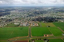
  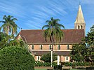     (From left to right) Aerial view of Bundaberg and the Burnett River, Bundaberg Post Office and Bundaberg War Memorial, Christ Church from Buss Park, Bundaberg Regional Art Gallery, Historic architecture along Bourbong street, Bundaberg Rum Distillery, South Sea Islander wall | |||||||||
 Bundaberg | |||||||||
| Coordinates | 24°51′58″S 152°20′58″E / 24.8661°S 152.3494°ECoordinates: 24°51′58″S 152°20′58″E / 24.8661°S 152.3494°E | ||||||||
| Population | |||||||||
| Established | 1870 | ||||||||
| Postcode(s) | 4670 | ||||||||
| Time zone | AEST (UTC+10:00) | ||||||||
| LGA(s) | Bundaberg Region | ||||||||
| County | Cook | ||||||||
| State electorate(s) | Bundaberg | ||||||||
| Federal Division(s) | Hinkler | ||||||||
| |||||||||

Bundaberg is a city in the Bundaberg Region, Queensland, Australia.[3] It is the headquarters of the Bundaberg Regional Council and a major centre within the broader Wide Bay–Burnett geographical region.
In the 2016 census Bundaberg had a population of 50,148 people in the Bundaberg urban area.[1]
In 2018, the Australian Bureau of Statistics estimated a population of 70,921 people in Bundaberg's significant urban area (which includes some rural areas outside the Bundaberg urban area).[2][4]
Geography[]
The city is about 385 kilometres (239 mi) north of the state capital, Brisbane. It is 15 kilometres (9.3 mi) inland from the Coral Sea coast and situated on the Burnett River.
Etymology[]
City name[]
The name was coined by surveyor John Charlton Thompson and his assistant Alfred Dale Edwards. Bunda is derived from the name of one of the kinship groups of the local Taribelang people, to which was added the Saxon suffix berg, meaning "town".[5] Colloquially the city is known as "Bundy".
Bourbong street[]
Bourbong Street is the main street of the city and there is some controversy in regards to its spelling and meaning; Bourbong was alternatively spelled Bourbon or Boorbong, which was a local Aboriginal title given to a large waterhole in the area.[6] The main street was historically also gazetted in the Bundaberg Mail as "Bourbon" street, but by 1941 there is no reference to "Bourbon" street. Robert Strathdee's farming selection in the vicinity of the watering holes was recorded on early survey maps as 'Boorbung'.[7]
A pioneer pastoralist of the region, Nicholas Tooth, wrote that "Bourbong" was derived from the local Aboriginal phrase "bier rabong", meaning "plenty dead". Tooth, who took up land in the area in the early 1860s, found that Aboriginal people resolutely avoided the "bier rabong" vicinity. He later found the skeletal remains there of around twenty Aboriginal people who were apparently massacred in a raid by the Native Police.[8]
History[]

Early History[]
The Traditional owner Aboriginal group are the people. They are the original inhabitants of the region.[9]
Initial British colonisation[]
The first non-indigenous man to visit the area was James Davis in the 1830s. He was an escaped convict from the Moreton Bay Penal settlement who lived with the Kabi people to the south of the region. He resided mostly around the Mary River and was referred to as Durrumboi.[10] The Burnett River was surveyed by John Charles Burnett, after whom it was named during his exploration mission of the Wide Bay and Burnett regions in 1847.[11][12]
British occupation of the land in the region began in 1848 when pastoral squatters Gregory Blaxland Jnr and William Forster established a sheep station. Blaxland was a son of the Blue Mountains explorer, Gregory Blaxland, and Forster was later to become a Premier of New South Wales. They selected a very large area of land which encompassed most of the western part of the modern day Bundaberg Region along the Burnett River. They named this pastoral lease Tirroan. Blaxland and Forster had previously set up sheep stations near the Clarence River and had a notable history of conflict with Aboriginal people.[13] This continued at Tirroan when two of their shepherds were killed by Aboriginal people in 1849. Forster and Blaxland led a punitive expedition causing multiple Aboriginal deaths. Further conflict occurred the following year when Blaxland was clubbed to death. Forster and a number of other squatters conducted another reprisal, resulting in a large massacre of Aboriginal people in scrubland toward the coastal part of Tirroan. In the early 1850s, Forster sold the property to Alfred Henry Brown who changed the name of the pastoral lease to Gin Gin. At the same time, Native Police officer, Richard Purvis Marshall, took up the Bingera leasehold in the rainforest scrubland downstream from Tirroan. Three towns in the Bundaberg region, Tirroan, South Bingera and Gin Gin, commemorate these massive initial leaseholds.[14][15]

Cattle and logging[]

Before colonisation, much of the land around the lower reaches of the Burnett River consisted of either the Woongarra Scrub, a subtropical rainforest that stood where most of the Bundaberg canefields now grow, or the Barolin Plains, a lightly timbered grassland that stretched along the coastal fringe. Neither of these areas were suitable for sheep farming but the British soon found that raising cattle was possible. In the early 1860s the first cattle stations in the area were established; Branyan on the south side of the Burnett River and Tantitha on the north side.[15][16]
Timber companies, such as that owned by William Pettigrew, started the logging of the Woongarra Scrub in 1867.[15] In 1868, Samuel Johnston erected a sawmill in Waterview, on the north bank of the Burnett River.[17][18] The Waterview sawmill became a prominent supplier of timber until its closure in 1903 after being damaged by flood.[19]
Town of Bundaberg[]
In 1867, timber-getters and farmers, John and Gavin Steuart, established the Woondooma property which consisted of a few houses and a wharf on the northern banks of the Burnett River where Bundaberg North now stands.[20][17] An official survey of the area was undertaken in 1869 by John Charlton Thompson,[17] assisted by James Ellwood and Alfred Dale Edwards,[21] and the town of Bundaberg was gazetted across the river on the higher, southern banks. The first Bundaberg land sale was held in Maryborough on 11 May 1870 where hotelier John Foley bought the original lots.[15][22]
Sugar[]

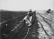
Most of the early settlers exploited the timber and grew maize on their selections but as a result of the incentives of the Sugar and Coffee Regulations of 1864, sugar became a major component in Bundaberg's development from the 1870s. Experimental sugar cane cultivation in the district was first grown at John Charlton Thompson's Rubyanna property in 1870 and the first sugar mill was built by Richard Elliot Palmer at his Millbank plantation in 1872.[23][24] Bundaberg rapidly became an important sugar production region after the construction of the Millaquin Sugar Refinery at East Bundaberg by and his sons in 1882.[25] The Fairymead sugar processing plant owned by the Young Brothers (Arthur, Horace and Ernest Young) opened in 1884 which further augmented Bundaberg's sugar producing capacity.
The initial 35 years of the sugar industry in Bundaberg was reliant on South Sea Islander workers, who were often blackbirded and kept in a status close to slavery. The first significant shipload of Kanaka labour, as it was called, to arrive on the Burnett River came in January 1872 aboard the Petrel.[26] Allegations of kidnapping and wounding immediately arose concerning the recruitment of the Islanders on this vessel.[27] Influential Bundaberg plantation owners were able to purchase recruiting ships in order to obtain labour directly from areas such as the Solomon Islands and the New Hebrides. The Young Brothers owned the Lochiel and the May vessels,[28][29] the Cran family and Frederic Buss were the major investors in the Helena while the Ariel was co-owned by a number of local planters.[30] While some of the recruitment was voluntary, violence and deception toward Islanders often took place. For example, the crew of the Helena fought a battle with the locals of Ambrym while taking Islanders from there.[31]
These labourers had to work for three years and were only paid at the end of this time period. Instead of cash, they usually received substandard goods and trinkets of minimal value as payment.[32] Excessive mortality of the Islanders while serving their term of labour in the Bundaberg region was frequent. Overwork, poor housing, inadequate food, contaminated water supplies and a lack of medical care all contributed to the high death rate. Penalties for the plantation owners whose neglect resulted in these fatalities were rare and did not exceed a £10 fine.[33][34] Importing South Sea Islander labour was made illegal in 1904 and enforced repatriation of these workers out of Bundaberg and other locations in Queensland occurred from 1906 to 1908.[35]

The occurred after the phasing out of South Sea Islander labour, with workers claiming that many plantation owners had substituted black indentured labourers (sometimes referred to as slaves) with white ones. Workers sought better accommodation, wages and conditions, including an eight-hour day and a minimum weekly wage of 30 shillings, including food. The mobilisation of unionists from Bundaberg to Mossman was a major achievement, with the 1911 strike lasting over seven weeks in Bundaberg where the town's economy was largely based on the sugar industry.[36] The end result of the strike was a Commonwealth Royal Commission into the sugar industry in 1911–12, which had been initially requested by Harry Hall, a Bundaberg AWA organiser in 1908 with a petition signed by 1500 Bundaberg sugar workers.[37] The Royal Commission, with ALF Secretary Albert Hinchcliffe as secretary, concluded the AWA demands had been justified. The union victory was a watershed in organised labour in Queensland and Australia.[38][39]
Further progress[]

St Joseph's School opened on June 1876.[40]
With the passage of the Local Authorities Act 1902, Barolin Division became the Shire of Barolin and the Borough of Bundaberg became the Town of Bundaberg on 31 March 1903. On 22 November 1913, Bundaberg was proclaimed a City.[41]
In 1912 Bundaberg pioneering aviator Bert Hinkler built and successfully flew his own glider on Mon Repos beach. He also completed a noteworthy non-stop flight from London to Turin in 1920. The following year in 1921 Hinkler flew from Sydney to Bundaberg, non-stop, in a record breaking flight of 8 and a half hours, in the process beating a telegram he had sent to his mother, to warn her of his arrival.[42]
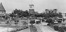
The Bundaberg War Memorial commemorating those who died in the Anglo-Boer War and World War I was unveiled by Major-General Charles Brand on 30 July 1921.[43][44] The Bundaberg digger was imported from Italy and is constructed of Italian marble. The completed memorial, at a cost of £1,650, was the third most costly to be erected in Queensland. It is a major regional memorial and one of the two most intact digger memorials that remain in their original settings of intersections.
In 1941 the Sisters of Mercy purchased the house Brabourne (originally owned by prominent citizen Frederick Buss) and established St Mary's Hostel, for women and girls working in or visiting Bundaberg. After World War II, doctors were calling for modern hospital facilities in Bundaberg, so the Sisters converted the hostel into the Mater Private Hospital, a 24-bed hospital with an operating theatre, chapel, and accommodation for the nurses and maids, officially opening on 28 July 1946. The nurses were initially all nuns, but they established a training school for other women to become nurses. The hospital expanded over the years with additional beds, operating theatres, X-ray, pathology and a dedicated children's ward. It was the first hospital in Queensland to use the Zeiss ophthalmic microscope, the first regional hospital in Queensland to have a lymphoedema clinic, and to use facial recognition technology for endoscopic sinus surgery.[45]
In the 1960s the township was completely flooded by the Burnett river. In 1967 Bundaberg celebrated its centenerary by producing a coin and opening in the in Bundaberg North.
Bundaberg in the 21st century[]
In December 2010, Bundaberg suffered its worst floods in 60 years, when floodwaters from the Burnett River inundated hundreds of homes.[46]
Two years later, in January 2013, Bundaberg experienced its worst flooding in recorded history as a result of Cyclone Oswald. Floodwaters from the Burnett River peaked at 9.53 meters. Over 4,000 properties and 600 businesses had been affected by floodwaters, which moved in excess of 70 km/h.[47] Two defence force Blackhawk helicopters were brought in from Townsville as part of the evacuation operation, which ultimately used an additional 14 aircraft.
In the 2016 census the city of Bundaberg had a population of 50,148 people.[1]
On 6 April 2018, Prince Charles visited Bundaberg Rum Distillery[48] He stated, “I'm thrilled that this Distillery's proving to be the one that produces some of the most famous and special of all rums around the world."[48]
In 2018, the Australian Bureau of Statistics estimated the population of Bundaberg's significant urban area was 70,921 people.[2]
Heritage listings[]

Bundaberg has a number of heritage-listed sites, including:
- Corner of Bargara Road and Zeilke Avenue, Kalkie: Kalkie State School[49]
- Bourbong Street, Bundaberg Central: Bourbong Street Weeping Figs[50]
- Bourbong Street, Bundaberg Central: Bundaberg War Memorial[51]
- Bourbong Street, West Bundaberg: Bundaberg War Nurses Memorial[52]
- Bourbong Street between Bundaberg Central and Bundaberg East: Kennedy Bridge[53]
- 155a Bourbong Street: Bundaberg Post Office[54]
- 184 Bourbong Street, Bundaberg Central: Bundaberg School of Arts[55]
- 191–193 Bourbong Street, Bundaberg Central: Commercial Bank[56]
- 13 Crofton Street: Bundaberg Central State School[57]
- 30 George Street, South Bundaberg: St John's Lutheran Church[58]
- 46 Johnston Street, Millbank: South Sea Islander Church[59]
- 1 Maryborough Street, Bundaberg Central: Fallon House[60]
- corner of Maryborough and Woongarra Streets, Bundaberg Central: St Andrews Uniting Church[61]
- Quay Street, Bundaberg Central: Bundaberg Police Station[62]
- Quay Street, Bundaberg Central, to Perry Street, Bundaberg North: Burnett Bridge[63]
- Quay Street, from Bundaberg Central to Bundaberg East: Saltwater Creek Railway Bridge[64]
- Sir Anthony's Rest Street, Qunaba: Sir Anthony's Rest[65]
- 17 Sussex Street, East Bundaberg: East Bundaberg Water Tower[66]
- Thornhill Street, Bundaberg North: Fairymead House[67]
- 55 Woongarra Street: 4BU Radio Station[68]
- Cnr Woongarra and Maryborough streets, Bundaberg Central: [69] The church sits adjacent to Buss Park which contains a memorial to Bert Hinkler.
Population[]
In the 2016 Census, there were 69,069 people in Bundaberg (Significant Urban Area).
- Aboriginal and Torres Strait Islander people made up 4.3% of the population.
- 81.2% of people were born in Australia. The next most common countries of birth were England 3.2%, New Zealand 1.8%, Philippines 0.7%, South Africa 0.5% and Scotland 0.4%.
- 88.9% of people spoke only English at home. Other languages spoken at home included Mandarin 0.5%, Italian 0.4%, German 0.3%, Afrikaans 0.2% and Tagalog 0.2%.
- The most common responses for religion were No Religion 26.3%, Catholic 18.7% and Anglican 18.6%.[70]
Climate[]
Bundaberg has a humid subtropical climate (Cfa) with hot, wet summers and mild, dry winters. The climate is rated the most equable of any Australian town or city and ranked 5th on a worldwide comparison.[17] The mean daily maximum temperature is highest in January at 30.3 °C (86.5 °F), and the mean daily minimum is lowest in July at 9.9 °C (49.8 °F).[71] The coldest temperature recorded in Bundaberg is −0.7 °C (30.7 °F), and some inland areas of Bundaberg sometimes experience frosts. The mean annual rainfall is 1,142.6 mm (44.98 in).
| hideClimate data for Bundaberg Post Office | |||||||||||||
|---|---|---|---|---|---|---|---|---|---|---|---|---|---|
| Month | Jan | Feb | Mar | Apr | May | Jun | Jul | Aug | Sep | Oct | Nov | Dec | Year |
| Record high °C (°F) | 38.9 (102.0) |
38.3 (100.9) |
37.7 (99.9) |
34.9 (94.8) |
31.7 (89.1) |
29.7 (85.5) |
28.8 (83.8) |
30.7 (87.3) |
36.5 (97.7) |
35.8 (96.4) |
37.7 (99.9) |
40.2 (104.4) |
40.2 (104.4) |
| Average high °C (°F) | 30.3 (86.5) |
30.0 (86.0) |
29.3 (84.7) |
27.5 (81.5) |
24.8 (76.6) |
22.4 (72.3) |
22.0 (71.6) |
23.2 (73.8) |
25.2 (77.4) |
27.1 (80.8) |
28.7 (83.7) |
30.1 (86.2) |
26.7 (80.1) |
| Average low °C (°F) | 21.3 (70.3) |
21.2 (70.2) |
20.0 (68.0) |
17.4 (63.3) |
13.9 (57.0) |
11.3 (52.3) |
9.9 (49.8) |
10.7 (51.3) |
13.4 (56.1) |
16.5 (61.7) |
18.8 (65.8) |
20.6 (69.1) |
16.3 (61.3) |
| Record low °C (°F) | 14.1 (57.4) |
12.2 (54.0) |
9.7 (49.5) |
6.7 (44.1) |
3.3 (37.9) |
0.7 (33.3) |
−0.7 (30.7) |
−0.2 (31.6) |
0.2 (32.4) |
5.5 (41.9) |
7.9 (46.2) |
10.6 (51.1) |
−0.7 (30.7) |
| Average precipitation mm (inches) | 205.8 (8.10) |
173.5 (6.83) |
139.7 (5.50) |
84.1 (3.31) |
70.6 (2.78) |
65.7 (2.59) |
53.5 (2.11) |
33.4 (1.31) |
35.7 (1.41) |
62.8 (2.47) |
85.0 (3.35) |
131.0 (5.16) |
1,142.6 (44.98) |
| Average precipitation days | 10.0 | 9.6 | 9.5 | 6.6 | 5.7 | 4.3 | 4.0 | 3.5 | 3.5 | 5.2 | 6.3 | 7.9 | 76.1 |
| Average afternoon relative humidity (%) | 62 | 63 | 63 | 60 | 58 | 56 | 53 | 52 | 53 | 57 | 59 | 61 | 58 |
| Source: Bureau of Meteorology[72] | |||||||||||||
Suburbs of Bundaberg[]
- Avenell
- Avoca
- Bundaberg Central
- Bundaberg East
- Bundaberg North
- Bundaberg South
- Bundaberg West
- Kalkie
- Kepnock
- Millbank
- Norville
- Svensson Heights
- Thabeban
- Walkervale
Increasing population in Bundaberg is extending residential development into rural localities, such as Ashfield.[73]
Economy[]


Subtropical Bundaberg is dependent to a large extent on the local sugar industry. Extensive sugar cane fields have been developed throughout the district. Value-adding operations, such as the milling and refinement of sugar, and its packaging and distribution, are located around the city. A local factory that manufactured sugar-cane harvesters was closed down after it was taken over by the US multinational corporation Case New Holland. Most of the raw sugar is exported.[24] A bulk terminal for the export of sugar is located on the Burnett River east of Bundaberg.
Another of the city's exports is Bundaberg Rum, made from the sugar cane by-product molasses. Bundaberg is also home to beverage producer Bundaberg Brewed Drinks, Craft Brewery and Craft Distillery .
Commercial fruit and vegetable production is also significant: avocado, banana, bean, button squash, capsicum, chilli, citrus, cucumber, custard apple, egg fruit, honeydew melon, lychee, mango, passionfruit, potato, pumpkin, rockmelon, snow peas, stone fruit, sweet corn, sweet potato, tomato, watermelon, zucchini.[74] Macadamia nuts are also grown.[75]
Because of its high rate of unemployment, Bundaberg has been referred to as the "dole capital of Australia".[76]
Tourism[]
Tourism is an important industry in Queensland, and Bundaberg is known as the 'Southern Gateway to the Great Barrier Reef'.[17] The city lies near the southern end of the reef in proximity to Lady Elliot and Lady Musgrave Islands. The nearby town of Bargara is an increasingly popular holiday and retirement destination.

Nearby beaches are popular with both locals and tourists.[77] Moore Park Beach, to the city's north, has 20 kilometres (12 mi) of golden sandy beach. Beaches on the southern side of the Burnett River are (from north to south) the Oaks Beach, Mon Repos, Nielson Park,[78] Bargara Beach, Kellys Beach, Innes Park and Elliott Heads.
Cania Gorge National Park, Deepwater National Park, Eurimbula National Park and , located in the Bundaberg region are popular with campers and bush-lovers.[77]
Tours of the Bundaberg Rum distillery and attractions at , such as the 2 ft narrow gauge[79] , are also popular with tourists.[77] The Mystery Craters, 35 unexplained water-filled holes in the ground, discovered in 1971 at South Kolan, are also a tourist attraction.[80]
Opened in 2002 by the former member for Hinkler Paul Neville, the Tom Quinn Community Centre gardens (a multiple "Bundy in Bloom" winner) is a site to be seen with local flora and fauna, its own cafe, marketplace, chapel, green house, training facilities, woodwork and indigenous nature section.[81]
Opened in December 2008, the Hinkler Hall of Aviation is an historical aviation tourist attraction that celebrates pioneer solo aviator Bert Hinkler. In 1928, Hinkler was the first person to fly solo from England to Australia.[82] The museum includes an exhibition hall, featuring multi-media exhibits, a flight simulator, a theatre, five aircraft and the historic .
Other local attractions and events include the Whaling Wall, East Bundaberg Water Tower, Baldwin Swamp Environmental Park, Alexandra Park Zoo, Buss Park, Barrell House, Bundy in Bloom, Whale watching, reef tours of Lady Musgrave & Lady Elliiot islands, the Bundaberg Show, Bundaberg & Childers Regional Art Galleries, the Bundaberg Gliding school, Fishing Charters, the Bundaberg International Air Show, and the Woongarra Marine Park.
Museums and galleries[]
The Bundaberg region contains a variety of museums and art galleries that showcase the region's history and culture.[83]
- Hinkler Hall of Aviation
- Fairymead House and Sugar History Museum
- BRAG, the
- CHARTS, the
- Bundaberg Rum Distillery Tours[84]
- containing the 'Hinkler Hall of Aviation', 'Hinkler House', 'Fairymead House' and the 'Bundaberg Steam Tramway Preservation Inc.'
- Mystery Craters in South Kolan
- (Bundy Kegs)
- Bundaberg Ginger Beer


Memorials[]
- Bundaberg War Memorial
- Hinkler Memorial
Culture[]
Arts and entertainment[]
Bundaberg has two cinemas. The Reading Cinemas, on Johanna Boulevarde, west Bundaberg, and the Moncrieff Entertainment Centre (formerly known as the ), located on Bourbong Street, central Bundaberg. The Moncrieff Entertainment Centre also holds live musical and theatrical performances year round.[85]
The Bundaberg Regional Art Gallery (BRAG) is a large multi-purpose visual arts facility located in central Bundaberg.[86] The Bundaberg Regional Council operates a public library at 49 Woondooma Street.[87]
Media[]
The NewsMail newspaper is published in Bundaberg from Monday to Saturday. It is available in print and online.[88] Several community newspapers are also available including the Guardian,[89] The Bugle[90] & the Bundaberg Coastline[91]
- ABC Local Radio: Wide Bay 855 AM/100.1 FM – due to the terrain of the area, both AM and FM frequencies are used.
- 4BU 1332 AM (commercial) – owned by Grant Broadcasters
- Sea FM 93.1 (commercial) – part of the Today Network, owned by Southern Cross Media Group .
- Hitz FM 93.9 (commercial) – owned by Grant Broadcasters
- Breeze 102.5 (commercial) Wide Bay
- Rebel 106.7 (commercial) Wide Bay
- 4BCR 94.7 FM (community)
- 4DoubleB 96.3 FM (community)
- Kix Country 97.1 FM (narrowcast) – owned by Grant Broadcasters
- RadioTAB 95.5 FM (narrowcast) – owned by Tatts Group
- ABC Classic FM 98.5 FM
- Triple J 99.3 FM
- ABC Radio National 100.9 FM
Bundaberg is served by three commercial television stations (Seven Queensland, WIN Television and 10) and publicly owned services (ABC TV) and (SBS).
Local news coverage of Bundaberg and the Wide Bay is provided on all three commercial networks with both Seven News and WIN Queensland's WIN News half-hour bulletins airing at 5:30 each weeknight. Southern Cross Austereo also airs brief local news & weather updates at various intervals throughout the day on Channel 10.
Popular culture[]
The city has been the location for three film sets:
- the 1989 film, The Delinquents, starring Kylie Minogue, which was set in Bundaberg, but partly shot in Brisbane[92]
- the 1977 film, The Mango Tree[93]
- the 2014 film, Talking Back at Thunder, starring Steven Tandy.[94]
Sport[]

Most major Australian sporting codes are played in Bundaberg.
Australian rules[]
Bundaberg has two current clubs playing in the AFL Wide Bay competition.
- Across The Waves Bundaberg Eagles (merger of North Bundaberg and Souths/ATW Magpies)
- Brothers Bulldogs (formerly West Bundaberg)
Basketball[]
Bundaberg has two professional teams competing in the ConocoPhillips Central Queensland Cup. They are the Bundaberg Autobarn Bulls (men) and Bundaberg Bears (women) and both feature local players.
Rowing[]
Bucca Weir, west of Bundaberg, is home to the Queensland State Rowing Championships every year in December.
Rugby league[]
The Bundaberg Rugby Football League is a nine-club competition run under the Queensland Rugby League's Central Division. Bundaberg competes in the Central Division's 47th Battalion Shield and the Bundaberg Grizzlies formerly competed in the Queensland Cup statewide competition.
Soccer[]
Bundaberg was home to the Bundaberg Spirit soccer club. They participated in the Queensland State League against other teams across Queensland.
Tennis[]
The Bundaberg & District Tennis Senior Association operates eleven floodlit clay courts in Drinan Park, Bundaberg West at the corner of George & Powers Streets.[95] Competition tennis is played all year round. The Bundaberg & District Junior Tennis Association operates five artificial grass courts, and two granite courts.
Community groups[]
The Bundaberg branch of the Queensland Country Women's Association meets at the QCWA Hall at 15 Quay Street, Bundaberg Central.[96] The Hinkler branch of the Queensland Country Women's Association meets at the McDonalds Central Bundaberg on the corner of Woongarra & Targo Street, Bundaberg Central.[96]
Education[]
There are many public and private primary schools in Bundaberg. Bundaberg South State School opened on 11 May 1891, with an enrollment of 167 students and under the direction of William Benbow.[97][98] The school celebrated its 125-year anniversary in 2016.[98]
Bundaberg has three public high schools, Bundaberg North State High School which opened on 29 January 1974,[99][97] Bundaberg State High School which opened on 30 January 1912 [100][97] (the second-oldest high school in Queensland that is still open)[97] and Kepnock State High School which opened on 28 January 1964.[97][101] There are also three main private secondary schools: Shalom Catholic College, St Luke's Anglican School, and Bundaberg Christian College.
There is a campus of the Wide Bay Institute of Technical and further education on Walker St and a campus of the Central Queensland University, located adjacent to the airport. There is a campus of the Booth College at the Salvation Army's Tom Quinn Community Centre.[102]
Transport[]

Bundaberg Airport has flights to Brisbane and Lady Elliot Island. The city is home to the Jabiru Aircraft Company, which designs and manufactures a range of small civil utility aircraft.
Bundaberg's bus operator is Duffy's City Buses. As of 2013, they transport over 1000 passengers in town services, and over 2000 passengers in school services every day.[103] Routes extend to the beach suburbs of Burnett Heads, Bargara, and Innes Park. Stewart & Sons also operates bus services in the area.[104]
Bundaberg is serviced by several Queensland Rail passenger trains, including the Tilt Train and is approximately four and a half hours north of Brisbane by rail. The closed North Bundaberg station formerly served the Mount Perry railway line and is now a museum.
Bundaberg is situated at the end of the Isis Highway (State Route 3), approximately 50 kilometres (31 mi) east of its junction with the Bruce Highway. Many long-distance bus services also pass through the city.
Bundaberg Port is located 20 kilometres (12 mi) northeast of the city, at the mouth of the Burnett River. The port is a destination for ships from Australia and overseas. It is predominantly used for shipping raw sugar and other goods related to that industry such as Bundaberg Rum.
Health[]
Bundaberg is served by three hospitals. One public hospital, Bundaberg Base Hospital on Bourbong St, and two private hospitals, Friendly Society Private Hospital & Mater Hospital.
The Friendly Society Hospital has undergone a redevelopment and forms part of the GP Super Clinic Program.[105]
Bundaberg is also home to the Royal Flying Doctor Service, who regularly transport patients to Bundaberg from more rural and remote areas, as well as transferring critically ill patients to Brisbane for specialist care.
Military[]
Bundaberg houses two military bases. Bundaberg Army Barracks and Training Ship (TS) Bundaberg. Bundaberg barracks contains mostly infantrymen and army cadets. TS Bundaberg houses mostly Cadet staff and Navy Cadets.
Sister cities[]
The city council responsible for the Bundaberg Region maintains Sister City arrangements with two cities.[106]
| City | Since |
|---|---|
| 12 May 1998 | |
| 9 November 1998 |
People[]
Notable residents[]


- Clint Bolton, association football player, Socceroo, 2 time A-League championship winning player
- Joshua Brillante, Australian football player
- David Carter, tennis player
- Wayne Coles-Janess, producer and director, documentary and feature films
- Allan Davis, Road racing cyclist, 2009 Tour Down Under Winner
- Troy Elder, field hockey player
- Steve Goodall, cyclist, 1978 Commonwealth Games Bronze Medalist, 1976 Olympian
- Coen Hess, rugby league footballer
- Bert Hinkler, pioneer aviator
- Antonio Kaufusi, rugby league footballer
- Felise Kaufusi, rugby league footballer
- Mitchell Langerak, association football player, A-League championship winning player
- David Surrey Littlemore, architect
- Errol McCormack, retired Chief of Air Force (1998–2001), Officer of the Order of Australia (1998)
- Rheed McCracken, 2012 Summer Paralympics, won a silver and bronze medal
- Sarah McLellan, dancer and entertainer, lead singer of the group Lez Zeppelin and blogger of "The Aussie who ate the Big Apple" currently living in New York
- Mal Meninga, rugby league footballer
- Tom Miles, professional athlete/sprinter, Winner 1927 Stawell Gift, 1928 World Champion
- Gladys Moncrieff, singer
- Clinton Moore, Freestyle Motorcross Rider
- Vance Palmer, writer
- Jayant Patel, the alleged "Doctor Death" of the Bundaberg Base Hospital
- Ian Quinn, Golden Guitar winner & singer/songwriter
- Chris Sarra, 2004 Queenslander of the Year
- Donald Smith, operatic tenor
- Michelle Steele, Winter Olympian at the 2006 Winter Olympics
- Don Tallon, Australian Cricketer
- Keith Thiele, World War II Pilot (awarded DSO, DFC & 2 medal bars)
- Tommy Trash, ARIA and Grammy nominated Australian DJ & Producer
- Shane Tichowitsch, Darts player
- Brad Evans, Queensland Top 10 Entrepreneur 2018
Representatives[]
Current
- Tom Smith, (Labor), State member for Bundaberg
- Keith Pitt (Liberal National Party of Queensland), Federal member for Hinkler
Former
- Prime Ministers Andrew Fisher and Frank Forde both represented Federal electorates that included Bundaberg, though neither was originally from the area.
Notes[]
- ^ Jump up to: a b c Australian Bureau of Statistics (27 June 2017). "Bundaberg (UCL)accessdate=20 October 2018". 2016 Census QuickStats.

- ^ Jump up to: a b c "3218.0 – Regional Population Growth, Australia, 2017–18: Population Estimates by Significant Urban Area, 2008 to 2018". Australian Bureau of Statistics. Australian Bureau of Statistics. 27 March 2019. Archived from the original on 27 March 2019. Retrieved 25 October 2019. Estimated resident population, 30 June 2018.
- ^ "Bundaberg – population centre in the Bundaberg Region (entry 5190)". Queensland Place Names. Queensland Government. Retrieved 25 March 2021.
- ^ "Main Features - Different Definitions of Urban". Australian Bureau of Statistics. 9 October 2017. Archived from the original on 27 October 2020. Retrieved 25 March 2021.
- ^ "EARLY BUNDABERG". Daily Mail (6679). Queensland, Australia. 23 July 1923. p. 8. Archived from the original on 25 March 2021. Retrieved 9 December 2018 – via National Library of Australia.
- ^ "Correspondence". Cairns Post. XXIV (641). Queensland, Australia. 18 January 1910. p. 7. Archived from the original on 25 March 2021. Retrieved 9 December 2018 – via National Library of Australia.
- ^ Rackemann (1992), Bundaberg, p. 48
- ^ "MEETINGS". The Brisbane Courier. LI (11, 556). Queensland, Australia. 28 January 1895. p. 3. Archived from the original on 25 March 2021. Retrieved 9 December 2018 – via National Library of Australia.
- ^ Haydon, Cam. "Aboriginal heritage". Discover Bundaberg. Archived from the original on 15 March 2021. Retrieved 4 January 2021.
- ^ Petrie, C.C. "Tom Petrie's Reminiscences of Early Queensland". archive.org. Retrieved 16 October 2018.
- ^ "Archived copy" (PDF). Archived from the original (PDF) on 22 March 2016. Retrieved 28 May 2015.CS1 maint: archived copy as title (link)
- ^ "Christ Church, Bundaberg" (PDF). Bundaberg Regional Council. Archived from the original (PDF) on 22 March 2016. Retrieved 28 May 2015.
- ^ "CLARENCE RIVER HISTORICAL SOCIETY". Daily Examiner. 28 (8999). New South Wales, Australia. 5 June 1937. p. 8. Archived from the original on 25 March 2021. Retrieved 17 October 2018 – via National Library of Australia.
- ^ Laurie, Arthur (1 January 1952), Early Gin Gin and the Blaxland tragedy, Royal Historical Society of Queensland, archived from the original on 25 March 2021, retrieved 23 April 2020
- ^ Jump up to: a b c d Nolan, Janette Gay (1 January 1978), A history of Bundaberg, 1840-1920, The University of Queensland, School of History, Philosophy, Religion, and Classics, archived from the original on 25 March 2021, retrieved 23 April 2020
- ^ "EARLY BUNDABERG". The Bundaberg Mail. Queensland, Australia. 4 April 1925. p. 8. Archived from the original on 25 March 2021. Retrieved 23 April 2020 – via Trove.
- ^ Jump up to: a b c d e "History of Bundaberg". Bundaberg Regional Council. Archived from the original on 17 February 2011. Retrieved 21 September 2010.
- ^ "History of Bundaberg". Bundaberg Regional Council. Archived from the original on 15 February 2014. Retrieved 26 December 2013.
- ^ Kerr, John (1998). "Report on Site Visits" (PDF): 298. Archived from the original (PDF) on 14 February 2014. Retrieved 26 December 2013. Cite journal requires
|journal=(help) - ^ "Bundaberg". Archived from the original on 14 May 2016.
- ^ Bundaberg – From Pioneers to Prosperity. (1992) Neville Rackemann. p46 ISBN 0-646-12555-9
- ^ "GOVERNMENT LAND SALE". Maryborough Chronicle, Wide Bay and Burnett Advertiser. Queensland, Australia. 12 May 1870. p. 2. Archived from the original on 25 March 2021. Retrieved 23 April 2020 – via Trove.
- ^ "THE QUEENSLAND, STEAMER, AT BUNDABERG". Maryborough Chronicle, Wide Bay and Burnett Advertiser. Queensland, Australia. 12 March 1872. p. 2. Archived from the original on 25 March 2021. Retrieved 23 April 2020 – via Trove.
- ^ Jump up to: a b Hall, James; Dening, Jill (1988). Beautiful Sugar Country. West End, Queensland: Child & Associates Publishing. p. 2. ISBN 0-949267-86-4.
- ^ "MILLAQUIN REFINERY". Maryborough Chronicle, Wide Bay and Burnett Advertiser. Queensland, Australia. 20 October 1882. p. 2. Archived from the original on 25 March 2021. Retrieved 23 April 2020 – via Trove.
- ^ "SHIPPING INTELLIGENCE". Maryborough Chronicle, Wide Bay and Burnett Advertiser. Queensland, Australia. 16 January 1872. p. 2. Archived from the original on 25 March 2021. Retrieved 23 April 2020 – via Trove.
- ^ "THE CHARGE OF KIDNAPPING ON BOARD THE PETREL". The Brisbane Courier. Queensland, Australia. 27 January 1872. p. 5. Archived from the original on 25 March 2021. Retrieved 24 April 2020 – via Trove.
- ^ "Schooner Lochiel". The Telegraph. Queensland, Australia. 20 September 1900. p. 7. Archived from the original on 25 March 2021. Retrieved 25 April 2020 – via Trove.
- ^ "A Successful Recruiting Trip". The Queenslander. Queensland, Australia. 2 February 1895. p. 197. Archived from the original on 25 March 2021. Retrieved 25 April 2020 – via Trove.
- ^ "BUNDABERG". Maryborough Chronicle, Wide Bay and Burnett Advertiser. Queensland, Australia. 5 December 1884. p. 2. Archived from the original on 25 March 2021. Retrieved 25 April 2020 – via Trove.
- ^ "TRIP OF THE "HELENA."". Morning Bulletin. Queensland, Australia. 12 November 1888. p. 5. Archived from the original on 25 March 2021. Retrieved 25 April 2020 – via Trove.
- ^ Docker, Edward W. (1970). The Blackbirders. Angus and Robertson.
- ^ "Kanaka Mortality at Bundaberg". The Queenslander. Queensland, Australia. 1 December 1883. p. 893. Archived from the original on 25 March 2021. Retrieved 25 April 2020 – via Trove.
- ^ "EXCESSIVE KANAKA MORTALITY". Toowoomba Chronicle And Darling Downs General Advertiser. Queensland, Australia. 29 July 1893. p. 3. Retrieved 25 April 2020 – via Trove.
- ^ "KANAKA DEPORTATION". The Queenslander. Queensland, Australia. 20 October 1906. p. 28. Archived from the original on 25 March 2021. Retrieved 25 April 2020 – via Trove.
- ^ Janette Nolan, Bundaberg, history and people, St Lucia: University of Queensland press, 1978, p. 147.
- ^ Brisbane Courier, 21 October 1908, p.5; Nolan, p. 146.
- ^ "Fallon House (entry 602814)". Queensland Heritage Register. Queensland Heritage Council. Retrieved 1 August 2014.
- ^ Dr K H Kennedy, "The Rise of the Amalgamated Workers Association" in Lectures on North Queensland History, James Cook University, Second Series 1975, pp. 198–199.
- ^ Queensland Family History Society (2010), Queensland schools past and present (Version 1.01 ed.), Queensland Family History Society, ISBN 978-1-921171-26-0
- ^ Queensland Government Gazette, Vol. CL, 22 November 1913, p.1422.
- ^ O'Connor, T. (1996). A Pictorial History Of Queensland. Brisbane: Robert Brown & Associates (Qld) Pty Limited, pp.271–272.
- ^ "Bundaberg Soldiers' Memorial". The Queensland Times (DAILY ed.). Ipswich, Qld. 1 August 1921. p. 6. Archived from the original on 18 July 2021. Retrieved 6 April 2014 – via National Library of Australia.
- ^ "Bundaberg War Memorial". Monument Australia. Archived from the original on 7 April 2014. Retrieved 6 April 2014.
- ^ Whittington, Dorothy. "18 July 2021". The Sunday Mail. p. 72.
- ^ Calligeros, Marissa and Cameron Atfield (30 December 2010). "Second Queensland town evacuated due to floodwater". The Sydney Morning Herald. Archived from the original on 18 July 2021. Retrieved 30 December 2010.
- ^ Honor, Dwayne; Regan, Ben. "Bundaberg Floods – The Science Behind the Story" (PDF). Archived (PDF) from the original on 13 June 2017. Retrieved 13 June 2017.
- ^ Jump up to: a b "HRH Prince Charles visits the Bundaberg Rum distillery in Australia". Diageo. 6 April 2018. Archived from the original on 25 September 2020. Retrieved 21 April 2020.
- ^ "Kalkie State School (entry 600971)". Queensland Heritage Register. Queensland Heritage Council. Retrieved 7 July 2013.
- ^ "Bourbong Street Weeping Figs (entry 602065)". Queensland Heritage Register. Queensland Heritage Council. Retrieved 7 July 2013.
- ^ "Bundaberg War Memorial (entry 600364)". Queensland Heritage Register. Queensland Heritage Council. Retrieved 7 July 2013.
- ^ "Bundaberg War Nurses Memorial and Park (entry 600365)". Queensland Heritage Register. Queensland Heritage Council. Retrieved 7 July 2013.
- ^ "Kennedy Bridge (entry 600367)". Queensland Heritage Register. Queensland Heritage Council. Retrieved 7 July 2013.
- ^ "Bundaberg Post Office (Place ID 106125)". Australian Heritage Database. Department of the Environment. Retrieved 30 September 2018.
- ^ "Bundaberg School of Arts (entry 600362)". Queensland Heritage Register. Queensland Heritage Council. Retrieved 7 July 2013.
- ^ "Commercial Bank of Sydney (former) (entry 600363)". Queensland Heritage Register. Queensland Heritage Council. Retrieved 7 July 2013.
- ^ "601533". Queensland Heritage Register. Queensland Heritage Council. Retrieved 16 December 2017.
- ^ "St John's Lutheran Church, Bundaberg (entry 602815)". Queensland Heritage Register. Queensland Heritage Council. Retrieved 7 July 2013.
- ^ "South Sea Islander Church and Hall (entry 602052)". Queensland Heritage Register. Queensland Heritage Council. Retrieved 7 July 2013.
- ^ "Fallon House (entry 602814)". Queensland Heritage Register. Queensland Heritage Council. Retrieved 7 July 2013.
- ^ "St Andrews Uniting Church (entry 602489)". Queensland Heritage Register. Queensland Heritage Council. Retrieved 7 July 2013.
- ^ "Bundaberg Police Station Complex (former) (entry 601762)". Queensland Heritage Register. Queensland Heritage Council. Retrieved 7 July 2013.
- ^ "Burnett Bridge (entry 600368)". Queensland Heritage Register. Queensland Heritage Council. Retrieved 7 July 2013.
- ^ "Saltwater Creek Railway Bridge (entry 600370)". Queensland Heritage Register. Queensland Heritage Council. Retrieved 7 July 2013.
- ^ "Sir Anthony's Rest (entry 602053)". Queensland Heritage Register. Queensland Heritage Council. Retrieved 7 July 2013.
- ^ "East Water Tower (entry 600369)". Queensland Heritage Register. Queensland Heritage Council. Retrieved 7 July 2013.
- ^ "Fairymead House (entry 601009)". Queensland Heritage Register. Queensland Heritage Council. Retrieved 7 July 2013.
- ^ "4BU Radio Station (former) (entry 601284)". Queensland Heritage Register. Queensland Heritage Council. Retrieved 7 July 2013.
- ^ "Christ Church, Bundaberg" (PDF). Local Heritage Register. Bundaberg Regional Council. Archived from the original (PDF) on 20 December 2016. Retrieved 8 December 2016.
- ^ Australian Bureau of Statistics (27 June 2017). "Bundaberg (Significant Urban Area)". 2016 Census QuickStats. Retrieved 23 September 2018.
 Material was copied from this source, which is available under a Creative Commons Attribution 4.0 International License "Creative Commons — Attribution 4.0 International — CC BY 4.0". Archived from the original on 16 October 2017. Retrieved 23 September 2018.CS1 maint: bot: original URL status unknown (link).
- ^ Climate Statistics for Australian Locations Archived 17 March 2014 at the Wayback Machine, Bureau of Meteorology
- ^ "Climate statistics for Australian locations". Bureau of Meteorology. Archived from the original on 17 March 2014. Retrieved 1 April 2014.
- ^ "Bundaberg Region's new Planning Scheme released". InsiteSJC. Archived from the original on 14 March 2021. Retrieved 1 February 2021.
- ^ "What's Growing?". Bundaberg Fruit and Vegetable Growers. Archived from the original on 27 December 2013. Retrieved 27 December 2013.
- ^ "Electra going nuts for macadamias". Bundaberg NewsMail. 28 May 2013. Archived from the original on 27 December 2013. Retrieved 27 December 2013.
- ^ Allyson Horn (21 September 2017). "Welfare quarantine on the cards for thousands of Queenslanders in Wide Bay region". ABC News. Australian Broadcasting Corporation. Archived from the original on 21 September 2017. Retrieved 21 September 2017.
- ^ Jump up to: a b c Vanessa Marsh (17 December 2009). "Bundaberg region a tourist haven". NewsMail. APN News & Media. Archived from the original on 2 October 2011. Retrieved 21 September 2010.
- ^ "Greg Barnes - Representative for Division 5 - Bundaberg Regional Council". Archived from the original on 14 March 2021. Retrieved 4 September 2020.
- ^ "Australian Sugar Cane Railway (ASCR), Bundaberg". qldrailheritage.com. Archived from the original on 9 March 2014.
- ^ "Mystery Craters". Tourism Queensland. Archived from the original on 30 October 2011. Retrieved 21 September 2010.
- ^ "TQCC » salvos.org.au/bundaberg/". Archived from the original on 4 March 2016.
- ^ Cook, Penny (2006). Discover Queensland Heritage. Corinda, Queensland: Pictorial Press Australia. p. 29. ISBN 1876561424.
- ^ "Bundaberg City Galleries, Museums and Collections Attractions – Bundaberg Region QLD". bundabergregion.org. Archived from the original on 29 September 2015.
- ^ "Tours". www.bundabergrum.com.au. Archived from the original on 21 January 2016. Retrieved 22 January 2016.
- ^ "Moncrieff Entertainment Centre". Archived from the original on 24 May 2012. Retrieved 25 June 2012.
- ^ "Bundaberg Regional Art Gallery". Archived from the original on 21 August 2012. Retrieved 25 June 2012.
- ^ "Bundaberg Library (Public Libraries Connect)". State Library of Queensland. Archived from the original on 13 December 2017. Retrieved 13 December 2017.
- ^ "NewsMail". Archived from the original on 15 June 2012. Retrieved 25 June 2012.
- ^ "Guardian". apnarm.com.au. Archived from the original on 9 April 2013. Retrieved 3 May 2013.
- ^ "Bugle Newspaper". TrueLocal.com.au. Archived from the original on 30 March 2013.
- ^ "Coastline Newspaper Group – Home". coastlinenews.com.au. Archived from the original on 3 May 2013.
- ^ imdb page for The Delinquents Archived 15 May 2018 at the Wayback Machine Retrieved 9 March 2014
- ^ imdb page for The Mango Tree Archived 15 May 2018 at the Wayback Machine Retrieved 9 March 2014
- ^ imdb page for Talking Back at Thunder Archived 20 February 2017 at the Wayback Machine Retrieved 20 February 2017
- ^ "Tennis Bundaberg Website" (PHP). Bundaberg & District Tennis Senior Association. 2008. Archived from the original on 31 January 2009. Retrieved 21 December 2008.
- ^ Jump up to: a b "Branch Locations". Queensland Country Women's Association. Archived from the original on 26 December 2018. Retrieved 26 December 2018.
- ^ Jump up to: a b c d e "Opening and closing dates of Queensland Schools". Queensland Government. Retrieved 18 April 2019.
- ^ Jump up to: a b "Bundaberg South State School 1891–2016" (PDF). imags. 2016. Archived (PDF) from the original on 3 February 2018. Retrieved 3 February 2018.
- ^ "Bundaberg North SHS". Archived from the original on 2 February 2017. Retrieved 30 January 2017.
- ^ "Bundaberg SHS". Archived from the original on 2 February 2017. Retrieved 30 January 2017.
- ^ "Kepnock SHS". Archived from the original on 2 February 2017. Retrieved 30 January 2017.
- ^ "Tom Quinn Community Centre, Bundaberg". Archived from the original on 6 March 2016.
- ^ "Duffy's City Buses". Duffy's City Buses. Archived from the original on 27 March 2013. Retrieved 20 February 2013.
- ^ "Stewart and Sons Coaches". stewarts-coaches.com.au. Archived from the original on 22 April 2014.
- ^ "GP Super Clinics Programme". Archived from the original on 15 July 2017. Retrieved 2 February 2018.
- ^ bundaberg.qld.gov.au/sistercity Archived 10 November 2014 at the Wayback Machine, Bundaberg Regional Council. Retrieved 4 September 2014.
External links[]
| Wikimedia Commons has media related to Bundaberg, Queensland. |
| Wikivoyage has a travel guide for Bundaberg. |
- Bundaberg, University of Queensland
- "The Districts of Queensland (15)". Queensland Country Life. 1 December 1901. p. 9. Retrieved 14 November 2015 – via National Library of Australia. — A description of Bundaberg in 1901
| show Authority control |
|---|
- Bundaberg
- 1870 establishments in Australia
- Bundaberg Region
- Populated places established in 1870
- Port cities in Queensland