Byrd Township, Cape Girardeau County, Missouri
Byrd Township | |
|---|---|
 | |
| Coordinates: 37°23′28″N 089°40′02″W / 37.39111°N 89.66722°WCoordinates: 37°23′28″N 089°40′02″W / 37.39111°N 89.66722°W | |
| Country | United States |
| State | Missouri |
| County | Cape Girardeau |
| Area | |
| • Total | 62.64 sq mi (162.23 km2) |
| • Land | 62.62 sq mi (162.2 km2) |
| • Water | 0.01 sq mi (0.04 km2) 0.02% |
| Elevation | 430 ft (131 m) |
| Population (2000) | |
| • Total | 15,693 |
| • Density | 250.6/sq mi (96.8/km2) |
| FIPS code | 29-10234[2] |
| GNIS feature ID | 0766396 |

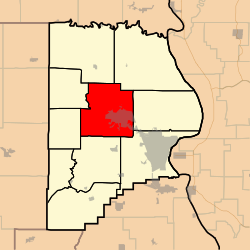
Byrd Township is one of ten townships in Cape Girardeau County, Missouri, USA. As of the 2000 census, its population was 15,693.
History[]
Byrd Township was founded in 1807 as one of the original five townships of Cape Girardeau County.[3] The township has the name of Abraham Byrd, a county commissioner.[4]
Geography[]
Byrd Township covers an area of 62.64 square miles (162.2 km2) and contains one incorporated settlement, Jackson (the county seat). It contains ten cemeteries: Byrd, Herzinger, Horrell, Howard, Mogler, Ramsey, Russell, Russell Heights, Slinkerd and Walker.
The streams of Cane Creek, Goose Creek, Helderman Creek and Horrell Creek run through this township.
References[]
- ^ "US Board on Geographic Names". United States Geological Survey. 2007-10-25. Retrieved 2008-01-31.
- ^ "U.S. Census website". United States Census Bureau. Retrieved 2008-01-31.
- ^ History of Southeast Missouri: A Narrative Account of Its Historical Progress, Its People and Its Principal Interests, Volume 1. Lewis Publishing Company. 1912. p. 163.
- ^ "Cape Girardeau County Place Names, 1928–1945 (archived)". The State Historical Society of Missouri. Archived from the original on 24 June 2016. Retrieved 10 September 2016.CS1 maint: bot: original URL status unknown (link)
External links[]
Municipalities and communities of Cape Girardeau County, Missouri, United States | ||
|---|---|---|
| Cities |  | |
| Villages | ||
| Townships | ||
| CDPs | ||
| Other communities | ||
| Ghost towns | ||
| Footnotes | ‡This populated place also has portions in an adjacent county or counties | |
| ||
This Cape Girardeau County, Missouri state location article is a stub. You can help Wikipedia by . |
- Townships in Cape Girardeau County, Missouri
- Cape Girardeau–Jackson metropolitan area
- Townships in Missouri
- Southeast Missouri geography stubs