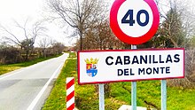
Cabanillas del Monte
This article may be expanded with text translated from the corresponding article in Spanish. (February 2021) Click [show] for important translation instructions.
|
Cabanillas del Monte | |
|---|---|
 | |
| Country | |
| Autonomous community | |
| Province | |
| Municipality | Torrecaballeros |
| Elevation | 1,150 m (3,770 ft) |
| Population (2020) | |
| • Total | 52 |
| Demonym(s) | cabanillero, -a del monte |
| Time zone | UTC+1 (CET) |
| • Summer (DST) | UTC+2 (CEST) |
Cabanillas del Monte is a city and a municipality which belongs to the municipality of Torrecaballeros, located in the province of Segovia, Castile and León, Spain. According to the 2020 census (INE), the municipality has a population of 52 inhabitants.[1]
Toponymy[]
In 1247 it was mentioned as Cabaniellas del Monte[2] and in the Ensenada Cadastre (1752) it was mentioned as Cabañuelas, Torrecavalleros neighborhood.[3] The word "Cabanillas" derives from the Latin capannelas, diminutive of capanna —of possible pre-Roman origin due to the suffix -anna—, with the meaning of cabin, farm where cattle are raised or stable for the herd.[4]
In the villages of the mountains, the houses or ranches with large corrals are still called cabins where cattle are sheared. In 1916 there was one of the few shearing yards that remained standing here, the one called Rancho de la Marquesa, which in the early 20th century maps was called Rancho de D. Tomás Mascaró.[2][5] The place name is also repeated in Cabañas de Polendos and (Adrada de Pirón). As for the word "Mount", it would refer to its location next to a mountain or forest.[2]
Geography[]
Location[]
The entrance to Cabanillas is located on the road that connects La Granja de San Ildefonso with the N-110 in Torrecaballeros.
Limits[]
It limits to the north with Espirdo and Torrecaballeros, to the south with Trescasas, to the east with the province of Madrid and to the west with .
| Northwest: | North: Torrecaballeros | Northeast: Torrecaballeros |
| West: | 
|
East: Rascafría (Madrid) |
| Southwest: Trescasas | South: Trescasas | Southeast: Trescasas, Rascafría (Madrid) |
Fauna and Flora[]
The area is mostly grasslands and abundant thorny shrubs, few specimens of shrub oak and reforestation pine forests. As aromatic species we have salsero thyme, white thyme, lavender.
Heritage[]

- declared an Asset of Cultural Interest on February 6, 1997.[6] The building dates back to the 16th century and was rebuilt in the 18th century[7] and is now converted into a private farmhouse for celebrations.
- , a single-vaulted Romanesque building, built during the 13th century, with Renaissance additions.
- , an old cabanillas enclosure and laundry located next to the Cañada Real Soriana Occidental.
- exhibition and dissemination and research center of the traditional culture of water and linen, projected for June 2021.[8]
- over the .
- located next to the church.
- Watering trough (Spanish: pílon) near the shear house.
Holidays[]
- September 22, 29 and 30: Saint Michel Archangel.
References[]
- ^ "INEbase. Alterations to the municipalities". www.ine.es. Archived from the original on 2019-02-26. Retrieved 2021-01-30.
- ^ a b c Siguero Llorente, Pedro Luis (1997). Significado de los nombres de los pueblos y despoblados de Segovia. p. 246.
- ^ "MINISTERIO DE CULTURA Y DEPORTE - Portal de Archivos Españoles". Archived from the original on 2007-05-13. Retrieved 2021-05-17.
- ^ Pancracio, Celdrán (2009). Diccionario de topónimos españoles y sus gentilicios. Madrid: Espasa Calpe. pp. 175–176. ISBN 978-84-670-3054-9.
- ^ "GR88 (9) Cabanillas – Sotosalbos – Pelayos". /www.acueducto2.com. Retrieved 2021-02-20.
- ^ "Bienes culturales protegidos". 2007-01-18. Archived from the original on 2007-01-18. Retrieved 2021-03-15.
- ^ "Cabanillas". Segovia Sur (in European Spanish). Retrieved 2021-03-15.
- ^ Barrenechea, Juana Hita. "El museo del pastor del agua" (in Spanish). Retrieved 2021-03-15.
External links[]
 Media related to Cabanillas del Monte at Wikimedia Commons
- Barrios - Ayuntamiento de Torrecaballeros
Coordinates: 40°59′N 4°02′W / 40.983°N 4.033°W

This article about a location in the province of Segovia, Spain is a stub. You can help Wikipedia by . |
This Spain location article is a stub. You can help Wikipedia by . |
- Municipalities in the Province of Segovia
- Populated places in the Province of Segovia
- Province of Segovia geography stubs
- Spain geography stubs