Camelback Mountain Resort
| Camelback Ski Area | |
|---|---|
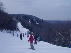 On the "Little Caesar" trail | |
| Location | Pocono Township / Jackson Township, Monroe County, near Tannersville, Pennsylvania, USA |
| Nearest major city | Scranton |
| Coordinates | 41°03′05″N 75°21′19″W / 41.05139°N 75.35528°W |
| Vertical | 800 feet (240 m) |
| Top elevation | 2,133 feet (650 m) |
| Skiable area | 166 acres (0.67 km2) |
| Runs | 35 trails |
| Longest run | "Nile Mile" – 5,280 feet (1,610 m) |
| Lift system | 16 2 high-speed detachable quad chairlifts, 3 triple chairlifts, 5 double chairlifts, 4 Surface lifts, 2 Tubing Surface Lifts |
| Terrain parks | 2 |
| Snowfall | 50 in/yr (1.27 m/yr) |
| Website | http://www.skicamelback.com |

Camelback Mountain Resort is a ski and snowboard resort located in the Pocono Mountains region in Pocono Township and Jackson Township, Monroe County, Pennsylvania, adjacent to, and partially within Big Pocono State Park. In the 1950s when developers were working to expand the original solitary ski run, they negotiated with the then PA DER for permission to use a small portion of the state park for the ski area in exchange for $1 a year and the obligation to maintain the entire park.

Camelback Mountain (Big Pocono) itself reaches an elevation of 2,133 feet (650 m). There are 166 acres (67 hectares) of skiing & snowboarding terrain; the mountains have a total of 35 slopes (the longest of which is 1 mile(1,609 m), namely, the Nile Mile) and features a vertical drop of 800 ft (244 m), 15 lifts, including 2 high speed detachable chairlifts; the Sullivan Express and Stevenson Express, both quads. It is the largest ski resort in the Poconos. It has two terrain parks. The resort was opened in December 1963. The mountain summit receives an average of 50 in (127 cm) of snowfall each winter. It has snowmaking facilities on ski slopes, primarily relying on portable snow guns to create snow, and is 100% lit for night skiing.[1]
In May 2015 Camelback opened Camelback Resort and Indoor Waterpark. An additional attraction was added with Camelback Mountain Adventures.
Camelback Mountain Resort is 2 miles (3.2 km) from Pinemere Camp, and about 45 miles (72 km) north of Allentown, Pennsylvania.[2][3]
Camelback invested in their educational ski and snowboard programs. They use the marketing term, Learn Here, Learn Right.[4]
Camelback Resort and Indoor Waterpark[]
Camelback Resort and Indoor Waterpark was opened in 2015. Their waterpark, known as Aquatopia, was voted the #1 Indoor Waterpark in the country by USA Today for 2015. The indoor park is open year-round while the outdoor park is open only in the summer. Aquatopia includes over 37 waterslides (the most in Pennsylvania), including four body slides, a mat slide, five tube slides and four raft rides, in addition to a 30,000-square-foot (2,800 m2) wave pool, lazy river, a children's play area, and a full-sized competition pool. Aquatopia also features the FlowRider, a wave riding pool for surfing and boogie boarding.

Camelback Mountain Adventures[]
Camelback Mountain Adventures offers Treetop Adventure courses, 1,000 ft (300 m) of zipline, 4,000 ft (1,200 m) ZipFlyer, Mountain Segways, Disc Golf, and a 4500' Mountain Coaster. Within Camelback Mountain Adventures, they also offer Adventure Zone activities of Climbing Wall, EuroBungee, and a Freefall Airbag Jump. Soon to be added to Camelback Mountain Adventures is an Alpine Slide. Camelback Mountain Adventures is open from June to November.
The ski trails[]
- The Birches, an Advanced Novice ski run

- King Tut, an Intermediate run

- The Hump, Expert

- The Asp
- The Rocket
- Marje's Delight
- The Dromedary
- Big Pocono Run
- Upper Cleopatra
- Marc Anthony
- Julius Caesar
- Little Caesar
- Laurel Glade
- Coolmoor
- The Meadows
- John Bailey
- Sulivan's Trail
- The Sphinx
- Honeymoon Lane
- Home Again
- Lower Cleopatra
- Sunbowl
- Oak Grove
- Turkey Trot
- Upper Moore's Ramble
- Lower Moore's Ramble
- Pocono Raceway
- The Pharaoh
- The Bactrian
- Cliffhanger

- Near East
- The Nile Mile
- Basilisk
Climate[]
According to the Trewartha climate classification system, Camelback Mountain Resort has a Temperate Continental climate (Dc) with warm summers (b), cold winters (o) and year-around precipitation (Dcbo). Dcbo climates are characterized by at least one month having an average mean temperature ≤ 32.0 °F (0.0 °C), four to seven months with an average mean temperature ≥ 50.0 °F (10.0 °C), all months with an average mean temperature < 72.0 °F (22.2 °C) and no significant precipitation difference between seasons. Although most summer days are comfortably humid at Camelback Mountain Resort, episodes of heat and high humidity can occur with heat index values > 93 °F (34 °C). Since 1981, the highest air temperature was 95.4 °F (35.2 °C) on 07/22/2011, and the highest daily average mean dew point was 70.7 °F (21.5 °C) on 08/01/2006. July is the peak month for thunderstorm activity which correlates with the average warmest month of the year. The wettest month of the year is September which correlates with tropical storm remnants during the peak of the Atlantic hurricane season. Since 1981, the wettest calendar day was 6.77 inches (172 mm) on 09/30/2010. During the winter months, the plant hardiness zone is 6a with an average annual extreme minimum air temperature of −9.4 °F (−23.0 °C).[5] Since 1981, the coldest air temperature was −21.6 °F (−29.8 °C) on 01/21/1994. Episodes of extreme cold and wind can occur with wind chill values < −22 °F (−30 °C). The average snowiest month is January which correlates with the average coldest month of the year. Ice storms and large snowstorms depositing ≥ 12 inches (30 cm) of snow occur nearly every year, particularly during nor’easters from December through March.
| hideClimate data for Camelback Mountain Resort, Elevation 1,883 ft (574 m), 1981-2010 normals, extremes 1981-2018 | |||||||||||||
|---|---|---|---|---|---|---|---|---|---|---|---|---|---|
| Month | Jan | Feb | Mar | Apr | May | Jun | Jul | Aug | Sep | Oct | Nov | Dec | Year |
| Record high °F (°C) | 63.9 (17.7) |
73.5 (23.1) |
82.0 (27.8) |
88.7 (31.5) |
90.5 (32.5) |
90.3 (32.4) |
95.4 (35.2) |
93.7 (34.3) |
91.5 (33.1) |
83.7 (28.7) |
75.3 (24.1) |
67.4 (19.7) |
95.4 (35.2) |
| Average high °F (°C) | 31.1 (−0.5) |
34.6 (1.4) |
42.3 (5.7) |
55.2 (12.9) |
66.2 (19.0) |
73.8 (23.2) |
78.1 (25.6) |
76.4 (24.7) |
69.6 (20.9) |
57.9 (14.4) |
46.7 (8.2) |
35.2 (1.8) |
55.7 (13.2) |
| Daily mean °F (°C) | 22.8 (−5.1) |
25.8 (−3.4) |
32.9 (0.5) |
45.0 (7.2) |
55.7 (13.2) |
63.8 (17.7) |
68.4 (20.2) |
67.0 (19.4) |
60.2 (15.7) |
48.7 (9.3) |
38.8 (3.8) |
27.8 (−2.3) |
46.5 (8.1) |
| Average low °F (°C) | 14.5 (−9.7) |
17.0 (−8.3) |
23.6 (−4.7) |
34.8 (1.6) |
45.1 (7.3) |
53.8 (12.1) |
58.7 (14.8) |
57.7 (14.3) |
50.8 (10.4) |
39.6 (4.2) |
30.9 (−0.6) |
20.4 (−6.4) |
37.3 (2.9) |
| Record low °F (°C) | −21.0 (−29.4) |
−11.5 (−24.2) |
−3.9 (−19.9) |
11.6 (−11.3) |
28.2 (−2.1) |
33.8 (1.0) |
39.3 (4.1) |
35.5 (1.9) |
29.0 (−1.7) |
18.1 (−7.7) |
1.2 (−17.1) |
−12.3 (−24.6) |
−21.0 (−29.4) |
| Average precipitation inches (mm) | 3.97 (101) |
3.36 (85) |
4.03 (102) |
4.68 (119) |
4.81 (122) |
5.32 (135) |
4.48 (114) |
4.51 (115) |
5.52 (140) |
5.32 (135) |
4.48 (114) |
4.54 (115) |
55.02 (1,398) |
| Average snowfall inches (cm) | 19.7 (50) |
14.1 (36) |
14.7 (37) |
3.5 (8.9) |
0.0 (0.0) |
0.0 (0.0) |
0.0 (0.0) |
0.0 (0.0) |
0.0 (0.0) |
0.1 (0.25) |
3.7 (9.4) |
11.8 (30) |
67.7 (172) |
| Average relative humidity (%) | 72.9 | 67.4 | 64.7 | 61.6 | 64.0 | 73.3 | 73.2 | 76.3 | 77.1 | 74.3 | 73.0 | 75.3 | 71.1 |
| Average dew point °F (°C) | 15.4 (−9.2) |
16.5 (−8.6) |
22.3 (−5.4) |
32.6 (0.3) |
43.7 (6.5) |
55.1 (12.8) |
59.5 (15.3) |
59.3 (15.2) |
53.0 (11.7) |
40.9 (4.9) |
30.9 (−0.6) |
21.0 (−6.1) |
37.6 (3.1) |
| Source: PRISM[6] | |||||||||||||
Ecology[]
According to the A. W. Kuchler U.S. potential natural vegetation types, Camelback Mountain Resort would have transient dominant vegetation types of Northern Hardwood (106) and Appalachian Oak (104) with transient dominant vegetation forms of Northern hardwood forest (26) and Eastern Hardwood Forest (25).[7] The peak spring bloom typically occurs in late-April and early-May and peak fall color usually occurs from early-to-mid October. The plant hardiness zone is 6a with an average annual extreme minimum air temperature of −9.4 °F (−23.0 °C).[5]
References[]
- ^ David G. Allan (January 28, 2009). "Camelback Mountain Resort". The New York Times. Retrieved April 10, 2014.
- ^ Peterson's (1994). Summer Jobs USA 1995. Peterson's. Retrieved May 5, 2013.
- ^ Paul Robbins (January 1995). Cheap Sleeperies '95; Camelback, Pennsylvania – Pinemere. Skiing. Retrieved May 5, 2013.
- ^ Dave Belin (January 9, 2014). "Top 4 Places to Learn to Ski and Snowboard". The Huffington Post. Retrieved April 10, 2014.
- ^ Jump up to: a b "USDA Interactive Plant Hardiness Map". United States Department of Agriculture. Retrieved September 10, 2019.
- ^ "PRISM Climate Group, Oregon State University". Retrieved September 10, 2019.
- ^ "U.S. Potential Natural Vegetation, Original Kuchler Types, v2.0 (Spatially Adjusted to Correct Geometric Distortions)". Retrieved September 10, 2019.
External links[]
| Authority control: National libraries |
|---|
- Pocono Mountains
- Ski areas and resorts in Pennsylvania
- 1963 establishments in Pennsylvania
- Buildings and structures in Monroe County, Pennsylvania
- Tourist attractions in Monroe County, Pennsylvania