Campbell, Australian Capital Territory
| Campbell Canberra, Australian Capital Territory | |||||||||||||||
|---|---|---|---|---|---|---|---|---|---|---|---|---|---|---|---|
 Campbell | |||||||||||||||
| Coordinates | 35°17′17″S 149°09′14″E / 35.28806°S 149.15389°ECoordinates: 35°17′17″S 149°09′14″E / 35.28806°S 149.15389°E | ||||||||||||||
| Population | 4,997 (2016 census)[1] | ||||||||||||||
| • Density | 781/km2 (2,022/sq mi) | ||||||||||||||
| Established | 1928 | ||||||||||||||
| Postcode(s) | 2612 | ||||||||||||||
| Area | 6.4 km2 (2.5 sq mi) | ||||||||||||||
| District | North Canberra | ||||||||||||||
| Territory electorate(s) | Kurrajong | ||||||||||||||
| Federal division(s) | Canberra | ||||||||||||||
| |||||||||||||||

Campbell (postcode: 2612) is a suburb of Canberra, Australian Capital Territory, Australia. Covering an area to the South East of the central business district, Campbell sits at the base of Mount Ainslie and is bounded to the south east by the Mount Pleasant Nature Reserve. At the 2016 census, Campbell had a population of 4,997 people.[1]
The suburb of Campbell is named after Robert Campbell, the owner of Duntroon station on which Campbell is now located.[2] Many buildings built by Robert Campbell and his family are still standing around Canberra, including Blundell's Cottage, St John the Baptist Church, Reid, Duntroon House (now part of RMC Duntroon) and Yarralumla House (now Government House).
Located in Campbell are the Australian War Memorial, Royal Military College, Duntroon, the Australian Defence Force Academy, and the former corporate headquarters of the CSIRO, which is awaiting demolition and redevelopment. Also with addresses in the suburb are the 'Ainslie Village' accommodation centre for people with special needs and the Campbell Park Offices.
Schools located in the suburb include Campbell High School, Campbell Primary School and Canberra Grammar Northside Infant School.
Population[]
In the 2016 Census, there were 4,997 people in Campbell. 73.6% of people were born in Australia. The next most common country of birth was England at 3.4%. 81.0% of people only spoke English at home. The most common responses for religion were No Religion 42.3%, Catholic 20.3% and Anglican 12.2%.[1]
Geology[]
Most of leafy Campbell is dominated by the lowest layer of the Ainslie Volcanics, a grey dacite and other erupted particles such as agglomerate and tuff. In the north is grey quartz andesite, a higher layer of the Ainslie Volcanics. In the north east is cream rhyolite from the highest layer of the Ainslie Volcanics. The Ainslie Volcanics were formed in the Silurian period. A layer of the Tertiary age pebbly gravels is around Anzac Parade, left over from when the Molonglo river was at a higher level.[3]
Gallery[]
Patey Street, a residential street in Campbell

Campbell local shops

Medium density flats located at the centre of the suburb

The suburb is bounded to the west by Anzac Parade

Most streets in Campbell are named after military personnel[2]

A view of Mount Ainslie from near the intersection of Elliot Street and Vasey Crescent, Campbell

A disused track in patchy bushland in the reserve behind Vasey Crescent near Northcott Drive in Campbell

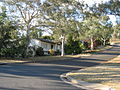
Looking up Patey Street from the Garsia Street intersection

The crown of Savige Street in mid Campbell
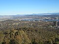
Campbell viewed from Mount Ainslie

A view of Getting Crescent, Campbell, in mid-autumn


References[]
- ^ a b c Australian Bureau of Statistics (27 June 2017). "Campbell (State Suburb)". 2016 Census QuickStats. Retrieved 28 June 2017.

- ^ a b "Suburb Name search results". ACT Environment and Sustainable Development. Retrieved 9 February 2014.
- ^ Henderson G A M and Matveev G, Geology of Canberra, Queanbeyan and Environs 1:50000 1980.
- Suburbs of Canberra