Canarreos Archipelago
This article needs additional citations for verification. (December 2009) |
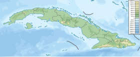
Canarreos Archipelago (Spanish: Archipiélago de los Canarreos) is an archipelago of Cuba.
It is located south of the main island of Cuba, in the Caribbean Sea, at 21°38′22″N 82°14′10″W / 21.6394444°N 82.2361111°WCoordinates: 21°38′22″N 82°14′10″W / 21.6394444°N 82.2361111°W. It is bordered to the east by the Gulf of Cazones, to the north by the Gulf of Batabano and to the west by the Los Indios Channel.
 WikiMiniAtlas
It comprises roughly 350 islets, and is almost as long as the Florida Keys.[1] By far the largest island of the archipelago is Isla de la Juventud, while the second largest is Cayo Largo del Sur.
List of Islands[]
| Nr. 1) | Island | Capital | Other Cities | Area (km²) |
Population (Census 2012 official) |
| 1 | Aguardiente | Punta del Canto | 6.50 | 0 | |
| 2 | , , , , , | 11.13 | 0 | ||
| 3 | 3.06 | 0 | |||
| 4 | 1.60 | 0 | |||
| 5 | Cayo Sur, , , , , | 47.05 | 0 | ||
| 6 | 12.00 | 2 | |||
| 7 | Punta Los Muertos, Punta del Ingles, Punta el Captivo, Punta Ciprey | 33.70 | 3 | ||
| 8 | Punta Mogote | 22.00 | 0 | ||
| 9 | 1.67 | 1 | |||
| 10 | Cayo Largo del Sur | Vilo Acuna, Las Piedras, Punta Gancho, Punta Mangle Prieto, Punta Iguanita, Punta del Este, Playa Tortuga, Playa los Cocos, Playa Blanca, Playa Lindamar, Playa Paraiso, Playa Sirena, Playa Luna | 37.50 | 24 | |
| 11 | Rico Restaurant | 1.10 | 0 | ||
| 12 | Cayo de Dios, Cayo Trabuco, Cayo Guano, Cayo Arenoso | 0.65 | 0 | ||
| 13 | Cayo Grande, Cayo Norte Manteca | 9.97 | 0 | ||
| 14 | Cayo La Grifa, Cayo Hambre Chica, Cayo Segundo, Cayo Rabihorcado | 4.76 | 0 | ||
| 15 | Isla de la Juventud | Nueva Gerona | Santa Fe, La Demajagua (Santa Bárbara), Columbia, , Cuchilla Alta, Punta del Este, Sierra de Caballos, | 2200.00 | 99970 |
| 16 | Playa Oeste | 2.19 | 0 | ||
| 17 | More Islands | de san felipe, Tablones, del pasaje, Divisa, Perases, traviesa, Balandras, Guayabo, Triangulo, El Navio, Los Inglesitos, Quitasol | 42.60 | 0 | |
| Canarreos Archipelago | Nueva Gerona | Santa Fe | 2438.00 | 100000 |
1) The Islands area and population data retrieved from the 2012 census.
See also[]
References[]
- ^ "Cayo Largo del Sur: sand, sun, and healthy ecosystems" (PDF). Archived from the original (PDF) on 2011-01-24. Retrieved 2010-11-09.
| Authority control |
|
|---|
This Cuban location article is a stub. You can help Wikipedia by . |
Categories:
- Islands of Cuba
- Cuba geography stubs