Cape Ashizuri
| Cape Ashizuri | |
|---|---|
| 足摺岬 | |
 above the cape | |
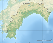 Location of Cape Ashizuri on Shikoku | |
| Location | Tosashimizu, Kōchi Prefecture, Japan |
| Coordinates | 32°43′26″N 133°01′13″E / 32.723829°N 133.020337°ECoordinates: 32°43′26″N 133°01′13″E / 32.723829°N 133.020337°E |


Cape Ashizuri (足摺岬, Ashizuri-misaki) is a headland at the southernmost tip[1] of the Japanese island of Shikoku, in the city of Tosashimizu, Kōchi Prefecture.[1] The promontory extends into the Pacific Ocean[2] and is situated within Ashizuri-Uwakai National Park.[1] Above the cape is , which started operating in 1914,[3] and two observatories,[2] while a short distance inland stand Kongōfuku-ji, the thirty-eighth temple on the Shikoku Pilgrimage,[4] and a bronze statue of Nakahama Manjirō, who was born nearby.[5] Due to coastal erosion, there are a number of caves around the cape, including , said to be the largest granite cave in the country and a Prefectural Natural Monument.[6][7]
See also[]
- List of Places of Scenic Beauty of Japan (Kōchi)
- List of Natural Monuments of Japan (Kōchi)
- Kuroshio Current
- Cape Muroto
References[]
| Wikimedia Commons has media related to Cape Ashizuri. |
- ^ Jump up to: a b c "Highlights of Ashizuri-Uwakai National Park". Ministry of the Environment. Retrieved 17 April 2021.
- ^ Jump up to: a b 足摺岬 [Cape Ashizuri] (in Japanese). Tosashimizu City. Retrieved 17 April 2021.
- ^ 足摺岬灯台 [Cape Ashizuri Lighthouse] (in Japanese). Tosashimizu City. Retrieved 17 April 2021.
- ^ 第38番札所 金剛福寺 [No.38: Kongōfukuji] (in Japanese). Tosashimizu City. Retrieved 17 April 2021.
- ^ ジョン万次郎銅像 [Bronze Statue of John Manjirō] (in Japanese). Tosashimizu City. Retrieved 17 April 2021.
- ^ 白山洞門 [Hakusan Cave] (in Japanese). Tosashimizu City. Retrieved 17 April 2021.
- ^ 白山洞門 [Hakusan Cave] (in Japanese). Kōchi Prefecture. Retrieved 17 April 2021.
| Authority control |
|
|---|
Categories:
- Tosashimizu, Kōchi
- Landforms of Kōchi Prefecture
- Headlands of Japan
- Extreme points of Japan