Carroll Creek (Maryland)
| Carroll Creek | |
|---|---|
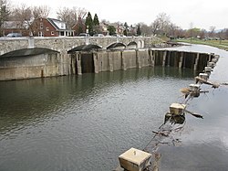 Carroll Creek in Frederick, Maryland | |
 Watershed map showing Carroll Creek | |
| Native name | Walkwaki Methtegui (Shawnee) |
| Location | |
| Country | United States |
| State | Maryland |
| Cities | Frederick, Tuscarora |
| Physical characteristics | |
| Source | |
| • location | Tuscarora, MD |
| • coordinates | 39°27′40″N 77°29′05″W / 39.461057°N 77.484649°W |
| Mouth | Monocacy River |
• location | Frederick, MD |
• coordinates | 39°25′37″N 77°22′47″W / 39.427029°N 77.379766°WCoordinates: 39°25′37″N 77°22′47″W / 39.427029°N 77.379766°W |
| Length | 8.3 mi (13.4 km) |
| Basin features | |
| Tributaries | |
| • left | Culler Lake |
| • right | Rock Creek (Potomac River) |
Carroll Creek is an 8.3-mile-long (13.4 km)[1] tributary of the Monocacy River in Frederick County, Maryland. The headwaters of the creek are located on the eastern slopes of Catoctin Mountain, southeast of Gambrill State Park. The stream runs roughly east through the city of Frederick to the Monocacy, which drains to the Potomac River. The Shawnee Indians, who called the Monocacy River Monnockkesey (which translates as “river with many bends”), named Carroll Creek Walkwaki Methtegui, (which translates as "down in the gully creek").
See also[]
- List of Maryland rivers
References[]
- ^ U.S. Geological Survey. National Hydrography Dataset high-resolution flowline data. The National Map Archived 2012-04-05 at WebCite, accessed August 15, 2011
External links[]
- Carroll Creek Park - Flood control and restoration project, City of Frederick
- Monocacy & Catoctin Watershed Alliance
Categories:
- Rivers of Frederick County, Maryland
- Rivers of Maryland
- Tributaries of the Monocacy River
- Frederick County, Maryland geography stubs
- Maryland river stubs