Miles River
| Miles River | |
|---|---|
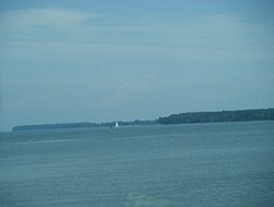 Miles River at Newcomb in June 2008. | |
| Etymology | Saint Michael |
| Location | |
| Country | United States of America |
| State | Maryland |
| Region | Talbot County |
| Municipality | Newcomb |
| Physical characteristics | |
| Length | 12.9 mi (20.8 km) |
| Basin size | 54 sq mi (140 km2) |
The Miles River is a 12.9-mile-long (20.8 km)[1] tidal river in Talbot County, Maryland. It is a tributary of the Eastern Bay and is thus part of the Chesapeake Bay watershed.
Etymology[]
Miles River was originally called the St. Michaels River; it derives its name from Saint Michael, the patron saint of Colonial Maryland.[2]
Geography[]
Its watershed area is 54 square miles (140 km2), of which 12 square miles (31 km2) is open water, so it is 22% water. The predominant land use is agricultural with 22 square miles (57 km2), or 52% of the land area.
References[]
- ^ U.S. Geological Survey. National Hydrography Dataset high-resolution flowline data. The National Map Archived 2012-04-05 at WebCite, accessed April 1, 2011
- ^ Harrison, Samuel Alexander (1915). History of Talbot County, Maryland, 1661-1861. Williams & Wilkins. p. 316.
External links[]
- Chesapeake Bay Program Watershed Profile: Miles River
Categories:
- Rivers of Maryland
- Tributaries of the Chesapeake Bay
- Rivers of Talbot County, Maryland
- Talbot County, Maryland geography stubs
- Maryland river stubs