Cabin John Creek
| Cabin John Creek | |
|---|---|
 Cabin John Creek near Rockville, Maryland | |
 Mouth of Cabin John Creek | |
| Location | |
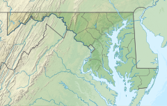
| Country | United States |
| State | Maryland |
| County | Montgomery County |
| Physical characteristics | |
| Source | |
| • location | Rockville |
| • coordinates | 39°04′33″N 77°09′12″W / 39.0759418°N 77.1533132°W |
| Mouth | |
• coordinates | 38°58′11″N 77°08′47″W / 38.969833°N 77.146368°WCoordinates: 38°58′11″N 77°08′47″W / 38.969833°N 77.146368°W |
• elevation | 56 ft (17 m)[1] |
| Length | 10.9 mi (17.5 km) |
| Basin size | 26 sq mi (67 km2) |
| Basin features | |
| River system | Potomac River |
Cabin John Creek is a tributary stream of the Potomac River in Montgomery County, Maryland. The watershed covers an area of 26 square miles (67 km2). The headwaters of the creek originate in the city of Rockville, and the creek flows southward for 10.9 miles (17.5 km)[2] to the Potomac River.[3]
History and course[]
History[]
Early land records in 1715 cite Captain John's Run, now Cabin John Creek. The toponym "Cabin John" is thought to be a corruption of the name "Captain John", but the origin of the name remains unresolved.[4]
The Cabin John Stream Valley Trail[5] follows the course of the creek for 8.8 miles (14.2 km), passing through Cabin John Regional Park[6] and Cabin John Local Park.[7] The Union Arch Bridge carries MacArthur Boulevard and the Washington Aqueduct over the stream about 1/4 mile before the creek flows through a culvert under the Chesapeake and Ohio Canal and empties into the Chesapeake and Ohio Canal and Potomac River near Cabin John, Maryland.
Water pollution[]
The Cabin John Creek watershed is highly developed, and as a result the water quality in the creek main stem and several tributaries is degraded.[8] Montgomery County Government is implementing a long-term plan to improve water quality throughout the area, including stormwater management and stream restoration projects.[9][10]
Tributaries of Cabin John Creek[]
- Booze Creek
- Thomas Branch (also called Beltway Branch and Thomas Run)
- Congressional Branch
- Ken Branch
- Buck Branch
- Snakeden Branch (also called Snake Den Branch)
- Old Farm Creek
- Bogley Branch
See also[]
- List of Maryland rivers
- Cabin John Parkway
- Cabin John, Maryland
- Chesapeake and Ohio Canal
References[]
- ^ U.S. Geological Survey Geographic Names Information System: Cabin John Creek
- ^ U.S. Geological Survey. National Hydrography Dataset high-resolution flowline data. The National Map Archived 2012-04-05 at WebCite, accessed August 15, 2011
- ^ Montgomery County Department of Environmental Protection (MCDEP). Rockville, MD (2010). "Cabin John Creek Profile." Archived 2011-04-03 at the Wayback Machine February 2010.
- ^ Welles, Judith (2008). Cabin John: Legends and Life of an Uncommon Place. Cabin John, Maryland: Cabin John Citizens Association. ISBN 978-0-615-21117-6.
- ^ "Cabin John Creek Trail Map". Montgomery County Parks. Archived from the original on February 26, 2021. Retrieved May 19, 2021.
- ^ "Cabin John Regional Park". Montgomery County Parks. Retrieved May 19, 2021.
- ^ "Cabin John Creek". Montgomery County Parks. Archived from the original on 2019-01-07.
- ^ MCDEP. "The Cabin John Creek Watershed." Archived 2011-04-03 at the Wayback Machine Accessed 2010-04-05.
- ^ MCDEP. "Cabin John Creek Watershed." Archived 2015-09-25 at the Wayback Machine Accessed 2015-08-18.
- ^ "Restoration Projects". Watershed Restoration. MCDEP. Retrieved 2018-06-23.
- Rapid Stream Assessment Technique (RSAT) Survey of the Cabin John Creek and Minnehaha Branch Watersheds, Montgomery County, Maryland: Final Report. Washington, DC: Metropolitan Washington Council of Governments]. December 1996.CS1 maint: date and year (link)
- "Friends of Cabin John Creek". Friends of Cabin John Creek. Retrieved May 19, 2021.
Authority control | |
|---|---|
| General |
|
| National libraries | |
- Rivers of Montgomery County, Maryland
- Rivers of Maryland
- Tributaries of the Potomac River
- Montgomery County, Maryland geography stubs
- Maryland river stubs