Catigbian
Catigbian
San Jacinto | |
|---|---|
| Municipality of Catigbian | |
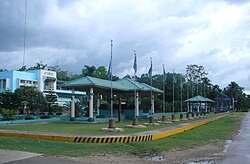 Catigbian Municipal Hall | |
 Flag | |
| Anthem: Catigbian Hymn | |
 Map of Bohol with Catigbian highlighted | |
OpenStreetMap  | |
 Catigbian Location within the Philippines | |
| Coordinates: 9°50′N 124°02′E / 9.83°N 124.03°ECoordinates: 9°50′N 124°02′E / 9.83°N 124.03°E | |
| Country | Philippines |
| Region | Central Visayas |
| Province | Bohol |
| District | 1st district |
| Founded | 17 June 1949 |
| Barangays | 22 (see Barangays) |
| Government | |
| • Type | Sangguniang Bayan |
| • Mayor | Elizabeth E. Mandin |
| • Vice Mayor | Esteban N. Angilan Jr. |
| • Representative | Edgardo M. Chatto |
| • Municipal Council | Members |
| • Electorate | 15,603 voters (2019) |
| Area | |
| • Total | 113.33 km2 (43.76 sq mi) |
| Elevation | 217 m (712 ft) |
| Highest elevation | 357 m (1,171 ft) |
| Lowest elevation | 91 m (299 ft) |
| Population (2020 census) [3] | |
| • Total | 23,805 |
| • Density | 210/km2 (540/sq mi) |
| • Households | 5,117 |
| Economy | |
| • Income class | 4th municipal income class |
| • Poverty incidence | 29.20% (2015)[4] |
| • Revenue | ₱114,016,786.05 (2020) |
| • Assets | ₱460,200,268.15 (2020) |
| • Expenditure | ₱124,304,804.13 (2020) |
| • Liabilities | ₱39,387,266.72 (2020) |
| Service provider | |
| • Electricity | Bohol 1 Electric Cooperative (BOHECO 1) |
| Time zone | UTC+8 (PST) |
| ZIP code | 6343 |
| PSGC | |
| IDD : area code | +63 (0)38 |
| Native languages | Boholano dialect Cebuano Tagalog |

Catigbian, officially the Municipality of Catigbian (Cebuano: Munisipyo sa Catigbian; Tagalog: Bayan ng Catigbian), is a 4th class municipality in the province of Bohol, Philippines. According to the 2020 census, it has a population of 23,805 people. [3]
Catigbian was formerly known as San Jacinto, and officially changed to its current name in 1954.[5] Catigbian is named after a certain group of seed-bearing plants named "Katigbi" (Coix lacrymajobi), which grow abundantly.[6]
History[]
The town was founded in 1829 as one of the villages where rebels were resettled after the Dagohoy Rebellion had been suppressed. In 1903, when the province was reorganized, it was annexed to Balilihan but was made an independent municipality once more on 17 June 1949.[7] At that time there were only 15 barrios within the territorial limits compared to the 22 barangays it has now.
Geography[]
Located 35 kilometres (22 mi) north of Tagbilaran, Catigbian is an interior town north of Balilihan, south of Sagbayan and Tubigon, east of San Isidro and west of Batuan.
Barangays[]
Catigbian comprises 22 barangays:
| PSGC | Barangay | Population | ±% p.a. | |||
|---|---|---|---|---|---|---|
| 2020 [3] | 2010 [8] | |||||
| 071213001 | Alegria | 5.2% | 1,248 | 1,247 | 0.01% | |
| 071213002 | Ambuan | 4.8% | 1,150 | 1,197 | −0.38% | |
| 071213003 | Baang | 6.1% | 1,442 | 1,381 | 0.41% | |
| 071213004 | Bagtic | 4.4% | 1,055 | 1,069 | −0.12% | |
| 071213005 | Bonbong | 2.4% | 565 | 579 | −0.23% | |
| 071213007 | Cambailan | 3.2% | 759 | 916 | −1.75% | |
| 071213008 | Candumayao | 6.7% | 1,600 | 1,545 | 0.33% | |
| 071213011 | Causwagan Norte | 7.4% | 1,763 | 1,812 | −0.26% | |
| 071213013 | Hagbuaya | 3.0% | 718 | 875 | −1.84% | |
| 071213014 | Haguilanan | 4.6% | 1,094 | 1,133 | −0.33% | |
| 071213009 | Kang‑iras | 3.0% | 724 | 709 | 0.20% | |
| 071213015 | Libertad Sur | 1.4% | 326 | 364 | −1.03% | |
| 071213016 | Liboron | 4.0% | 954 | 930 | 0.24% | |
| 071213017 | Mahayag Norte | 2.3% | 551 | 577 | −0.43% | |
| 071213018 | Mahayag Sur | 1.2% | 277 | 277 | 0.00% | |
| 071213019 | Maitum | 3.8% | 896 | 1,035 | −1.34% | |
| 071213020 | Mantasida | 4.2% | 1,001 | 913 | 0.87% | |
| 071213021 | Poblacion | 7.8% | 1,848 | 1,810 | 0.20% | |
| 071213027 | Poblacion Weste | 7.4% | 1,754 | 1,742 | 0.06% | |
| 071213022 | Rizal | 2.9% | 700 | 694 | 0.08% | |
| 071213025 | Sinakayanan | 3.8% | 913 | 733 | 2.08% | |
| 071213026 | Triple Union | 4.8% | 1,149 | 1,148 | 0.01% | |
| Total | 23,805 | 22,686 | 0.45% | |||
Climate[]
| Climate data for Catigbian, Bohol | |||||||||||||
|---|---|---|---|---|---|---|---|---|---|---|---|---|---|
| Month | Jan | Feb | Mar | Apr | May | Jun | Jul | Aug | Sep | Oct | Nov | Dec | Year |
| Average high °C (°F) | 26 (79) |
27 (81) |
28 (82) |
30 (86) |
30 (86) |
29 (84) |
29 (84) |
29 (84) |
29 (84) |
28 (82) |
27 (81) |
27 (81) |
28 (83) |
| Average low °C (°F) | 22 (72) |
21 (70) |
22 (72) |
22 (72) |
23 (73) |
23 (73) |
23 (73) |
23 (73) |
23 (73) |
23 (73) |
22 (72) |
22 (72) |
22 (72) |
| Average precipitation mm (inches) | 98 (3.9) |
82 (3.2) |
96 (3.8) |
71 (2.8) |
104 (4.1) |
129 (5.1) |
101 (4.0) |
94 (3.7) |
99 (3.9) |
135 (5.3) |
174 (6.9) |
143 (5.6) |
1,326 (52.3) |
| Average rainy days | 18.0 | 14.1 | 17.1 | 16.8 | 23.7 | 25.7 | 25.8 | 23.3 | 24.2 | 25.9 | 24.0 | 20.6 | 259.2 |
| Source: Meteoblue (modeled/calculated data, not measured locally) [9] | |||||||||||||
Demographics[]
| Year | Pop. | ±% p.a. |
|---|---|---|
| 1903 | 1,580 | — |
| 1960 | 13,438 | +3.83% |
| 1970 | 13,782 | +0.25% |
| 1975 | 15,570 | +2.48% |
| 1980 | 15,620 | +0.06% |
| 1990 | 17,362 | +1.06% |
| 1995 | 17,596 | +0.25% |
| 2000 | 21,461 | +4.35% |
| 2007 | 23,333 | +1.16% |
| 2010 | 22,686 | −1.02% |
| 2015 | 22,675 | −0.01% |
| 2020 | 23,805 | +0.96% |
| Source: Philippine Statistics Authority [10] [8] [11][12] | ||
Economy[]
| Poverty Incidence of Catigbian | |
| Source: Philippine Statistics Authority[13][14][15][16][17][18] | |

Commerce and industry[]
- Catigbian Public Market
- Livestock Auction Center – the biggest in the province of Bohol
- Abattoir
- Catigbian Waterworks System
- One Town One Product (OTOP) Display Center
Agriculture[]
- 8,950 ha (22,100 acres) alienable & disposable land
- 43.85% devoted to crops
- 56.15% pasture land, grassland, idle land
- 2,351 ha (5,809 acres) forestal land
- Livestock raising (alternative)
Infrastructure[]
Water[]
- 3 Pumping Stations for 12 barangays – 500 m3 (130 thousand US gallons) /day
- 2 more barangays with own pumping station
Facilities[]
- Catigbian Training Center
- Municipal Court Hall
- Municipal Conference Hall
- Public Market
- Tennis Court
- Basketball Court/Multi-Purpose Court (sports and other activities)
- Catigbian District Hospital
- Municipal Health Center
Feast Days & Patron Saints[]
Catigbian comprises two parishes:
- Immaculate Conception Parish (church located in Poblacion West), which celebrates its Feast Day on 8 December in honor of the Immaculate conception of the Virgin Mary[19]
- Santo Niño Parish (church located in Baang), which celebrates its feast day on the third Saturday of January in honor of the Holy Child Jesus
Tourism[]
Catigbian is home to caves, hanging bridges, handicrafts, livestock market and for its nature resort. Among its attractions are
- Betn'Choy Farms and Resort
- Rizal Hanging Bridge
- Cantalina Cave
- Haguilanan Cave
- Candumayao Cave
- Bongbong Cave
- Dagook Falls
The Katigbawan Festival[]
What distinguishes Catigbian from other towns is its annual festival, the Katigbawan, which is a week-long festival in June consisting of various activities like carabao-racing, hog-catching, agrofair, motorcross and a search for Miss Katigbawan.
This four-day event has several activities lined up starting with the opening of the festival with a parade after a holy mass. It is followed by a comparza and a talent contest of Miss Katigbawan candidates during the day. Judging of the display of agrofair, bloodletting and motorcross takes place on the second day. On the third day is the Carabao Parade with carabao-racing and hog-catching at central elementary school and the search for Catigbian's prettiest – the Miss Katigbawan Beauty Pageant – in the evening.[a] On the fourth day is the street dancing, then a fireworks display to cap the festival.
Education[]
Literacy Rate: 87.9%
- 1 Tertiary School
- Bohol Northwestern Colleges
-
- Catigbian National High School
- Haguilanan High School
- Hagbuaya High School
- Holy Infant Academy
- Immaculate Mary Academy
- Mahayag High School
- Mantacida National High School
- 19 Public Elementary Schools
- 3 Primary Schools
- 22 Day Care Centers
See also[]
Notes[]
- ^ A beauty and brains search for the girl best exemplifying the true Catigbianon. The winner represents the town in the province's most prestigious pageant – Miss Bohol Sandugo – held in July
References[]
- ^ Municipality of Catigbian | (DILG)
- ^ "2015 Census of Population, Report No. 3 – Population, Land Area, and Population Density" (PDF). Philippine Statistics Authority. Quezon City, Philippines. August 2016. ISSN 0117-1453. Archived (PDF) from the original on May 25, 2021. Retrieved July 16, 2021.
- ^ a b c Census of Population (2020). "Region VII (Central Visayas)". Total Population by Province, City, Municipality and Barangay. PSA. Retrieved 8 July 2021.
- ^ https://psa.gov.ph/sites/default/files/City%20and%20Municipal-level%20Small%20Area%20Poverty%20Estimates_%202009%2C%202012%20and%202015_0.xlsx; publication date: 10 July 2019; publisher: Philippine Statistics Authority.
- ^ Republic Act No. 1032 (12 June 1954), An Act Changing the Name of the Municipality of San Jacinto, Province of Bohol, to Catigbi-an
- ^ "Municipality of Catigbian". Province of Bohol. Retrieved 30 January 2015.
- ^ Executive Order No. 229 (17 June 1949), ORGANIZING CERTAIN PORTIONS OF THE MUNICIPALITIES OF BALILIHAN, ANTEQUERA AND TUBIGON, ALL OF THE PROVINCE OF BOHOL, INTO AN INDEPENDENT MUNICIPALITY UNDER THE NAME OF SAN JACINTO. (PDF)
- ^ a b Census of Population and Housing (2010). "Region VII (Central Visayas)". Total Population by Province, City, Municipality and Barangay. NSO. Retrieved 29 June 2016.
- ^ "Catigbian: Average Temperatures and Rainfall". Meteoblue. Retrieved 9 May 2020.
- ^ Census of Population (2015). "Region VII (Central Visayas)". Total Population by Province, City, Municipality and Barangay. PSA. Retrieved 20 June 2016.
- ^ Censuses of Population (1903–2007). "Region VII (Central Visayas)". Table 1. Population Enumerated in Various Censuses by Province/Highly Urbanized City: 1903 to 2007. NSO.
- ^ "Province of Bohol". Municipality Population Data. Local Water Utilities Administration Research Division. Retrieved 17 December 2016.
- ^ "Poverty incidence (PI):". Philippine Statistics Authority. Retrieved 28 December 2020.
- ^ https://psa.gov.ph/sites/default/files/NSCB_LocalPovertyPhilippines_0.pdf; publication date: 29 November 2005; publisher: Philippine Statistics Authority.
- ^ https://psa.gov.ph/sites/default/files/2003%20SAE%20of%20poverty%20%28Full%20Report%29_1.pdf; publication date: 23 March 2009; publisher: Philippine Statistics Authority.
- ^ https://psa.gov.ph/sites/default/files/2006%20and%202009%20City%20and%20Municipal%20Level%20Poverty%20Estimates_0_1.pdf; publication date: 3 August 2012; publisher: Philippine Statistics Authority.
- ^ https://psa.gov.ph/sites/default/files/2012%20Municipal%20and%20City%20Level%20Poverty%20Estima7tes%20Publication%20%281%29.pdf; publication date: 31 May 2016; publisher: Philippine Statistics Authority.
- ^ https://psa.gov.ph/sites/default/files/City%20and%20Municipal-level%20Small%20Area%20Poverty%20Estimates_%202009%2C%202012%20and%202015_0.xlsx; publication date: 10 July 2019; publisher: Philippine Statistics Authority.
- ^ "Catigbian Destination Guide". "www.bohol-philippines.com". Retrieved 2019-04-15.
External links[]
| Wikimedia Commons has media related to Catigbian. |
- Catigbian Profile at PhilAtlas.com
- Philippine Standard Geographic Code
- Municipality of Catigbian
- Provincial Government of Bohol
Places adjacent to Catigbian | ||||||||||||||||
|---|---|---|---|---|---|---|---|---|---|---|---|---|---|---|---|---|
| ||||||||||||||||
Tagbilaran (capital) | |
| Municipalities |
|
| Component city | |
| Islands | |
- Municipalities of Bohol