Centre, Alabama
Centre | |
|---|---|
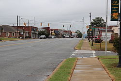 Downtown Centre | |
 Location of Centre in Cherokee County, Alabama. | |
| Coordinates: 34°9′33″N 85°40′29″W / 34.15917°N 85.67472°W | |
| Country | United States |
| State | Alabama |
| County | Cherokee |
| Government | |
| • Type | Mayor/Council |
| • Mayor | Mark Powell Mansfield |
| Area | |
| • Total | 11.76 sq mi (30.45 km2) |
| • Land | 11.70 sq mi (30.31 km2) |
| • Water | 0.05 sq mi (0.14 km2) |
| Elevation | 663 ft (202 m) |
| Population (2010) | |
| • Total | 3,489 |
| • Estimate (2019)[1] | 3,542 |
| • Density | 302.66/sq mi (116.86/km2) |
| Time zone | UTC-6 (Central (CST)) |
| • Summer (DST) | UTC-5 (CDT) |
| ZIP code | 35960 |
| Area code(s) | 256 |
| FIPS code | 01-13648 |
| GNIS feature ID | 0115902 |
| Website | www |

Centre is a city in Cherokee County, Alabama, United States. At the 2010 census the population was 3,489.[3] The city is the county seat of Cherokee County and is part of the Gadsden, Alabama Metropolitan Statistical Area.
History[]
Cherokee County was created on January 9, 1836, and named for the Cherokee people who once lived in the area. The famous Cherokee chief Pathkiller lived in Turkeytown near the present town of Centre. In 1836 the newly founded town of Cedar Bluff became the county seat, but in 1844 the county seat was moved to the more centrally located town of Centre.[4] The name was chosen, and carries the British English spelling, because of this central location in the county.[5] In 2011, Centre began allowing the sale of alcoholic beverages, and is no longer a dry city.
Geography[]
Centre is located slightly west of the center of Cherokee County at 34°9'33.052" North, 85°40'29.071" West (34.159181, -85.674742).[6] The city limits extend north to the south shore of Weiss Lake on the Coosa River.
U.S. Route 411 and Alabama State Route 68 run to the north of the city as a bypass, with US-411 leading east 22 mi (35 km) to Cave Spring, Georgia, and northwest 5 mi (8 km) to Leesburg. Alabama State Route 9 also runs through the city, leading northeast 6 mi (10 km) to Cedar Bluff with AL-68, and south 18 mi (29 km) to Piedmont.
According to the U.S. Census Bureau, the city has a total area of 11.5 square miles (29.9 km2), of which 11.4 square miles (29.6 km2) is land and 0.08 square miles (0.2 km2), or 0.81%, is water.[7]
Demographics[]
| Historical population | |||
|---|---|---|---|
| Census | Pop. | %± | |
| 1850 | 250 | — | |
| 1880 | 144 | — | |
| 1890 | 347 | 141.0% | |
| 1900 | 282 | −18.7% | |
| 1940 | 1,012 | — | |
| 1950 | 1,672 | 65.2% | |
| 1960 | 2,392 | 43.1% | |
| 1970 | 2,418 | 1.1% | |
| 1980 | 2,351 | −2.8% | |
| 1990 | 2,893 | 23.1% | |
| 2000 | 3,216 | 11.2% | |
| 2010 | 3,489 | 8.5% | |
| 2019 (est.) | 3,542 | [1] | 1.5% |
| U.S. Decennial Census[8] 2013 Estimate[9] | |||
As of the census[10] of 2010, there were 3,489 people, 1,426 households, and 880 families residing in the city. The population density was 305 inhabitants per square mile (118/km2). There were 1,690 housing units at an average density of 147 per square mile (57/km2). The racial makeup of the city was 87.0% White, 9.9% Black or African American, 0.4% Native American, 0.3% Asian, 0.3% from other races, and 2.1% from two or more races. 1.2% of the population were Hispanic or Latino of any race.
There were 1,426 households, out of which 24.5% had children under the age of 18 living with them, 42.5% were married couples living together, 14.6% had a female householder with no husband present, and 38.3% were non-families. 35.3% of all households were made up of individuals, and 17.6% had someone living alone who was 65 years of age or older. The average household size was 2.24 and the average family size was 2.88.
In the city, the population was spread out, with 19.9% under the age of 18, 8.4% from 18 to 24, 20.4% from 25 to 44, 26.8% from 45 to 64, and 24.5% who were 65 years of age or older. The median age was 45.9 years. For every 100 females, there were 86.1 males. For every 100 females age 18 and over, there were 97.5 males.
The median income for a household in the city was $40,564, and the median income for a family was $44,665. Males had a median income of $43,816 versus $24,043 for females. The per capita income for the city was $20,491. About 14.7% of families and 21.8% of the population were below the poverty line, including 42.0% of those under age 18 and 1.8% of those age 65 or over.
Education[]
Centre Public Schools are part of Cherokee County Schools (Alabama). Schools in the district include Cedar Bluff School, Centre Elementary School, Gaylesville School, Sand Rock School, Centre Middle School, Cherokee County High School, Spring Garden High School and Cherokee County Career & Technology Center.
The Cherokee County Board of Education provides public education for Centre.
Schools in Centre include Cherokee County High School, Cherokee County Career and Technology Center, Centre Middle School, and Centre Elementary School.
Michael Welsh is the Superintendent of Schools.[11]
Media[]
Radio stations[]
Newspaper[]
- Cherokee County Herald (weekly)
- The Post (weekly)
Recreation[]
Centre is located near Weiss Lake, a man-made reservoir and self-proclaimed "Crappie Capital of the World".
Transportation and Infrastructure[]
Centre is served by Centre–Piedmont–Cherokee County Regional Airport for general aviation, though no regularly-schedules commercial aviation flies directly to Centre. The closest commercial airports are Hartsfield–Jackson Atlanta International Airport and Birmingham–Shuttlesworth International Airport, both of which are a roughly-equal distance to Centre.
No US Interstate highways pass directly though Centre. The closest Interstate highways are Interstate 759 and Interstate 59, which are accessible from the nearby city of Gadsden. Centre itself is served by Alabama State Route 58 and U.S. Route 411; the two roads intersect at the city centre.
Notable people[]
- John Jonathon Pratt, inventor of the pterotype (1865), an early form of typewriter
- Greg Jelks, baseball player
- Jason LaRay Keener, filmmaker
- John Ross, Cherokee leader
References[]
- ^ Jump up to: a b "Population and Housing Unit Estimates". United States Census Bureau. May 24, 2020. Retrieved May 27, 2020.
- ^ "2019 U.S. Gazetteer Files". United States Census Bureau. Retrieved June 29, 2020.
- ^ http://www.bestplaces.net/city/profile.aspx?ccity=&city=Centre_AL
- ^ "Centre". Encyclopedia of Alabama. December 10, 2009. Retrieved 12 January 2010.
- ^ "History". Cherokee County Chamber of Commerce. Archived from the original on 14 January 2010. Retrieved 12 January 2010.
- ^ "US Gazetteer files: 2010, 2000, and 1990". United States Census Bureau. 2011-02-12. Retrieved 2011-04-23.
- ^ "Geographic Identifiers: 2010 Demographic Profile Data (G001): Centre city, Alabama". U.S. Census Bureau, American Factfinder. Archived from the original on February 12, 2020. Retrieved June 3, 2014.
- ^ "U.S. Decennial Census". Census.gov. Retrieved June 6, 2013.
- ^ "Annual Estimates of the Resident Population: April 1, 2010 to July 1, 2013". Retrieved June 3, 2014.
- ^ "U.S. Census website". United States Census Bureau. Retrieved 2015-07-10.
- ^ "Cherokee County Schools". Cherokee County Schools. Retrieved 2012-06-21.
External links[]
Coordinates: 34°09′33″N 85°40′29″W / 34.159181°N 85.674742°W
| hide Municipalities and communities of Cherokee County, Alabama, United States | ||
|---|---|---|
| City |  | |
| Towns | ||
| CDPs | ||
| Unincorporated communities | ||
| Ghost town | ||
| Footnotes | ‡This populated place also has portions in an adjacent county or counties | |
| ||
| Authority control |
|---|
- Cities in Alabama
- Cities in Cherokee County, Alabama
- County seats in Alabama