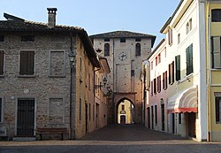
Ceresara
Ceresara
Sareşére (Emilian) | |
|---|---|
| Comune di Ceresara | |
 | |
show Location of Ceresara | |
 Ceresara Location of Ceresara in Italy | |
| Coordinates: 45°16′N 10°34′E / 45.267°N 10.567°ECoordinates: 45°16′N 10°34′E / 45.267°N 10.567°E | |
| Country | Italy |
| Region | Lombardy |
| Province | Province of Mantua (MN) |
| Frazioni | San Martino Gusnago, Villa Cappella |
| Area | |
| • Total | 37.8 km2 (14.6 sq mi) |
| Population (Dec. 2004)[2] | |
| • Total | 2,544 |
| • Density | 67/km2 (170/sq mi) |
| Demonym(s) | Ceresaresi |
| Time zone | UTC+1 (CET) |
| • Summer (DST) | UTC+2 (CEST) |
| Postal code | 46040 |
| Dialing code | 0376 |
| Website | Official website |


Ceresara (Upper Mantovano: Sareşére) is a comune (municipality) in the Province of Mantua in the Italian region Lombardy, located about 110 kilometres (68 mi) east of Milan and about 20 kilometres (12 mi) northwest of Mantua. As of 31 December 2004, it had a population of 2,544 and an area of 37.8 square kilometres (14.6 sq mi).[3]
The municipality of Ceresara contains the frazioni (subdivisions, mainly villages and hamlets) San Martino Gusnago and Villa Cappella.
Ceresara borders the following municipalities: Casaloldo, Castel Goffredo, Gazoldo degli Ippoliti, Goito, Guidizzolo, Medole, Piubega, Rodigo.
Demographic evolution[]

References[]
- ^ "Superficie di Comuni Province e Regioni italiane al 9 ottobre 2011". Istat. Retrieved 16 March 2019.
- ^ "Popolazione Residente al 1° Gennaio 2018". Istat. Retrieved 16 March 2019.
- ^ All demographics and other statistics: Istituto Nazionale di Statistica (Istat).
External links[]
| Authority control |
|
|---|
This article on a location in the Province of Mantua is a stub. You can help Wikipedia by . |
Categories:
- Cities and towns in Lombardy
- Municipalities of the Province of Mantua
- Province of Mantua geography stubs