Cha-uat District
This article needs additional citations for verification. (September 2019) |
Cha-uat
ชะอวด | |
|---|---|
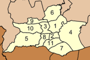
 District location in Nakhon Si Thammarat Province | |
| Coordinates: 7°57′54″N 99°59′54″E / 7.96500°N 99.99833°ECoordinates: 7°57′54″N 99°59′54″E / 7.96500°N 99.99833°E | |
| Country | Thailand |
| Province | Nakhon Si Thammarat |
| Seat | Cha-uat |
| Area | |
| • Total | 833.002 km2 (321.624 sq mi) |
| Population (2005) | |
| • Total | 84,227 |
| • Density | 101.1/km2 (262/sq mi) |
| Time zone | UTC+7 (ICT) |
| Postal code | 80180 |
| Geocode | 8007 |

Cha-uat (Thai: ชะอวด, pronounced [t͡ɕʰā.ʔùa̯t]) is a district (amphoe) in the southern part of Nakhon Si Thammarat Province, southern Thailand.
Geography[]
Neighboring districts are (from the west clockwise): Thung Song, Chulabhorn, Ron Phibun, Chaloem Phra Kiat, Chian Yai, and Hua Sai of Nakhon Si Thammarat Province; Ranot of Songkhla Province; Khuan Khanun and Pa Phayom of Phattalung Province; and Huai Yot of Trang Province.
Khao Pu - Khao Ya National Park is in the Nakhon Si Thammarat mountain range at the boundary of Phattalung and Trang Provinces.
History[]
The minor district (king amphoe) was created in 1923, when it was split from Ron Phibun district. It was upgraded to a full district on 1 January 1953.[1]
Administration[]
The district is divided into 11 sub-districts (tambons), which are further subdivided into 88 villages (mubans). Cha-uat is a township (thesaban tambon) which covers parts of tambon Cha-uat and Tha Pra Cha. There are a further 11 tambon administrative organizations (TAO).
|
|
References[]
- ^ พระราชกฤษฎีกาจัดตั้งอำเภอจักราช อำเภอสัตตหีบ อำเภอศรีสงคราม อำเภอชะอวด อำเภอหนองแซง อำเภอภาชี อำเภอเขาไชยสน อำเภอชุมพลบุรี อำเภอวาริชภูมิ อำเภอสบปราบ และอำเภอสุไหงโกลก พ.ศ. ๒๔๙๖ (PDF). Royal Gazette (in Thai). 70 (17 ก): 368–371. March 10, 1953.
External links[]
This Nakhon Si Thammarat Province location article is a stub. You can help Wikipedia by . |
- Amphoe of Nakhon Si Thammarat Province
- Southern Thailand geography stubs