Nopphitam District
Nopphitam
นบพิตำ | |
|---|---|
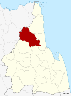 District location in Nakhon Si Thammarat Province | |
| Coordinates: 8°43′10″N 99°45′6″E / 8.71944°N 99.75167°ECoordinates: 8°43′10″N 99°45′6″E / 8.71944°N 99.75167°E | |
| Country | Thailand |
| Province | Nakhon Si Thammarat |
| Seat | Nopphitam |
| Area | |
| • Total | 720.156 km2 (278.054 sq mi) |
| Population (2005) | |
| • Total | 29,670 |
| • Density | 41.2/km2 (107/sq mi) |
| Time zone | UTC+7 (ICT) |
| Postal code | 80160 |
| Geocode | 8021 |

Nopphitam (Thai: นบพิตำ, pronounced [nóp.pʰí(ʔ).tām]) is a district (amphoe) of Nakhon Si Thammarat Province, southern Thailand.
History[]
The district was created on 1 April 1995 by splitting off the four western tambons from Tha Sala District.[1]
On 15 May 2007, all 81 minor districts were upgraded to full districts.[2] On 24 August, the upgrade became official.[3]
Geography[]
Neighboring districts are (from the northeast clockwise): Sichon, Tha Sala, and of Nakhon Si Thammarat Province and and Kanchanadit of Surat Thani Province.
Nopphitam contains the northernmost part of the Khao Luang National Park, protecting a large part of the Nakhon Si Thammarat mountain range.
Administration[]
The district is divided into four sub-districts (tambons), which are further subdivided into 38 villages (mubans). There are no municipal (thesaban) areas, and four tambon administrative organizations (TAO).
|

|
References[]
- ^ ประกาศกระทรวงมหาดไทย เรื่อง แบ่งเขตท้องที่อำเภอท่าศาลา จังหวัดนครศรีธรรมราช ตั้งเป็นกิ่งอำเภอนบพิตำ (PDF). Royal Gazette (in Thai). 112 (Special 9 ง): 53. March 22, 2007.
- ^ แถลงผลการประชุม ครม. ประจำวันที่ 15 พ.ค. 2550. Manager Online (in Thai).
- ^ พระราชกฤษฎีกาตั้งอำเภอฆ้องชัย...และอำเภอเหล่าเสือโก้ก พ.ศ. ๒๕๕๐ (PDF). Royal Gazette (in Thai). 124 (46 ก): 14–21. August 24, 2007.
External links[]
This Nakhon Si Thammarat Province location article is a stub. You can help Wikipedia by . |
- Amphoe of Nakhon Si Thammarat Province
- Southern Thailand geography stubs