Charleston, Missouri
Charleston, Missouri | |
|---|---|
City | |
 Main Street | |
 Location of Charleston, Missouri | |
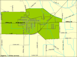 U.S. Census Map | |
| Coordinates: 36°55′17″N 89°20′47″W / 36.92139°N 89.34639°WCoordinates: 36°55′17″N 89°20′47″W / 36.92139°N 89.34639°W | |
| Country | United States |
| State | Missouri |
| County | Mississippi |
| Area | |
| • Total | 4.85 sq mi (12.56 km2) |
| • Land | 4.80 sq mi (12.42 km2) |
| • Water | 0.06 sq mi (0.14 km2) |
| Elevation | 322 ft (98 m) |
| Population | |
| • Total | 5,947 |
| • Estimate (2019)[5] | 5,468 |
| • Density | 1,140.12/sq mi (440.24/km2) |
| Time zone | UTC-6 (Central (CST)) |
| • Summer (DST) | UTC-5 (CDT) |
| ZIP code | 63834 |
| Area code(s) | 573 |
| FIPS code | 29-13366[3] |
| GNIS feature ID | 0715743[4] |
| Website | www |

Charleston is a city in Mississippi County, Missouri, United States. The population was 5,947 at the 2010 census. It is the county seat of Mississippi County.[6] It is a home to a local correctional facility.
History[]
Charleston is the largest town on the Missouri side near the confluence of the Mississippi and Ohio rivers at Bird's Point (11 miles east on U.S. Route 60). Its history has been tied to traffic on the rivers.
Settlement initially occurred on the north side, in what in 1805 was called Matthews Prairie.
After purchasing 22.5 acres (91,000 m2) for $337, Joseph Moore laid out Charleston in 1837.[7] Some say the community derives its name from nearby Charles Prairie,[8] while others believe the name is a transfer from Charleston, South Carolina.[9] In 1845, it was selected as the county seat. A post office named Charleston has been in operation since 1847.[10]
The Battle of Charleston was fought on August 19, 1861. Killed in the battle were one Union soldier and thirteen Missouri State Guard soldiers.[11]
On September 1, 1861, Confederate General M. Jeff Thompson robbed the Union Bank of Charleston. Thompson, who handed the cashier a note, gave the cashier an hour to get approval from superiors to give him keys to the vault. After receiving the money, he left a receipt for $57,000 and discovered later that only $56,000 was in the bags.[12]
The city was the epicenter of the October 31, 1895 5.9 Mfa earthquake on the New Madrid Seismic Zone. The quake damaged virtually every building in Charleston, creating sand volcanoes and cracking a pier on the Cairo Rail Bridge. In addition, chimneys toppled in St. Louis, Missouri; Memphis, Tennessee; Gadsden, Alabama; and Evansville, Indiana. The fate of specific buildings may also be traced by Sanborn maps that were produced of the town during this period.[13] This was the largest quake since the 1812 New Madrid earthquake, which measured at 8.3 and was the biggest recorded quake in the Contiguous United States.[14] One of the most visible signs of the quake is located south of Charleston at Henson Lake, which was greatly expanded by the quake.
In 1901, the county courthouse was built. It was designed by J.B. Legg, who designed numerous buildings throughout Missouri, including the Gasconade and St. Charles County courthouses. On February 10, 1997, the courthouse was damaged by fire and was subsequently torn down.
The , Missouri Pacific Depot, Moore House, , and Jacob Swank House are listed on the National Register of Historic Places.[15]
Geography[]
Charleston is situated in northwestern Mississippi County, a few miles west of the confluence of the Mississippi and Ohio rivers at Bird's Point. Interstate 57 passes through Charleston, connecting it with southern Illinois across the Mississippi River to the northeast, and Interstate 55 near Sikeston to the west. U.S. Route 62 and Missouri Route 105 intersect near downtown Charleston.
According to the United States Census Bureau, the city has a total area of 4.86 square miles (12.59 km2), of which 4.80 square miles (12.43 km2) is land and 0.06 square miles (0.16 km2) is water.[16]
Demographics[]
| Historical population | |||
|---|---|---|---|
| Census | Pop. | %± | |
| 1860 | 273 | — | |
| 1870 | 635 | 132.6% | |
| 1880 | 1,028 | 61.9% | |
| 1890 | 1,381 | 34.3% | |
| 1900 | 1,893 | 37.1% | |
| 1910 | 3,144 | 66.1% | |
| 1920 | 3,410 | 8.5% | |
| 1930 | 3,357 | −1.6% | |
| 1940 | 5,182 | 54.4% | |
| 1950 | 5,501 | 6.2% | |
| 1960 | 5,911 | 7.5% | |
| 1970 | 5,131 | −13.2% | |
| 1980 | 5,230 | 1.9% | |
| 1990 | 5,085 | −2.8% | |
| 2000 | 4,732 | −6.9% | |
| 2010 | 5,947 | 25.7% | |
| 2019 (est.) | 5,468 | [5] | −8.1% |
| source:[17] | |||
2010 census[]
As of the census[2] of 2010, there were 5,947 people, 1,705 households, and 1,107 families residing in the city. The population density was 1,239.0 inhabitants per square mile (478.4/km2). There were 1,883 housing units at an average density of 392.3 per square mile (151.5/km2). The racial makeup of the city was 47.55% White, 50.45% Black or African American, 0.03% Native American, 0.32% Asian, 0.61% from other races, and 1.04% from two or more races. Hispanic or Latino of any race were 1.78% of the population.
There were 1,705 households, of which 35.4% had children under the age of 18 living with them, 35.5% were married couples living together, 25.3% had a female householder with no husband present, 4.2% had a male householder with no wife present, and 35.1% were non-families. 32.1% of all households were made up of individuals, and 11.6% had someone living alone who was 65 years of age or older. The average household size was 2.44 and the average family size was 3.05.
The median age in the city was 37.1 years. 20.3% of residents were under the age of 18; 9.6% were between the ages of 18 and 24; 32% were from 25 to 44; 26.4% were from 45 to 64; and 11.6% were 65 years of age or older. The gender makeup of the city was 61.3% male and 38.7% female.
2000 census[]
As of the census[3] of 2000, there were 4,732 people, 1,834 households, and 1,228 families residing in the city. The population density was 1,011.8 people per square mile (390.4/km2). There were 1,957 housing units at an average density of 418.5 per square mile (161.5/km2). The racial makeup of the city was 53.11% White, 45.60% African American, 0.04% Native American, 0.27% Asian, 0.02% Pacific Islander, 0.15% from other races, and 0.80% from two or more races. Hispanic or Latino of any race were 1.10% of the population.
There were 1,834 households, out of which 32.9% had children under the age of 18 living with them, 39.0% were married couples living together, 24.8% had a female householder with no husband present, and 33.0% were non-families. 30.6% of all households were made up of individuals, and 16.0% had someone living alone who was 65 years of age or older. The average household size was 2.50 and the average family size was 3.13.
In the city, the population was spread out, with 30.2% under the age of 18, 8.5% from 18 to 24, 24.6% from 25 to 44, 20.8% from 45 to 64, and 16.0% who were 65 years of age or older. The median age was 35 years. For every 100 females, there were 82.6 males. For every 100 females age 18 and over, there were 74.7 males.
The median income for a household in the city was $21,812, and the median income for a family was $28,178. Males had a median income of $25,908 versus $17,292 for females. The per capita income for the city was $12,876. About 21.2% of families and 26.0% of the population were below the poverty line, including 41.3% of those under age 18 and 16.8% of those age 65 or over.
Government[]
- List of Charleston mayors
Education[]
Charleston R-I School District operates one elementary school, one middle school, and Charleston High School.[18] Charleston High School has won 11 state boys basketball championships, the most recent being in 2012.[19]
Charleston has a public library, a branch of the Mississippi County Library District.[20]
Notable people[]
- Charlie Babb, former NFL player for the Miami Dolphins[21]
- Lanie Black, Missouri state legislator
- William H. Danforth, businessman
- Ricky Frazier, former basketball player[22]
- Betty Cooper Hearnes, Missouri politician[23]
- Warren E. Hearnes, former Missouri Governor
- Joseph J. Russell, former member of the State house of representatives in 1886–1890 and served as speaker pro tempore of the house in 1886 and as speaker in 1888
- James Boon Lankershim, Los Angeles area landowner and real estate developer
- Ernie Nevel, baseball player[24]
- Kenny Rollins, basketball player
- John E. Scott, former state senate president pro tempore[citation needed]
- Samuel "Bay" Taylor, Negro league baseball player[25]
- Matt Whiteside, baseball player[26]
References[]
- ^ "2019 U.S. Gazetteer Files". United States Census Bureau. Retrieved July 26, 2020.
- ^ Jump up to: a b "U.S. Census website". United States Census Bureau. Retrieved 2012-07-08.
- ^ Jump up to: a b "U.S. Census website". United States Census Bureau. Retrieved 2008-01-31.
- ^ "US Board on Geographic Names". United States Geological Survey. 2007-10-25. Archived from the original on 2012-02-12. Retrieved 2008-01-31.
- ^ Jump up to: a b "Population and Housing Unit Estimates". United States Census Bureau. May 24, 2020. Retrieved May 27, 2020.
- ^ "Find a County". National Association of Counties. Archived from the original on 2011-05-31. Retrieved 2011-06-07.
- ^ "City of Charleston MO - Home". www.charlestonmo.net. Archived from the original on 25 March 2018. Retrieved 27 April 2018.
- ^ "Mississippi County Place Names, 1928–1945". The State Historical Society of Missouri. Archived from the original on June 24, 2016. Retrieved November 6, 2016.
- ^ Eaton, David Wolfe (1917). How Missouri Counties, Towns and Streams Were Named. The State Historical Society of Missouri. pp. 208.
- ^ "Post Offices". Jim Forte Postal History. Archived from the original on 7 November 2016. Retrieved 6 November 2016.
- ^ Lawler, Michael K. (21 August 1861). Congressional Series of United States Public Documents, Volume 3114. U.S. Government Printing Office. p. 136.
- ^ Doris Land Mueller (2007). M. Jeff Thompson: Missouri's Swamp Fox of the Confederacy. University of Missouri Press. p. 41. ISBN 978-0-8262-6590-6.
- ^ Sanborn Maps for Missouri: Charleston, from the University of Missouri Digital Library. Accessed 2011-03-14.
- ^ Historic Earthquakes: Near Charleston, Mississippi County, Missouri - usgs.gov - Retrieved August 27, 2009 Archived July 7, 2012, at archive.today
- ^ "National Register Information System". National Register of Historic Places. National Park Service. July 9, 2010.
- ^ "US Gazetteer files 2010". United States Census Bureau. Archived from the original on 2012-01-25. Retrieved 2012-07-08.
- ^ "Missouri Population 1900 - 1990" (PDF). Missouri Census Data Center. Archived from the original (CSV) on 4 July 2014. Retrieved 28 February 2010.
- ^ "Charleston R-I School District". Greatschools. Archived from the original on 24 March 2018. Retrieved 23 March 2018.
- ^ "Show-Me Showdown schedule & results". Mo. State High School Activities Assn. website. 2012-03-17. Archived from the original on 2012-03-19. Retrieved 2012-03-18.
- ^ "Homepage". Mississippi County Library District. Archived from the original on 24 March 2018. Retrieved 23 March 2018.
- ^ "Charlie Babb". databseFootball.com. Archived from the original on December 31, 2013. Retrieved May 27, 2013.
- ^ "Mizzou Basketball All-Century Team Revealed". mutigers.com. Archived from the original on July 14, 2011. Retrieved March 12, 2015.
- ^ Standard Democrat (2017-07-23). "Charleston church to honor Betty Hearnes' 90th birthday with music celebration". seMissourian.com. Retrieved 2019-06-16.
- ^ "Ernie Wyre Nevel". Baseball-Reference.com. Archived from the original on April 23, 2013. Retrieved May 27, 2013.
- ^ Obituary: Samuel "Bay" Taylor (1929-2019). R.I.P. Baseball website. Retrieved on May 8, 2019.
- ^ "Matt Whiteside Stats". Baseball Almanac. Archived from the original on May 8, 2013. Retrieved May 27, 2013.
External links[]
| Wikisource has the text of a 1905 New International Encyclopedia article about "Charleston, Missouri". |
 Media related to Charleston, Missouri at Wikimedia Commons
- Official website
- Sanborn Maps of Missouri Collection at the University of Missouri
| show Municipalities and communities of Mississippi County, Missouri, United States |
|---|

| show Authority control |
|---|
- Cities in Missouri
- Cities in Mississippi County, Missouri
- County seats in Missouri
- Populated places established in 1837