Cherhill, Alberta
Cherhill | |
|---|---|
Hamlet | |
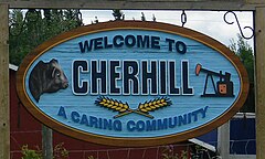 An entrance sign of Cherhill | |
 Location of Cherhill in Alberta | |
| Coordinates: 53°49′09″N 114°40′38″W / 53.8192°N 114.6772°W | |
| Country | Canada |
| Province | Alberta |
| Census division | No. 13 |
| Municipal district | Lac Ste. Anne County |
| Government | |
| • Type | Unincorporated |
| • Reeve | William Hegy |
| • Governing body | Lac Ste. Anne County Council
|
| Population (2008)[1] | |
| • Total | 60 |
| Time zone | UTC−7 (MST) |
| • Summer (DST) | UTC−6 (MDT) |

Cherhill is a hamlet in Alberta, Canada within Lac Ste. Anne County.[2] It is located along Highway 43, approximately 35 kilometres (22 mi) east of Mayerthorpe and 82 kilometres (51 mi) northwest of Edmonton.
The hamlet is located in census division No. 13.
The first syllable of the Cherhill's name is derived from the last syllable of the name of A. P. Stetcher, an early postmaster,[3] with "hill" added to it.[4]
Demographics[]
The population of Cherhill according to the conducted by Lac Ste. Anne County is 60.[1]
See also[]
- List of communities in Alberta
- List of hamlets in Alberta
- Cherhill, Wiltshire, England
References[]
- ^ a b "Alberta Population Summary: Alberta's Hamlets Alphabetically, 2010" (PDF). Alberta Population. Retrieved September 25, 2021.
- ^ "Specialized and Rural Municipalities and Their Communities" (PDF). Alberta Municipal Affairs. January 6, 2021. Retrieved September 29, 2021.
- ^ Place-names of Alberta. Ottawa: Geographic Board of Canada. 1928. p. 32.
- ^ Lac Ste. Anne Historical Society. Archives Committee (1959). West of the Fifth: a history of Lac Ste. Anne Municipality. Edmonton, Alberta: The Institute of Applied Arts Ltd. p. 141.
| Subdivisions |
|
|---|---|
| Communities |
|
| Cities and urban service areas |
|
| Hamlets |
|
| |
Coordinates: 53°49′09″N 114°40′38″W / 53.81917°N 114.67722°W
This Central Alberta location article is a stub. You can help Wikipedia by . |
Categories:
- Hamlets in Alberta
- Lac Ste. Anne County
- Central Alberta geography stubs