Chichester, Quebec
Chichester | |
|---|---|
Township municipality | |
 | |
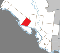 Location within Pontiac RCM | |
 Chichester Location in western Quebec | |
| Coordinates: 45°55′N 77°07′W / 45.917°N 77.117°WCoordinates: 45°55′N 77°07′W / 45.917°N 77.117°W[1] | |
| Country | Canada |
| Province | Quebec |
| Region | Outaouais |
| RCM | Pontiac |
| Constituted | January 1, 1857 |
| Named for | Chichester[1] |
| Government | |
| • Mayor | Donald Gagnon |
| • Federal riding | Pontiac |
| • Prov. riding | Pontiac |
| Area | |
| • Total | 235.40 km2 (90.89 sq mi) |
| • Land | 221.14 km2 (85.38 sq mi) |
| Population | |
| • Total | 348 |
| • Density | 1.5/km2 (4/sq mi) |
| • Pop 2011-2016 | |
| • Dwellings | 243 |
| Time zone | UTC−5 (EST) |
| • Summer (DST) | UTC−4 (EDT) |
| Postal code(s) | J0X 1M0 |
| Area code(s) | 819 |
| Highways | No major routes |

Chichester is a township municipality and village in the Canadian province of Quebec, located within the Pontiac Regional County Municipality. The township had a population of 348 in the 2016 Canadian Census.[3][4]
Chichester is located along the north shores of the Ottawa River across from Chapeau on Allumette Island.
Its settlements include Chichester and Nichabau. Nichabau, also known as Nicabeau or Nichabong, is a scenic hamlet located northwest of Chichester in what used to be referred to as Poupore's Limits. It is noted for its great number of square log homes. [5]
Geography[]
The northern part of the municipal territory is sparsely populated and undeveloped, dotted with several lakes including Lake McGillivray. In its centre there are hills some of which reach an altitude of 400 metres (1,300 ft). The southern portion is mostly cleared and used for agriculture, and where the 2 communities are located.[6]
History[]

The Gale and Duberger Map of 1795 already showed the planned "Chicheter" [sic] Township but it was not officially proclaimed until 1849. It is named after the administrative capital of West Sussex, England.[6]
In 1854, the local post office opened (closed in 1970). In 1855, the township was incorporated as a municipality[7] with John B. Poupore as its first mayor.[5]
Chichester was once a thriving community with numerous sawmills, a grist mill, shingle mill, blacksmith shop and two hotels. In the 19th century (1873-1876), the township tried to boost its economy by petitioning the Federal Department of Public Works[8] to build large wooden locks in the Culbute Channel of the Ottawa River, claimed to be the largest wooden ones in Canada. The locks were meant to allow steamboat travel on the upper portion of the river but this idea never caught on.[5] The Culbute Locks (and associated dam) were in use from 1876 until the fall of 1889 when they were "...abandoned to the forces of the river and Nature's wood-rotting agents..."[8]
Today, the municipality is predominantly dependent on farming, lumbering, and some summer tourism.[5]
Demographics[]
Population[]
| hideCanada census – Chichester, Quebec community profile | |||
|---|---|---|---|
| 2016 | 2011 | 2006 | |
| Population: | 348 (-5.4% from 2011) | 368 (-5.2% from 2006) | 388 (+1.8% from 2001) |
| Land area: | 221.14 km2 (85.38 sq mi) | 221.39 km2 (85.48 sq mi) | 221.21 km2 (85.41 sq mi) |
| Population density: | 1.5/km2 (3.9/sq mi) | 1.7/km2 (4.4/sq mi) | 1.8/km2 (4.7/sq mi) |
| Median age: | 52.0 (M: 48.8, F: 54.2) | 48.2 (M: 44.2, F: 49.8) | 44.8 (M: 43.2, F: 47.1) |
| Total private dwellings: | 243 | 239 | 223 |
| Median household income: | $43,605 | $.N/A | $26,917 |
| Notes: 2011 income data for this area has been suppressed for data quality or confidentiality reasons.[9] – References: 2016[10] 2011[11] 2006[12] earlier[13] | |||
| Year | Pop. | ±% |
|---|---|---|
| 1986 | 488 | — |
| 1991 | 460 | −5.7% |
| 1996 | 462 | +0.4% |
| 2001 | 381 | −17.5% |
| 2006 | 388 | +1.8% |
| 2011 | 368 | −5.2% |
| 2016 | 348 | −5.4% |
| Source: [14] | ||
Language[]
Mother tongue:[3]
- English as first language: 86.1%
- French as first language: 10.8%
- Other as first language: 3.1%
See also[]
References[]
- ^ Jump up to: a b Reference number 13173 of the Commission de toponymie du Québec (in French)
- ^ Jump up to: a b "Chichester". Répertoire des municipalités (in French). Ministère des Affaires municipales, des Régions et de l'Occupation du territoire. Archived from the original on 2012-07-08. Retrieved 2011-01-11.
- ^ Jump up to: a b c d "(Code 2484090) Census Profile". 2016 census. Statistics Canada. 2017.
- ^ Jump up to: a b "Population and dwelling count amendments, 2016 Census". www12.statcan.gc.ca. Government of Canada - Statistics Canada. 15 August 2018. Retrieved 18 November 2019.
- ^ Jump up to: a b c d "Pontiac MRC Gateway: Chichester". Pontiac MRC Gateway. Archived from the original on October 7, 2006. Retrieved 2008-06-27.
- ^ Jump up to: a b "Canton de Chichester" (in French). Commission de toponymie du Québec. Archived from the original on 2014-10-21. Retrieved 2008-06-27.
- ^ "Municipalité de Canton de Chichester" (in French). Commission de toponymie du Québec. Archived from the original on 2016-01-23. Retrieved 2008-06-27.
- ^ Jump up to: a b Clyde C. Kennedy, The Upper Ottawa Valley, Renfrew County Council, Pembroke, Ontario, 1970
- ^ "Chichester census profile". 2011 Census of Population. Statistics Canada. Retrieved 2012-04-02.
- ^ "2016 Community Profiles". 2016 Canadian Census. Statistics Canada. February 21, 2017. Retrieved 2019-11-18.
- ^ "2011 Community Profiles". 2011 Canadian Census. Statistics Canada. July 5, 2013. Retrieved 2014-02-01.
- ^ "2006 Community Profiles". 2006 Canadian Census. Statistics Canada. March 30, 2011. Retrieved 2012-04-02.
- ^ "2001 Community Profiles". 2001 Canadian Census. Statistics Canada. February 17, 2012.
- ^ Statistics Canada: 1996, 2001, 2006, 2011 census
External links[]
![]() Media related to Chichester, Quebec at Wikimedia Commons
Media related to Chichester, Quebec at Wikimedia Commons
| show Adjacent Municipal Subdivisions |
|---|
| hide | |
|---|---|
| Municipalities | |
| Townships | |
| Villages |
|
| Unorganized territories |
|
| |
- Township municipalities in Quebec
- Incorporated places in Outaouais