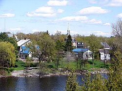
Portage-du-Fort
Portage-du-Fort | |
|---|---|
Village municipality | |
 | |
 Location within Pontiac RCM | |
 Portage-du-Fort Location in western Quebec | |
| Coordinates: 45°36′N 76°40′W / 45.600°N 76.667°WCoordinates: 45°36′N 76°40′W / 45.600°N 76.667°W[1] | |
| Country | |
| Province | |
| Region | Outaouais |
| RCM | Pontiac |
| Settled | 1844 |
| Constituted | January 1, 1863 |
| Government | |
| • Mayor | Lynne Cameron |
| • Federal riding | Pontiac |
| • Prov. riding | Pontiac |
| Area | |
| • Total | 4.24 km2 (1.64 sq mi) |
| • Land | 4.23 km2 (1.63 sq mi) |
| Population (2016)[3] | |
| • Total | 234 |
| • Density | 55.3/km2 (143/sq mi) |
| • Pop 2011-2016 | |
| • Dwellings | 150 |
| Time zone | UTC−5 (EST) |
| • Summer (DST) | UTC−4 (EDT) |
| Postal code(s) | J0X 2T0 |
| Area code(s) | 819 |
| Highways | |

Portage-du-Fort is a village municipality in the Pontiac Regional County Municipality in the southwest corner of the Outaouais region of Quebec, Canada. The village lies across the Ottawa River from Chenaux, Ontario and Horton, Ontario.
At Portage-du-Fort there is a dam, the Chenaux Hydro-Electric Power Station, and bridge across the Ottawa River.
Toponymy[]
Portage-du-Fort is named after the portage trail which started here and would lead upstream around a set of falls on the Ottawa River.
However, there are several hypotheses to explain the "Fort" portion. Among the most popular is the assumption that a fort was present here on the shore of the Ottawa River to keep provisions at the portage. It has been claimed that a fort called Dufort was flooded in the rapids at this location. However, some researchers argue that the fort in question has never existed and may be a reference to another fort at the mouth of the Coulonge River (after which modern Fort-Coulonge is named). Moreover, the word formerly did not always convey a military connotation and could be more or less synonymous with a village or hamlet, or even a post or warehouse which was fortified.[1]
One theory suggests that the name goes back to a custom of the Algonquins who would paint their bodies here and it was originally named Portage du Fard (French for "make-up"), which changed into "Fort".[1]
Another possibility is that Fort (French also for "strong") makes reference to the strength needed to haul the heavy canoes and supplies over the arduous portage.[4]
But there is no certainty on any of these theories.
History[]
In 1611, a French scout named Nicolas de Vignau arrived at this site together with a group of Algonquins while on their way to Allumette Island. From here they had to portage around a series of 5 difficult waterfalls on the Ottawa River. The portage from Harbor Square to Bentley's Landing is one of the oldest trails in North America because the Native peoples inhabiting the valley have used it for thousands of years.[5]
In 1694, Louis d'Ailleboust, Sieur de Coulonge, established a fur trading post near the mouth of the Coulonge River. Subsequently the long portage around the falls that led to Fort Coulonge became known as "le portage du fort".[5] But the site was only periodically inhabited, based on travel periods, especially in spring and early summer.[1]
In the early 19th century timber slides were built around the falls, allowing loggers easy access to Pontiac County and Portage-du-Fort became the hub for all traffic connected with the lumber industry.[5]
The first real settlers came in 1844, the year when the village was surveyed.[1][5] In 1847, the post office opened[1] and Henry Osborne built a depot with storehouse to supply the lumber industry further inland. On September 19, 1855, Portage-du-Fort became the county seat with Patrick Fox as its first mayor and warden.[6]
A memorial of Lady Head`s visit to the Upper Ottawa, in a bark canoe, in 1856, stands at Portage-du-Fort, Quebec. She was the wife of Sir Edmund Walker Head, 8th Baronet.[7] Portage du Fort was home to the area's first newspaper, the Pontiac Pioneer and Portage du Fort Advertiser, which was published by G.E. White from 1855 to 1865.[5]
From 1860 onward, Portage-du-Fort was an important centre of the Pontiac with its mills, its train station, and its terminus for steam boats carrying grain and wood.[1]
This prosperity led to the creation of the municipality in 1863 when it separated from the municipality of Litchfield Township. That same year Stanislas Drapeau wrote:[1]
The Portage-du-Fort is the meeting place for men involved in the timber trade, and serves as the granery for provisions brought by steam vessels which travel on Lac des Chats for the many sites located in the interior. This post is without doubt a very interesting place and already has the looks of a large village which it will soon be in a few years, one of the most important of the entire Outaouais region.
However, a serious fire in 1914 almost destroyed the place entirely and curbed its development for many years.[1] Further decline came when the Canadian Northern Railway bypassed the village.[6]
In 1950, the Chenaux hydroelectric power plant and dam were built.[4]
Demographics[]
Population[]
| hideCanada census – Portage-du-Fort community profile | |||
|---|---|---|---|
| 2016 | 2011 | 2006 | |
| Population: | 234 (-12.0% from 2011) | 266 (-5.0% from 2006) | 280 (+9.8% from 2001) |
| Land area: | 4.23 km2 (1.63 sq mi) | 4.36 km2 (1.68 sq mi) | 4.36 km2 (1.68 sq mi) |
| Population density: | 55.3/km2 (143/sq mi) | 61.0/km2 (158/sq mi) | 64.2/km2 (166/sq mi) |
| Median age: | 49.2 (M: 43.0, F: 51.0) | 47.8 (M: 47.5, F: 48.0) | 43.4 (M: 44.3, F: 42.3) |
| Total private dwellings: | 150 | 152 | 141 |
| Median household income: | $40,960 | $.N/A | $35,704 |
| Notes: 2011 income data for this area has been suppressed for data quality or confidentiality reasons.[8] – References: 2016[9] 2011[10] 2006[11] earlier[12] | |||
| Year | Pop. | ±% |
|---|---|---|
| 1986 | 337 | — |
| 1991 | 295 | −12.5% |
| 1996 | 289 | −2.0% |
| 2001 | 255 | −11.8% |
| 2006 | 280 | +9.8% |
| 2011 | 266 | −5.0% |
| 2016 | 234 | −12.0% |
| Source: [13] | ||
Language[]
Mother tongue:[3]
- English as first language: 89.1%
- French as first language: 10.9%
- Other as first language: none
Local government[]

List of former mayors:
This list is incomplete; you can help by . (November 2019) |
- Gérald Manwell (2001–2009)
- Lynne Cameron (2009–present)
See also[]
References[]
- ^ Jump up to: a b c d e f g h i "Municipalité de Village de Portage-du-Fort" (in French). Commission de toponymie du Québec. Retrieved 2010-07-29.
- ^ Jump up to: a b "Portage-du-Fort". Répertoire des municipalités (in French). Ministère des Affaires municipales, des Régions et de l'Occupation du territoire. Retrieved 2012-04-02.
- ^ Jump up to: a b c "(Code 2484020) Census Profile". 2016 census. Statistics Canada. 2017.
- ^ Jump up to: a b "Chenaux Station". Ontario Power Generation. Retrieved 2008-07-11.
- ^ Jump up to: a b c d e "Pontiac MRC Gateway: Portage-du-Fort". Pontiac MRC Gateway. Archived from the original on October 7, 2006. Retrieved 2008-07-11.
- ^ Jump up to: a b . Pontiac Archives https://web.archive.org/web/20070210022259/http://www.pontiacarchives.org/. Archived from the original on February 10, 2007. Missing or empty
|title=(help) - ^ Morgan, Henry James, ed. (1903). Types of Canadian Women and of Women who are or have been Connected with Canada. Toronto: Williams Briggs. p. 153.
- ^ "Portage-du-Fort census profile". 2011 Census of Population. Statistics Canada. 8 February 2012. Retrieved 2012-04-02.
- ^ "2016 Community Profiles". 2016 Canadian Census. Statistics Canada. February 21, 2017. Retrieved 2019-11-22.
- ^ "2011 Community Profiles". 2011 Canadian Census. Statistics Canada. July 5, 2013. Retrieved 2014-01-31.
- ^ "2006 Community Profiles". 2006 Canadian Census. Statistics Canada. March 30, 2011. Retrieved 2012-04-02.
- ^ "2001 Community Profiles". 2001 Canadian Census. Statistics Canada. February 17, 2012.
- ^ Statistics Canada: 1996, 2001, 2006, 2011 census
External links[]
| Wikimedia Commons has media related to Portage-du-Fort. |
- Elections Canada Results - 39th General Election (2006)
- Director General of Quebec Elections
- Official Transport Quebec Road Map
| show Adjacent Municipal Subdivisions |
|---|
| hide | |
|---|---|
| Municipalities | |
| Townships | |
| Villages |
|
| Unorganized territories |
|
| |
- Incorporated places in Outaouais
- Portages in Canada
- Villages in Quebec