Chichester District
This article needs additional citations for verification. (June 2013) |
Chichester District | |
|---|---|
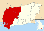 Chichester shown within West Sussex | |
| Sovereign state | United Kingdom |
| Constituent country | England |
| Region | South East England |
| Non-metropolitan county | West Sussex |
| Status | Non-metropolitan district |
| Admin HQ | Chichester |
| Incorporated | 1 April 1974 |
| Government | |
| • Type | Non-metropolitan district council |
| • Body | Chichester District Council |
| • Leadership | Leader & Cabinet (Conservative) |
| • MPs | Andrew Griffith Jeremy Quin Gillian Keegan |
| Area | |
| • Total | 303.60 sq mi (786.32 km2) |
| Area rank | 48th (of 309) |
| Population (mid-2019 est.) | |
| • Total | 121,129 |
| • Rank | 192nd (of 309) |
| • Density | 400/sq mi (150/km2) |
| • Ethnicity | 98.4% White |
| Time zone | UTC0 (GMT) |
| • Summer (DST) | UTC+1 (BST) |
| Website | www |
Chichester is a local government district in West Sussex, England. Its council is based in the city of Chichester and the district also covers a large rural area to the north.[1]
History[]
The district was formed on 1 April 1974, under the Local Government Act 1972, as a merger of the municipal borough (city) of Chichester and the Rural Districts of Midhurst, Petworth and part of the former Chichester Rural District.
Governance[]
Chichester District Council has 36 councillors, representing 21 wards. Chichester itself has five of those wards (North, South, East, West and Central) whilst the remaining wards comprise groups of villages; see Wards of Chichester District. Local elections are held every four years and at the May 2011 and 2015 elections, the Conservative party retained control.[2][3]
| Party | Seats | |
|---|---|---|
| Conservative | 18 | |
| Liberal Democrats | 11 | |
| Labour | 2 | |
| Green Party | 2 | |
| Local Alliance | 2 | |
| Independent | 1 | |
Civil parishes[]
There are 67 civil parishes in Chichester District.[5][6] Apart from the City of Chichester, and the three towns of Midhurst, Selsey and Petworth, most are villages.
Geography[]
Chichester District occupies the western part of West Sussex, bordering on Hampshire to the west and Surrey to the north. The districts of Arun and Horsham abut to the east; the English Channel to the south. The district is divided by the South Downs escarpment, with the northern part being in the Weald, composed of a mixture of sandstone ridges and low-lying clays known as the Western Weald. To the south the dip slope of the downs falls gently to a flat coastal plain and the sea. The Western Weald is drained by the River Arun and its tributaries including the rivers Lox, Kird and especially the River Rother and its tributaries the River Lod and the Haslingbourne Stream. On the northern boundary Blackdown is the highest point in Sussex, while further east around Loxwood the land is low and quite flat. The south of the district has many permeable chalk and gravel areas and is drained by two winterbournes, the River Lavant and River Ems, which are usually dry in the summer. The large inlet known as Chichester Harbour and the headland of Selsey Bill are conspicuous features of the coast.
The district, apart from the few main roads, is generally rural in character, as can be seen by the number of villages within it. Apart from the coastal strip there are few main roads, and the erstwhile railways which once served Midhurst have long been closed.
Landmarks[]
Apart from the geographical landmarks Chichester District contains architectural and cultural places including Chichester Cathedral, Chichester Festival Theatre, The Novium and Pallant House Gallery in the city. Stately homes open to the public include Petworth House and Uppark, both National Trust properties, Goodwood House and Stansted Park. West Dean College is open at certain times of the year. There is horse racing at Goodwood Racecourse, the Goodwood Festival of Speed at Goodwood House, and the Goodwood Revival at Goodwood Motor Racing Circuit. Cowdray House is a ruined Tudor mansion near Midhurst. Fishbourne Roman Palace lies west of Chichester city centre. To the north of the city are Weald and Downland Open Air Museum and Halnaker Windmill. There are gardens open to the public at Woolbeding and Pound Commons and West Dean College.
Economy[]
West Sussex County Council and Chichester District Council are major employers in Chichester, along with Rolls-Royce Motor Cars assembly plant at nearby Westhampnett. Boatbuilding is an important industry along the coast. Many people from the northern parts of the district commute to work in London, using the A3 road or the railways from Portsmouth to London Waterloo station and Littlehampton to London Victoria station.[citation needed] Fertile soils on the coastal plain are used for arable farming and intensive vegetable production, the latter employing many migrant workers from Eastern Europe. High sunlight levels and a mild climate also make the coastal region suitable for glasshouse growing. A fertile strip of land on the north side of the River Rother is also used for vegetable growing, but most of the area north of the Downs is of low agricultural value and there are large areas of forest and pasture, interspersed with arable cropping.
Football clubs[]
- Bosham F.C.
- Chichester City F.C.
- Midhurst & Easebourne F.C.
- Selsey F.C.
References[]
- ^ The dignity and privileges of the City of Chichester are vested in its town council, known as Chichester City Council, occupying only 10.6 km² of the total area of the District), which covers over 70 times the area
- ^ "Chichester council elections". BBC. 10 May 2011. Retrieved 25 October 2014.
- ^ "England council results". BBC. 2015. Retrieved 19 May 2015.
- ^ "Your councillors". 5 August 2021.
- ^ "Chichester". Office for National Statistics.
- ^ "Chichester". Ordnance Survey.


- Chichester District
- Districts of England established in 1974
- Non-metropolitan districts of West Sussex