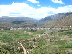
Chivay District
Chivay
Chiway | |
|---|---|
 | |
| Country | |
| Region | Arequipa |
| Province | Caylloma |
| Capital | Chivay |
| Government | |
| • Mayor | Jorge Modesto Cueva Tejada |
| Area | |
| • Total | 240.64 km2 (92.91 sq mi) |
| Elevation | 3,635 m (11,926 ft) |
| Population (2005 census) | |
| • Total | 6,570 |
| • Density | 27/km2 (71/sq mi) |
| Time zone | UTC-5 (PET) |
| UBIGEO | 040501 |
Chivay District is one of twenty districts of the province Caylloma in Peru.[1]
Geography[]
One of the highest mountains of the district is Waran K'anthi at 5,426 m (17,802 ft). Other mountains are listed below:[2]
- Ankachita
- Laymi
- Llallawi
- Mama Qucha
- Q'illu Q'illu
- Saylluta
- Sinawa
- Uyuni
See also[]
References[]
- ^ (in Spanish) Instituto Nacional de Estadística e Informática. Banco de Información Distrital Archived April 23, 2008, at the Wayback Machine. Retrieved April 11, 2008.
- ^ escale.minedu.gob.pe - UGEL maps of the Caylloma Province 2, Arequipa Region
Coordinates: 15°38′12″S 71°36′32″W / 15.6366°S 71.6090°W

This Arequipa Region geography article is a stub. You can help Wikipedia by . |
Categories:
- Districts of the Arequipa Region
- Districts of the Caylloma Province
- Arequipa Region geography stubs