Clare and Gilbert Valleys Council
| Clare and Gilbert Valleys Council South Australia | |||||||||||||||
|---|---|---|---|---|---|---|---|---|---|---|---|---|---|---|---|
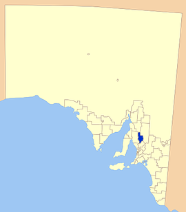 Location of Clare and Gilbert Valleys Council | |||||||||||||||
| Population | 9,023 (2016 census)[1] | ||||||||||||||
| • Density | 4.904/km2 (12.70/sq mi) | ||||||||||||||
| Established | 1997 | ||||||||||||||
| Area | 1,840 km2 (710.4 sq mi) | ||||||||||||||
| Mayor | Wayne Thomas [2] | ||||||||||||||
| Council seat | Clare | ||||||||||||||
| Region | Yorke and Mid North[3] | ||||||||||||||
| State electorate(s) | Frome, Goyder | ||||||||||||||
| Federal division(s) | Grey | ||||||||||||||
| Website | Clare and Gilbert Valleys Council | ||||||||||||||
| |||||||||||||||
The Clare and Gilbert Valleys Council is a local government area located in the Yorke and Mid North region of South Australia.[3] The council was founded on 1 July 1997 with the amalgamation of the District Council of Clare, the and the .[4] The council seat is located at Clare; it also maintains branch offices at Riverton and Saddleworth.[5]
Geography[]
It includes the towns and localities of Anama, Armagh, Auburn, Barinia, Benbournie, Black Springs, Bungaree, Boconnoc Park, Clare, Emu Flat, Giles Corner, , Hill River, Hilltown, Leasingham, Manoora, Marrabel, Mintaro, Penwortham, Polish Hill River, Rhynie, Riverton, Saddleworth, Sevenhill, , , , Stanley Flat, , Stockport, Tarlee, , , Tothill Creek, Undalya, Waterloo, Watervale and Woolshed Flat, and parts of Alma, Farrell Flat, Halbury, Hoyleton and Salter Springs.[6]
Councillors[]
The Clare and Gilbert Valleys Council has a directly elected mayor.[7]
| Ward | Councillor | Notes | |
|---|---|---|---|
| Mayor[2] | Wayne Thomas | ||
| Deputy Mayor | Elizabeth Calvert | ||
| Unsubdivided[2] | Ann Alder | ||
| Malcolm Bartholomaeus | |||
| Leon Bruhn | |||
| Ian Burfitt | |||
| Lucy Drummond | |||
| Nedd Golding | |||
| Cate Hunter | |||
| Brian Koch | |||
See also[]
References[]
- ^ Australian Bureau of Statistics (27 June 2017). "Clare and Gilbert Valleys (DC)". 2016 Census QuickStats. Retrieved 10 April 2018.

- ^ a b c "Elected Members". Clare & Gilbert Valleys Council. Retrieved 6 June 2019.
- ^ a b "Yorke and Mid North SA Government region" (PDF). The Government of South Australia. Retrieved 10 October 2014.
- ^ "Clare & Gilbert Valleys Council Profile". District Council of Clare & Gilbert Valleys. Retrieved 31 March 2016.
- ^ "Contact Us". Clare & Gilbert Valleys Council. Retrieved 1 April 2016.
- ^ "Location SA Map Viewer". Government of South Australia. Retrieved 1 April 2016.
- ^ "Election Results 2014" (PDF). Local Government Association of South Australia. Archived from the original (PDF) on 30 June 2007. Retrieved 1 April 2016.
External links[]

- Populated places established in 1997
- 1997 establishments in Australia
- Local government areas of South Australia
- Mid North (South Australia)