Clearfield Colony, South Dakota
Clearfield Colony, South Dakota | |
|---|---|
 Clearfield Colony | |
| Coordinates: 43°8′47″N 98°8′19″W / 43.14639°N 98.13861°WCoordinates: 43°8′47″N 98°8′19″W / 43.14639°N 98.13861°W | |
| Country | United States |
| State | South Dakota |
| County | Charles Mix |
| Area | |
| • Total | 0.30 sq mi (0.78 km2) |
| • Land | 0.30 sq mi (0.78 km2) |
| • Water | 0.0 sq mi (0.0 km2) |
| Elevation | 1,740 ft (530 m) |
| Population (2020) | 99 |
| Time zone | UTC-6 (Central (CST)) |
| • Summer (DST) | UTC-5 (CDT) |
| ZIP Code | 57330 (Delmont) |
| Area code(s) | 605 |
| FIPS code | 46-12508 |
| GNIS feature ID | 2813005[2] |


Clearfield Colony is a Hutterite colony[3] and census-designated place (CDP) within the Yankton Indian Reservation in Charles Mix County, South Dakota, United States. It was first listed as a CDP prior to the 2020 census.[2] The population of the CDP was 99 at the 2020 census.[4]
It is in the eastern part of the county, 10 miles (16 km) south of Delmont and 12 miles (19 km) northeast of Wagner.
References[]
- ^ "2020 U.S. Gazetteer Files – South Dakota". United States Census Bureau. Retrieved September 10, 2021.
- ^ a b "Clearfield Colony Census Designated Place". Geographic Names Information System. United States Geological Survey.
- ^ Friesen, Bert (May 2021). "Clearfield Hutterite Colony (Wagner, South Dakota, USA)". Global Anabaptist Mennonite Encyclopedia Online. Retrieved September 10, 2021.
- ^ "U.S. Census Bureau: Clearfield Colony CDP, South Dakota". www.census.gov. United States Census Bureau. Retrieved 5 February 2022.
Municipalities and communities of Charles Mix County, South Dakota, United States | ||
|---|---|---|
| Cities | 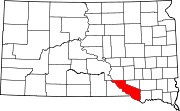 | |
| Towns | ||
| CDPs | ||
| Other communities | ||
| Indian reservation | ||
| ||
This South Dakota state location article is a stub. You can help Wikipedia by . |
Categories:
- Census-designated places in Charles Mix County, South Dakota
- Census-designated places in South Dakota
- Hutterite communities
- South Dakota geography stubs