Marty, South Dakota
Marty, South Dakota | |
|---|---|
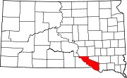
 Location in Charles Mix County and the state of South Dakota | |
| Coordinates: 42°59′28″N 98°25′50″W / 42.99111°N 98.43056°WCoordinates: 42°59′28″N 98°25′50″W / 42.99111°N 98.43056°W | |
| Country | United States |
| State | South Dakota |
| County | Charles Mix |
| Area | |
| • Total | 3.2 sq mi (8.4 km2) |
| • Land | 3.2 sq mi (8.4 km2) |
| • Water | 0 sq mi (0 km2) |
| Elevation | 1,447 ft (441 m) |
| Population (2010) | |
| • Total | 402 |
| • Density | 125.6/sq mi (47.9/km2) |
| Time zone | UTC-6 (Central (CST)) |
| • Summer (DST) | UTC-5 (CDT) |
| ZIP code | 57361 |
| Area code(s) | 605 |
| FIPS code | 46-41180[1] |
| GNIS feature ID | 1256340[2] |

Marty is a census-designated place (CDP) in southern Charles Mix County, South Dakota, United States. The population was 402 at the 2010 census.
The community has the name of Martin Marty, a Roman Catholic bishop.[3]
Geography[]

Marty is located at 42°59′28″N 98°25′50″W / 42.99111°N 98.43056°W (42.991203, -98.430509).[4]
According to the United States Census Bureau, the CDP has a total area of 3.2 square miles (8.3 km2), all land.
Demographics[]
As of the census[1] of 2000, there were 421 people, 96 households, and 79 families residing in the CDP. The population density was 129.7 people per square mile (50.0/km2). There were 106 housing units at an average density of 32.7 per square mile (12.6/km2). The racial makeup of the CDP was 4.51% White, 0.24% African American, 90.26% Native American, 1.66% from other races, and 3.33% from two or more races. Hispanic or Latino of any race were 8.08% of the population.
There were 96 households, out of which 58.3% had children under the age of 18 living with them, 21.9% were married couples living together, 43.8% had a female householder with no husband present, and 16.7% were non-families. 16.7% of all households were made up of individuals, and 4.2% had someone living alone who was 65 years of age or older. The average household size was 4.33 and the average family size was 4.55.
In the CDP, the population was spread out, with 46.6% under the age of 18, 13.3% from 18 to 24, 23.0% from 25 to 44, 11.6% from 45 to 64, and 5.5% who were 65 years of age or older. The median age was 20 years. For every 100 females, there were 102.4 males. For every 100 females age 18 and over, there were 99.1 males.
The median income for a household in the CDP was $18,750, and the median income for a family was $23,750. Males had a median income of $16,964 versus $26,250 for females. The per capita income for the CDP was $5,917. About 43.1% of families and 40.9% of the population were below the poverty line, including 44.2% of those under age 18 and 25.0% of those age 65 or over.
Education[]
Marty Indian School, a tribal boarding K-12 school affiliated with the Bureau of Indian Education (BIE), is in Marty.
The local school district is .[5]
See also[]
References[]
- ^ Jump up to: a b "U.S. Census website". United States Census Bureau. Retrieved 2008-01-31.
- ^ U.S. Geological Survey Geographic Names Information System: Marty
- ^ Federal Writers' Project (1940). South Dakota place-names, v.1-3. University of South Dakota. p. 50.
- ^ "US Gazetteer files: 2010, 2000, and 1990". United States Census Bureau. 2011-02-12. Retrieved 2011-04-23.
- ^ "2020 CENSUS - SCHOOL DISTRICT REFERENCE MAP: Charles Mix County, SD" (PDF). U.S. Census Bureau. Retrieved 2021-08-06.
External links[]
![]() Media related to Marty, South Dakota at Wikimedia Commons
Media related to Marty, South Dakota at Wikimedia Commons
| show Municipalities and communities of Charles Mix County, South Dakota, United States |
|---|
| show Authority control |
|---|
- Census-designated places in Charles Mix County, South Dakota
- Census-designated places in South Dakota