Coffins Corner, New Jersey
Coffins Corner, New Jersey | |
|---|---|
Neighborhood | |
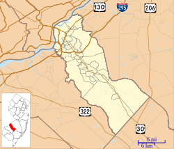
 Coffins Corner Location in Camden County (Inset: Camden County in New Jersey) | |
| Coordinates: 39°51′36″N 74°59′20″W / 39.86000°N 74.98889°WCoordinates: 39°51′36″N 74°59′20″W / 39.86000°N 74.98889°W | |
| Country | |
| State | |
| County | Camden |
| Township | Cherry Hill |
| Named for | Edward Winslow Coffin |
| Elevation | 35 m (105 ft) |
| Time zone | UTC-5 (Eastern (EST)) |
| • Summer (DST) | UTC-4 (EDT) |
| Area code(s) | 856 |
| GNIS feature ID | 875534[1] |
Coffins Corner is a neighborhood located within Cherry Hill Township, in Camden County, New Jersey, United States.[2] Located near the border of Voorhees, Coffins Corner is at the crossroads of County Route 561 (Haddonfield-Berlin Road), County Route 544 (Evesham Road), and County Route 678 (Somerdale Road).
It is named after the Coffin family, specifically Edward Winslow Coffin, whose name also was given to Winslow Township, New Jersey.[3]
References[]
Categories:
- Neighborhoods in Cherry Hill, New Jersey
- New Jersey geography stubs
