Columbus, Wisconsin
Columbus, Wisconsin | |
|---|---|
City | |
 Columbus City Hall | |
| Nickname(s): "Red Bud City"[1] | |
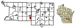 Location of Columbus in Dodge County, Wisconsin. | |
| Coordinates: 43°20′20″N 89°00′55″W / 43.33889°N 89.01528°WCoordinates: 43°20′20″N 89°00′55″W / 43.33889°N 89.01528°W | |
| Country | |
| State | |
| Counties | Columbia, Dodge |
| Government | |
| • Mayor | Mary Arnold |
| Area | |
| • Total | 4.59 sq mi (11.89 km2) |
| • Land | 4.55 sq mi (11.79 km2) |
| • Water | 0.04 sq mi (0.10 km2) |
| Elevation | 871 ft (265 m) |
| Population | |
| • Total | 4,991 |
| • Estimate (2019)[4] | 5,120 |
| • Density | 1,124.53/sq mi (434.20/km2) |
| Time zone | UTC-6 (Central) |
| • Summer (DST) | UTC-5 (Central) |
| Zip Code | 53925 |
| Area code(s) | 920 |
| FIPS code | 55-16450 |
| Website | www.cityofcolumbuswi.com |


Columbus is a city in Columbia (mostly) and Dodge Counties in the south-central part of the U.S. state of Wisconsin. The population was 4,991 at the 2010 census. All of this population resided in the Columbia County portion of the city. Columbus is located about 28 miles (45 km) northeast of Madison on the Crawfish River. The Columbia County portion of the city lies within the Madison Metropolitan Statistical Area while the Dodge County portion is a part of the Milwaukee-Waukesha-Racine CSA. Nearly all of the city is located within the town of Columbus in Columbia County, though a small portion lies within the town of Elba in Dodge County.
History[]
This section needs expansion. You can help by . (April 2017) |
This section needs additional citations for verification. (March 2017) |
H. A. Whitney, a Yankee peddler from Vermont, moved to Columbus in 1845 and constructed the first wood frame store building in the community on the land where the Whitney now stands. The building served as a combination store/tavern/rooming house and post office, with Whitney as the first postmaster. In 1857, the building burned down and was replaced by the current Whitney Hotel in 1858. This cream brick, Italianate-style hotel's third floor ballroom was heated by six wood-burning stoves. The local newspaper reported on a ball there in 1863, "if you ever hear of a ball by Fuller, ask no questions, but go at once, and enjoy yourselves, and for one night forget the 'fear of the draft'".
During the 1880s, The Whitney hosted traveling health practitioners whose expertise ranged from "delivering a 40-foot long tape worm" to a local couple to curing piles. Near the turn of the 20th century, the ballroom was turned into an apartment, and from then on served as commercial, professional, and apartment space.
In the 1950s, a restaurant and bar occupied the first floor of the building. From the 1960s to the present, a succession of owners occupied the building and maintenance was deferred. In the 1950s, the building fell into disrepair and as a result of its continued decline, faced demolition in 1990. In February 1991, Heartland Properties, Inc.[5] helped local citizens create the Columbus Downtown Development Corporation (CDDC), which served as the developer to restore the Whitney.
Today, the Whitney provides affordable housing for eight households and 1,570 square feet of downtown retail space for local businesses, including the Daily Citizen newspaper.[6][failed verification]
Geography[]
Columbus is located at 43°20′14″N 89°1′21″W / 43.33722°N 89.02250°W (43.337366, -89.022753).[7]
According to the United States Census Bureau, the city has a total area of 4.25 square miles (11.01 km2), of which, 4.21 square miles (10.90 km2) is land and 0.04 square miles (0.10 km2) is water.[8]
Climate[]
| ||||||||||||||||||||||||||||||||||||||||||||||||||||||||||||||||||||||||||||
Demographics[]
| Historical population | |||
|---|---|---|---|
| Census | Pop. | %± | |
| 1850 | 288 | — | |
| 1860 | 892 | 209.7% | |
| 1870 | 1,888 | 111.7% | |
| 1880 | 1,876 | −0.6% | |
| 1890 | 1,977 | 5.4% | |
| 1900 | 2,349 | 18.8% | |
| 1910 | 2,523 | 7.4% | |
| 1920 | 2,460 | −2.5% | |
| 1930 | 2,514 | 2.2% | |
| 1940 | 2,760 | 9.8% | |
| 1950 | 3,250 | 17.8% | |
| 1960 | 3,467 | 6.7% | |
| 1970 | 3,789 | 9.3% | |
| 1980 | 4,049 | 6.9% | |
| 1990 | 4,093 | 1.1% | |
| 2000 | 4,479 | 9.4% | |
| 2010 | 4,991 | 11.4% | |
| 2019 (est.) | 5,120 | [4] | 2.6% |
| U.S. Decennial Census[10] | |||
In 1900, 2,349 people lived in Columbus, Wisconsin; in 1910, there were 2,523 residents.
2020 census[]
As of the 2020 census, 5,114 people were living in Columbus, Wisconsin.
2010 census[]
As of the census[3] of 2010, there were 4,991 people, 2,123 households, and 1,336 families living in the city. The population density was 1,185.5 inhabitants per square mile (457.7/km2). There were 2,287 housing units at an average density of 543.2 per square mile (209.7/km2). The racial makeup of the city was 95.7% White, 0.9% African American, 0.3% Native American, 0.6% Asian, 1.1% from other races, and 1.4% from two or more races. Hispanic or Latino of any race were 3.3% of the population.
There were 2,123 households, of which 31.3% had children under the age of 18 living with them, 48.5% were married couples living together, 9.8% had a female householder with no husband present, 4.6% had a male householder with no wife present, and 37.1% were non-families. 30.8% of all households were made up of individuals, and 11.2% had someone living alone who was 65 years of age or older. The average household size was 2.33 and the average family size was 2.91.
The median age in the city was 38.3 years. 24.1% of residents were under the age of 18; 7.1% were between the ages of 18 and 24; 27.7% were from 25 to 44; 27.2% were from 45 to 64; and 14.1% were 65 years of age or older. The gender makeup of the city was 48.8% male and 51.2% female.
2000 census[]
As of the census[11] of 2000, there were 4,479 people, 1,843 households, and 1,194 families living in the city. The population density was 1,122.7 people per square mile (433.4/km2). There were 1,927 housing units at an average density of 483.0 per square mile (186.5/km2). The racial makeup of the city was 98.28% White, 0.36% Black or African American, 0.22% Native American, 0.31% Asian, 0.02% Pacific Islander, 0.29% from other races, and 0.51% from two or more races. Hispanic or Latino of any race were 0.98% of the population.
There were 1,843 households, out of which 32.0% had children under the age of 18 living with them, 52.0% were married couples living together, 9.0% had a female householder with no husband present, and 35.2% were non-families. 31.4% of all households were made up of individuals, and 14.1% had someone living alone who was 65 years of age or older. The average household size was 2.37 and the average family size was 2.98.
In the city, the population was spread out, with 26.0% under the age of 18, 6.6% from 18 to 24, 29.9% from 25 to 44, 20.2% from 45 to 64, and 17.3% who were 65 years of age or older. The median age was 38 years. For every 100 females, there were 91.0 males. For every 100 females age 18 and over, there were 87.1 males.
The median income for a household in the city was $42,667, and the median income for a family was $52,604. Males had a median income of $36,518 versus $22,891 for females. The per capita income for the city was $21,435. About 3.7% of families and 5.4% of the population were below the poverty line, including 4.0% of those under age 18 and 11.7% of those age 65 or over.
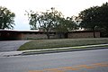
Education[]
Columbus is served by the Columbus School District, which operates an elementary school, a middle school, and a high school:
- Columbus Elementary School (K-2)
- Columbus Intermediate School (3-5)
- Columbus Middle School (6-8)
- Columbus High School (9-12)
Other schools in Columbus:
- St. Jerome Catholic School, Roman Catholic, grades K-8
- Zion Lutheran School, WELS (Wisconsin Evangelical Lutheran Synod), grades K-8
- Wisconsin Academy, Seventh Day Adventist, grades 9-12
Transportation[]
Columbus is served by Amtrak's Empire Builder between Chicago and Seattle, with a train stopping at the station in each direction every day.
Columbus is also served by Lamers Bus Service which provides a Connect to Madison, Wisconsin from Amtrak.

Highways[]
Columbus is served by US 151. Columbus is almost halfway on the US 151 freeway/expressway between Madison and Fond du Lac. There are 3 exits on the freeway that serve Columbus. The exits are Wis 73/Business US 151 Park Ave (Exit 115), Wis 16/Wis 60 James St (Exit 118) and Wis 73/Business US 151 Ludington St (Exit 120). Columbus is also served by 4 state highways.
- Wis 16 runs northwest towards Portage and east with Wis 60 for several miles before heading to Watertown.
- Wis 60 heads west to Lodi and east to Hustiford.
- Wis 73 runs south to Marshall and north to Randolph.
- Wis 89 heads south to Waterloo and Fort Atkinson.
- Business US 151 is cosigned with Wis 73 through Columbus.
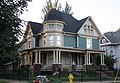
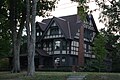
Historic buildings[]

- Adolphus and Sarah Ingalsbe House
- Albert M. and Alice Bellack House
- Columbus City Hall
- Columbus Post Office
- Columbus Fireman's Park Complex
- Columbus Public Library
- E. Clarke and Julia Arnold House
- F. A. Chadbourn House
- Farmers and Merchants Union Bank
- Frances Kurth Sharrow House
- Fred and Lucia Farnham House
- George Griswold House
- Gov. James T. Lewis House
- Holsten Family Farmstead
- John A. and Maggie Jones House
- Kurth Brewery
- Reinhard and Amelia Schendel House
- Zion Evangelical Lutheran Church and Parsonage
- Amtrak station (1906).
- Chapel Street Water Tower
Attractions[]
 Christopher Columbus Museum
- Farmers and Merchants Union Bank, a "jewel box" bank building designed by architect Louis Sullivan

Events[]

The Redbud Festival occurs in May around Mother's Day. Each year the community crowns a prince and princess during the budding of the "Columbus Wisconsin Strain" of the redbud tree (cercis canadensis).[13][failed verification] The festival includes brats, music, and trees in full bloom.
Movie set[]
Downtown Columbus was used to film several scenes for the 2009 Johnny Depp movie Public Enemies.[14] The Farmers & Merchants Union Bank is featured in the film.[15]
Notable people[]
- Michael Adams, Wisconsin state representative and businessman[16]
- Charles L. Dering, Wisconsin State Senator[17]
- Francis Fagan, Navy Cross recipient
- Harmon J. Fisk, Wisconsin state representative
- William M. Griswold, Wisconsin state senator
- Joshua James Guppey, Union Army general
- William Jones, Wisconsin state representative
- Frank Lange, major league baseball player
- James T. Lewis, governor of Wisconsin
- Lewis Ludington, founded the city
- Heather Miller, Olympic athlete
- Peter Morris, major league baseball player
- Bob Poser, major league baseball player
- Frederick J. Stare, nutritionist
- Samuel R. Webster, Wisconsin state representative
- Russel R. Weisensel, Wisconsin state representative
- E. W. Ziebarth, radio broadcaster
Gallery[]
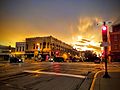


Downtown Columbus on Highway 60/16 - a portion of the Columbus Downtown Historic District
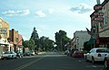
Downtown Columbus on Highway 73


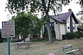
A portion of the Dix Street-Warner Street Historic District

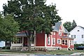
A portion of the Holsten Family Farmstead

A house within the Prairie Street Historic District
A house within the South Dickason Boulevard Residential Historic District


References[]
- ^ "History". Columbus Area Chamber of Commerce. Archived from the original on March 11, 2016. Retrieved March 11, 2016.
- ^ "2019 U.S. Gazetteer Files". United States Census Bureau. Retrieved August 7, 2020.
- ^ Jump up to: a b "U.S. Census website". United States Census Bureau. Retrieved 2012-11-18.
- ^ Jump up to: a b "Population and Housing Unit Estimates". United States Census Bureau. May 24, 2020. Retrieved May 27, 2020.
- ^ http://www.heartland-properties.com/profiles/whitney.html
- ^ http://wisconsinhistoricalmarkers.blogspot.com/2014/10/whitney-building-1858.html
- ^ "US Gazetteer files: 2010, 2000, and 1990". United States Census Bureau. 2011-02-12. Retrieved 2011-04-23.
- ^ "US Gazetteer files 2010". United States Census Bureau. Archived from the original on 2012-07-02. Retrieved 2012-11-18.
- ^ "NASA Earth Observations Data Set Index". NASA. Retrieved 30 January 2016.
- ^ "Census of Population and Housing". Census.gov. Retrieved June 4, 2015.
- ^ "U.S. Census website". United States Census Bureau. Retrieved 2008-01-31.
- ^ "Archived copy". Archived from the original on 2015-07-17. Retrieved 2015-04-24.CS1 maint: archived copy as title (link)
- ^ Corlin Center for Biodiversity. Trees of Wisconsin.
- ^ http://www.bizjournals.com/milwaukee/stories/2008/02/25/daily21.html
- ^ "Public Enemies". 2019-06-17. Retrieved 2020-04-19.
- ^ 'Wisconsin Blue Book 1883,' Biographical Sketch of Michael Adams, pg. 486
- ^ 'Wisconsin bluebook 1880,' Biographical Sketch of Charles Dering, pg. 505
Further reading[]
- Stare, Fred A. (ed.). Story of Columbus.
- "The City of Columbus" in The History of Columbia County, Wisconsin. Chicago: Western Historical Company, 1880.
External links[]
| Wikimedia Commons has media related to Columbus, Wisconsin. |
| Wikivoyage has a travel guide for Columbus, Wisconsin. |
- City of Columbus
- Columbus Wisconsin Chamber of Commerce
- Sanborn fire insurance maps: 1885 1892 1898 1904 1915
| show Municipalities and communities of Columbia County, Wisconsin, United States |
|---|

| show Municipalities and communities of Dodge County, Wisconsin, United States |
|---|

| show Authority control |
|---|
- Columbus, Wisconsin
- Cities in Wisconsin
- Cities in Columbia County, Wisconsin
- Cities in Dodge County, Wisconsin