Cooch Behar district
This article needs additional citations for verification. (July 2015) |
Cooch Behar district | |
|---|---|
District of West Bengal | |
     Clockwise from top-left: Cooch Behar Palace, Gadadhar river near Tufanganj, Mount of Rajpat in Gosanimari, Torsa river near Cooch Behar, Madan Mohan temple | |
 Location of Cooch Behar district in West Bengal | |
| Country | |
| State | |
| Division | Jalpaiguri |
| Headquarters | Cooch Behar |
| Government | |
| • Lok Sabha constituencies | Cooch Behar |
| • Vidhan Sabha constituencies | Mathabhanga, Cooch Behar Uttar, Cooch Behar Dakshin, Sitalkuchi, Sitai, Dinhata, Natabari, Tufanganj |
| Area | |
| • Total | 3,387 km2 (1,308 sq mi) |
| Population (2011) | |
| • Total | 2,819,086 |
| • Density | 830/km2 (2,200/sq mi) |
| • Urban | 10.27% |
| Demographics | |
| • Literacy | 74.78% (2011) |
| • Sex ratio | 942 (2011) |
| Time zone | UTC+05:30 (IST) |
| Vehicle registration | WB-64 |
| Major highways | NH 17 |
| Average annual precipitation | 3201 mm |
| Website | coochbehar |
Cooch Behar district (pronounced [ˈkuːtʃ biˈɦaːr]) is a district of the state of West Bengal, India, as well as the district's namesake town. During the British Raj, the town of Cooch Behar was the seat of a princely state of Koch Bihar, ruled by the Koch dynasty.
Etymology[]
The name Cooch Behar is derived from the name of the Koch or Rajbongshi tribes indigenous to this region.[1] The word behar is derived from Sanskrit: विहार vihara.
History[]

Early period[]

Cooch Behar formed part of the Kamarupa Kingdom of Assam from the 4th to the 12th centuries. In the 12th century, the area became a part of the Kamata Kingdom, first ruled by the Khen dynasty from their capital at Kamatapur. The Khens were an indigenous tribe, and they ruled till about 1498 CE, when they fell to Alauddin Hussain Shah, the independent Pathan Sultan of Gour. The new invaders fought with the local Bhuyan chieftains and the Ahom king Suhungmung and lost control of the region. During this time, the Koch tribe became very powerful and proclaimed itself Kamateshwar (Lord of Kamata) and established the Koch dynasty.
The first important Koch ruler was Biswa Singha, who came to power in 1510 or 1530 CE.[2] Under his son, Nara Narayan, the Kamata Kingdom reached its zenith.[3] Nara Narayan's younger brother, Shukladhwaj (Chilarai), was a noted military general who undertook expeditions to expand the kingdom. He became governor of its eastern portion.
After Chilarai's death, his son Raghudev became governor of this portion. Since Nara Narayan did not have a son, Raghudev was seen as the heir apparent. However, a late child of Nara Narayan removed Raghudev's claim to the throne. To placate him, Nara Narayan had to anoint Raghudev as a vassal chief of the portion of the kingdom east of the Sankosh river. This area came to be known as Koch Hajo. After the death of Nara Narayan in 1584, Raghudev declared independence. The kingdom ruled by the son of Nara Narayan, Lakshmi Narayan, came to be known as Cooch Behar. The division of the Kamata Kingdom into Koch Behar and Koch Hajo was permanent. Koch Behar aligned itself with the Mughal Empire and finally joined the India as a part of the West Bengal, whereas remnants of the Koch Hajo rulers aligned themselves with the Ahom kingdom and the region became a part of Assam.
As the early capital of the Koch Kingdom, Cooch Behar's location was not static and became stable only when shifted to Cooch Behar town. Maharaja , on the advice of an unknown saint, transferred the capital from Attharokotha to Guriahati (now called Cooch Behar town) on the banks of the Torsa river between 1693 and 1714. After this, the capital was always in or near its present location.
In 1661 CE, Maharaja Pran Narayan planned to expand his kingdom. However, Mir Jumla, the subedar of Bengal under the Mughal emperor Aurangazeb, attacked Cooch Behar and conquered the territory, meeting almost no resistance.[4] The town of Cooch Behar was subsequently named Alamgirnagar.[5] Maharaja Pran Narayan regained his kingdom within a few days.
British Raj[]
In 1772–1773, the king of Bhutan attacked and captured Cooch Behar. To expel the Bhutanese, the kingdom of Cooch Behar signed a defence treaty with the British East India Company on 5 April 1773. After expelling the Bhutanese, Cooch Behar again became a princely kingdom under the protection of British East India company.[6]
The Victor Jubilee Palace was based on Buckingham Palace and built in 1887, during the reign of Maharaja Nripendra Narayan.[5] In 1878, the maharaja married the daughter of Brahmo preacher Keshab Chandra Sen. This union led to a renaissance in Cooch Behar state.[7] Maharaja Nripendra Narayan is known as the architect of modern Cooch Behar town.[8]
Post Independence[]
Under an agreement between the kings of Cooch Behar and the Indian Government at the end of British rule, Maharaja Jagaddipendra Narayan transferred full authority, jurisdiction and power of the state to the Dominion Government of India, effective 12 September 1949.[9] Eventually, Cooch Bihar became part of the state of West Bengal on 19 January 1950, with Cooch Behar town as its headquarters.[9]
A geopolitical curiosity was that there were 92 Bangladeshi exclaves, with a total area of 47.7 km2 in Cooch-Behar. Similarly, there were 106 Indian exclaves inside Bangladesh, with a total area of 69.5 km2. These were part of the high stake card or chess games centuries ago between two regional kings, the Raja of Cooch Behar and the Maharaja of Rangpur.[10]
Twenty-one of the Bangladeshi exclaves were within Indian exclaves, and three of the Indian exclaves were within Bangladeshi exclaves. The largest Indian exclave was Balapara Khagrabari which surrounded a Bangladeshi exclave, Upanchowki Bhajni, which itself surrounded an Indian exclave called Dahala Khagrabari, of less than one hectare (link to external map here [1]). But all this has ended in the historic India-Bangladesh land agreement. See Indo-Bangladesh enclaves.
Geography[]

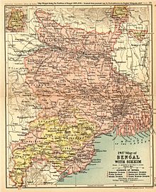
Cooch Behar is a district under the Jalpaiguri Division of the state of West Bengal. Cooch Behar is located in the northeastern part of the state and bounded by the district of Jalpaiguri and Alipurduar in the north, Dhubri and Kokrajhar district of Assam in the east and by Bangladesh in the west as well as in the south. The district forms part of the Himalayan Terai of West Bengal.
A geopolitical curiosity was that there were 92 Bangladeshi exclaves, with a total area of 47.7 km2 in Cooch-Behar. Similarly, there were 106 Indian exclaves inside Bangladesh, with a total area of 69.5 km2. These were part of the high stake card or chess games centuries ago between two regional kings, the Raja of Cooch Behar and the Maharaja of Rangpur.[10]
Twenty-one of the Bangladeshi exclaves were within Indian exclaves, and three of the Indian exclaves were within Bangladeshi exclaves. The largest Indian exclave was Balapara Khagrabari which surrounded a Bangladeshi exclave, Upanchowki Bhajni, which itself surrounded an Indian exclave called Dahala Khagrabari, of less than one hectare (link to external map here [2]). But all this has ended in the historic India-Bangladesh land agreement. See Indo-Bangladesh enclaves.
Rivers and topography[]
Cooch Behar is a flat region with a slight southeastern slope along which the main rivers of the district flow. Most of the highland areas are in the Sitalkuchi region and most of the low-lying lands lie in Dinhata region.
The rivers in the district of Cooch Behar generally flow from northwest to southeast. Six rivers that cut through the district are the Teesta, Jaldhaka, Torsha, , Raidak, and .
Divisions[]
Sub-divisions[]
The district of Cooch Behar comprises five sub-divisions:
- Cooch Behar Sadar subdivision
- Dinhata subdivision
- Mathabhanga subdivision
- Tufanganj subdivision
- Mekhliganj subdivision
Assembly constituencies[]
The district is divided into 8 assembly constituencies:[11]
- Sitalkuchi (SC) (assembly constituency no. 2),
- Mathabhanga (SC) (assembly constituency no. 3),
- Cooch Behar North (assembly constituency no. 4),
- Cooch Behar West (assembly constituency no. 5),
- Sitai (assembly constituency no. 6),
- Dinhata (assembly constituency no. 7),
- Natabari (assembly constituency no. 8) and
- Tufanganj (SC) (assembly constituency no. 9).
Mekliganj, Sitalkuchi, Mathabhanga and Tufanganj constituencies are reserved for Scheduled Castes (SC) candidates. Mekhliganj constituency is part of Jalpaiguri (Lok Sabha constituency), which also contains six assembly segments from Jalpaiguri district. Sitalkuchi, Mathabhanga, Cooch Behar North, Cooch Behar West, Sitai, Dinhata and Natabari constituencies form the Cooch Behar (Lok Sabha constituency), which is reserved for Scheduled Castes (SC). Tufanganj constituency is part of Alipurduars (Lok Sabha constituency), which also contains six assembly segments from Jalpaiguri district.
Impact of delimitation of constituencies[]
As per order of the 2008 Delimitation Commission in respect of the delimitation of constituencies in the West Bengal, the district is divided into 9 assembly constituencies:[12]
- Mekliganj (SC) (assembly constituency no. 1),
- Mathabhanga (SC) (assembly constituency no. 2),
- Cooch Behar Uttar (SC) (assembly constituency no. 3),
- Cooch Behar Dakshin (assembly constituency no. 4),
- Sitalkuchi (SC) (assembly constituency no. 5),
- Sitai (SC) (assembly constituency no. 6),
- Dinhata (assembly constituency no. 7),
- Natabari (assembly constituency no. 8) and
- Tufanganj (assembly constituency no. 9).
Mekliganj, Mathabhanga, Cooch Behar Uttar, Sitalkuchi and Sitai constituencies are reserved for Scheduled Castes (SC) candidates. Mekhliganj constituency is part of Jalpaiguri (Lok Sabha constituency), which also contains six assembly segments from Jalpaiguri district. Mathabhanga, Cooch Behar Uttar, Cooch Behar Dakshin, Sitalkuchi, Sitai, Dinhata and Natabari constituencies will continue to form the Cooch Behar (Lok Sabha constituency), which is reserved for Scheduled Castes (SC). Tufanganj constituency is part of Alipurduars (Lok Sabha constituency), which also contains six assembly segments from Alipurduar and Jalpaiguri districts.
Demographics[]
Languages of Cooch Behar district (2011).[14]
According to the 2011 census Cooch Behar district has a population of 2,819,086,[15] roughly equal to the nation of Jamaica.[16] This gives it a ranking of 136th in India (out of a total of 739).[15] The district has a population density of 833 inhabitants per square kilometre (2,160/sq mi) .[15] Its population growth rate over the decade 2001–2011 was 13.86%.[15] Koch Bihar has a sex ratio of 942 females for every 1000 males,[15] and a literacy rate of 75.49%.[15] With 50.1% of the population, Cooch Behar is the district with the highest proportion of Scheduled Castes in the country as per the 2011 census.[17]
At the time of the 2011 census, 96.79% of the population spoke Bengali, 1.31% Rajbongshi, 1.52% Hindi.[18]
| Year | Pop. | ±% p.a. |
|---|---|---|
| 1901 | 565,116 | — |
| 1911 | 591,012 | +0.45% |
| 1921 | 590,599 | −0.01% |
| 1931 | 589,053 | −0.03% |
| 1941 | 638,703 | +0.81% |
| 1951 | 668,949 | +0.46% |
| 1961 | 1,019,806 | +4.31% |
| 1971 | 1,414,183 | +3.32% |
| 1981 | 1,771,643 | +2.28% |
| 1991 | 2,171,145 | +2.05% |
| 2001 | 2,479,155 | +1.34% |
| 2011 | 2,819,086 | +1.29% |
| source:[19] | ||
Flora and fauna[]
In 1976 Cooch Behar district became home to the Jaldapara Wildlife Sanctuary (now Jaldapara National Park), which has an area of 217 km2 (83.8 sq mi).[20] It shares the park with Alipurduar district.[20]
See also[]
- Indo-Bangladesh enclaves
- Koch Rajbongshi people
- Koch Bihar
- List of enclaves and exclaves
- List of West Bengal districts ranked by literacy rate
References[]
- ^ Pal, Dr. Nripendra Nath (2000). Itikathai Cooch Behar (A brief history of Cooch Behar). Kolkata: Anima Prakashani. pp. 11–12.
- ^ Royal history of Cooch Behar. Coochbehar.nic.in (1 January 1950). Retrieved on 18 July 2015.
- ^ "Royal History of Cooch Behar". Retrieved 22 October 2006.
- ^ Pal, Dr. Nripendra Nath (2000). Itikathai Cooch Behar (A brief history of Cooch Behar). Kolkata: Anima Prakashani. p. 68.
- ^ Jump up to: a b Bhattacharyya, PK (2012). "Kamata-Koch Behar". In Islam, Sirajul; Jamal, Ahmed A. (eds.). Banglapedia: National Encyclopedia of Bangladesh (Second ed.). Asiatic Society of Bangladesh.
- ^ Pal, Dr. Nripendra Nath (2000). Itikathai Cooch Behar (A brief history of Cooch Behar). Kolkata: Anima Prakashani. p. 73.
- ^ Pal, Dr. Nripendra Nath (2000). Itikathai Cooch Behar (A brief history of Cooch Behar). Kolkata: Anima Prakashani. p. 75.
- ^ "Royal History of Cooch Behar 5". Retrieved 22 October 2006.
- ^ Jump up to: a b "Brief Royal History of Cooch Behar 5". Archived from the original on 24 July 2011. Retrieved 22 October 2006.
- ^ Jump up to: a b "A Great Divide". Time. 5 February 2009. Archived from the original on 19 April 2011.
- ^ "General election to the Legislative Assembly, 2001 – List of Parliamentary and Assembly Constituencies" (PDF). West Bengal. Election Commission of India. Archived from the original (PDF) on 11 April 2008. Retrieved 16 November 2008.
- ^ "Press Note, Delimitation Commission" (PDF). Assembly Constituencies in West Bengal. Delimitation Commission. Retrieved 16 November 2008.
- ^ "C-1 Population By Religious Community". Census. Retrieved 14 November 2019.
- ^ Population by Mother Tongue - West Bengal
- ^ Jump up to: a b c d e f "District Census 2011". Census2011.co.in. 2011. Retrieved 30 September 2011.
- ^ US Directorate of Intelligence. "Country Comparison:Population". Retrieved 1 October 2011.
Jamaica 2,868,380 July 2011 est
- ^ "Census of India : Scheduled Castes & Scheduled Tribes Population". www.censusindia.gov.in. Retrieved 5 February 2021.
- ^ http://www.censusindia.gov.in/2011census/C-16.html
- ^ Decadal Variation In Population Since 1901
- ^ Jump up to: a b Indian Ministry of Forests and Environment. "Protected areas: Sikkim". Archived from the original on 23 August 2011. Retrieved 25 September 2011.
Further reading[]
- Moore, Lucy (2004) Maharanis: The Extraordinary Tale Of Four Indian Queens And Their Journey From Purdah To Parliament, Penguin, ISBN 0-670-03368-5
External links[]
| Wikimedia Commons has media related to Cooch Behar district. |
| show Places adjacent to Cooch Behar district |
|---|
| show Cities and towns in Cooch Behar district |
|---|
| show |
|---|
| show |
|---|

| show Authority control |
|---|
Coordinates: 26°19′27″N 89°27′04″E / 26.32419°N 89.45103°E

![[1]](http://geosite.jankrogh.com/enklaver/CoochBehar_Annotated.jpg)
- Cooch Behar district
- Districts of West Bengal
- Minority Concentrated Districts in India
- Proposed states and union territories of India